- Difficulty: Moderate-Difficult.
- Facilities: Some adjacent private campgrounds.
- Signage: Minimal, at East & Main Branches.
- Features: 3 converging branches; Main (14km), West (36km), and East (17km). Live water level reporting to help plan your trip.
- Biodiversity: Atlantic Salmon | Wood Turtle | Bald Eagle | More…
- Tags: #Backcountry, #Bird-Watching, #Bridge, #Fishing, #Nature-Reserve, #Old-Growth, #Paddling, #River.
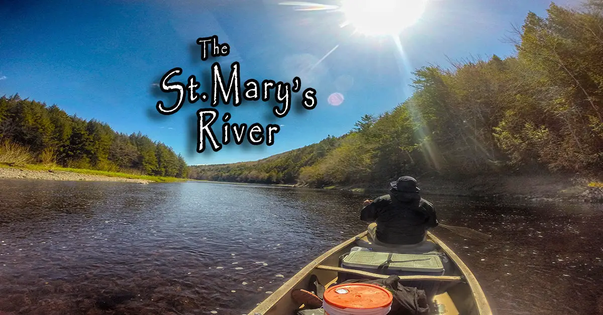
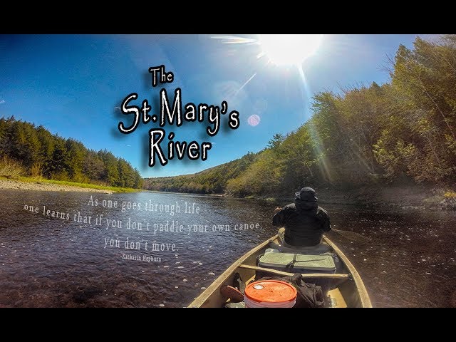
The St. Mary’s River
Remote Beauty
You know it’s a remote area when the Google Maps satellite details are sketchy and blurry. The irony is that you can clearly see the satellites themselves amongst the astounding kaleidoscope of stars visible on clear nights. The starry vastness of the night sky, the likes of which most people have never seen, is one of the most memorable parts of this trip. (Google’s “Sky Map” app is one of my favourite activities for such nights).
You have 3 main paddling routes to choose from. The Main, West and East branches all diverge on a central point in Glenelg, making it fairly easy to plan trips of various lengths. As a general rule of thumb, I assume that I will paddle a fully loaded canoe around 5km/h and use that to plan trip time. Of course, river and weather conditions play a huge part in that calculation so I would use it as a ballpark estimate.
When I did this trip, my crew tackled the West branch. We used 2 cars, parking one at Sutherland’s Bridge (pulled onto the narrow shoulder of the road) and one at the Waternish Bridge entry point (plenty of space on the shoulder). One important aspect to remember when coordinating such a trip is that cell phone service is unreliable to non-existent throughout much of this area. Phoning your crew during the many km’s of rough backroads often isn’t possible, so have plans fully in place beforehand.
Paddling Adventure
We paddled the West Branch in late May and the water levels were extremely low (this was likely just a bad couple of days because I checked the water levels again days later and it had risen substantially). This section of the river seems to get deeper the farther you go, and is most shallow in the first segment or two. When water levels are at 2 feet (0.6 meters) or below, you will be dragging your canoe for large stretches, so it’s very important to factor that in.
🔴 High: Use caution.
Shop.HalifaxTrails.ca: Paddling Gear | Camping Gear.| On Sale
The padding can be challenging in spots. You’re likely to encounter various combinations of slow shallows, fast-moving narrows (where you can end up on a backward ride with fingers crossed), and Titanic iceberg-like rocks which are never good to meet at top speed. The exhausting challenge we faced was mainly the extended periods of canoe dragging due to the low water levels in the first segment of the West branch. There were some technically challenging spots, but never anything approaching difficult rapids.
As far as campsites on the West Branch there are no official sites, but we had heard of a couple of unofficial sites (marked on my map) that we unintentionally paddled right by. My advice would be to not pass up a spot that looks like an ideal campsite and plan on not being able to harvest much firewood on-site (nor are you allowed to cut anything down). There are private campgrounds along the East/Main branches (marked on my map).
Since I haven’t paddled the Main or East branches yet, I’ll refer those sections to the extremely informative website created by the St. Mary’s River Association which is a wealth of information. I used their info to plan my trip.
Protection & Conservation
If you visit this river, I highly suggest making a stop at the St. Mary’s River Association Gift Shop to learn more about the area and to support their work. You can also make a donation online.. The Nova Scotia Nature Trust is also doing important work at protecting significant portions of the river. Recent developments have put the river in the crosshairs of toxic industry as a huge open-pit gold mine has been proposed nearby. Goldmines have a notoriously poor environmental track record and would pose an enormous threat to the last of Nova Scotia’s pristine entire ecosystems. It would bring an industrial footprint that does not at all square with the immense value of preserving & protecting this waterway to the fullest extent possible.
In August of 2020, the St. Mary’s River Association announced a barrier-free fishing location at McKeens Pool along the river’s East Branch. This location has concrete pads along the river’s edge to make fly fishing possible for people of all abilities. They have also put together a fantastic online visual showcase of the river’s cultural & natural significance here. You’ll see that this climate-change-hedging, goldmine of biodiversity has been a draw for generations by people from all around the world, including Babe Ruth himself. Its history as a fully sustainable fishing, paddling & eco-tourism destination began before “The Babe” cast his fly in Nova Scotia, and should be a tradition carried on for generations of visitors.
To add to the local eco-attractions, a newly announced whale sanctuary in nearby Port Hilford. All of this makes the area a world-class nature destination that is increasingly at odds with, the Nova Scotia’s toxic industries of old. A come-and-go gold mining operation that produces multi-generational pollution, pay next to nothing for water & offer us some of the lowest paying royalties in the world seems like a poor investment from just about any angle.
As Babe Ruth, himself said, “you can’t beat a person who never gives up.” These local organizations are full of people who fit that bill: The St. Mary’s River Association, Nova Scotia Nature Trust, Ecology Action Centre & CPAWS NS. Join the chorus & voice your concerns to your elected representatives.
Safety Tips
When planning any trip on this river, remember that you are in a remote area so you should be properly prepared with the right gear. Weather and river conditions can change very rapidly so it’s never safe to make assumptions. I recommend using a dedicated GPS device, (preferably a satellite communicator) a substantial first aid kit, and a compass. Plan for worst-case scenarios and not being able to use your cell phone at all for communication.
St Mary's Church of Scotland, Dumfries in the rain for #SteepleSaturday. The congregation was dissolved in 2025, and the building is now in the ownership of the River of Life Church, part of the Independent Evangelical Alliance. Presumably many of the same people go here.
