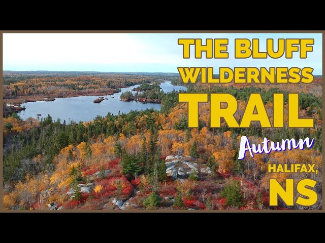
The Bluff Wilderness Trail
- Difficulty: Moderate – Difficult (Distance/Terrain). 4 stacked loops (~4 hours each).
- Facilities: Parking, bike rack, and garbage cans at the trailhead.
- Signage: Info kiosk at the trailhead, periodic maps, and trail markings throughout.
- Biodiversity: A mosaic of Acadian forest, granite barrens, and pristine wetlands, supporting an exceptional variety of native flora and fauna unique to the Nova Scotian landscape, including microbes new to science (see the Nature section below).
- Trail Conditions: View & sign the logbook for recent updates from fellow explorers.
UPDATE: Large section of the Pot Lake Loop closed due to unsafe conditions of 2 boardwalks (marked on my map). Announced July 10, 2026 and closed until further notice. The Woodens River Watershed Association volunteer organization could really use your help! Please donate or volunteer.
Parking & Access
Access to the Bluff Wilderness Trail begins in a large but easy-to-miss parking area adjacent to Bay Self Storage in Timberlea. Often verging on full during peak times, it’s best to come early to assure yourself a spot. There are important directions posted in the lot regarding parking rules, so make sure you’re in compliance.
If the lot is full, you may park on the side of St. Margaret’s Bay Rd. The trail operators ask that you leave 130 feet from the parking lot entrance to allow visibility for people exiting the lot. Obey all posted signs and other local parking laws. These rules are enforced and you will be ticketed for not abiding. From the top of the parking lot you’ll enter directly onto the BLT Trail, where you’ll head to the right for 500m until it meets Cranberry Lake.
Planning & Preparation
Everything along the trail is well marked & maintained with corresponding colour-coded trail markers throughout. You shouldn’t get off course if you’re paying full attention, but it is certainly possible. A large map and info are posted at the trailhead (take a photo for reference) with others placed sparingly at key junctures. Signs warn of wildlife encounters as the large area is home to black bears, moose, and coyotes, all of which are easily avoided by making your presence heard.
These trails are intended for experienced hikers and as such, you should carry a printed map, compass, and basic survival gear. Your first major decision will be which of the 4 stacked loops you would like to tackle. This decision should be based on how much time/daylight you have, as well as your experience and physical condition. Keep in mind that a kilometer along this rugged terrain takes significantly longer than a kilometer along a typical hiking trail. Naturally rugged and uneven, it demands your careful attention. Stretch (with extra attention on calves & Achilles tendon), warm up, and stay hydrated to avoid injury as even small ones can turn into big problems when backcountry hiking.
For the latest news and updates on the trail, visit The Bluff Wilderness Trail Facebook page.
The Bluff Wilderness Trail
1) Pot Lake Loop
The shortest is the 7km return trip Pot Lake Loop, which takes around 3-4 hours (3 for exercise and 4+ at a photographer’s pace). A delightfully rugged trail with plenty of dips and climbs to keep your blood pumping (view elevation profile).
From the parking lot, you’ll walk a half kilometer along the BLT Rails-To-Trails through a highway underpass, shortly after which is the Bluff Wilderness trailhead. The Pot Lake Loop Trail begins with an easy stroll along its aesthetically pleasing 100m boardwalk which combined allows for plenty of distance to get warmed up for the rest of the hike.
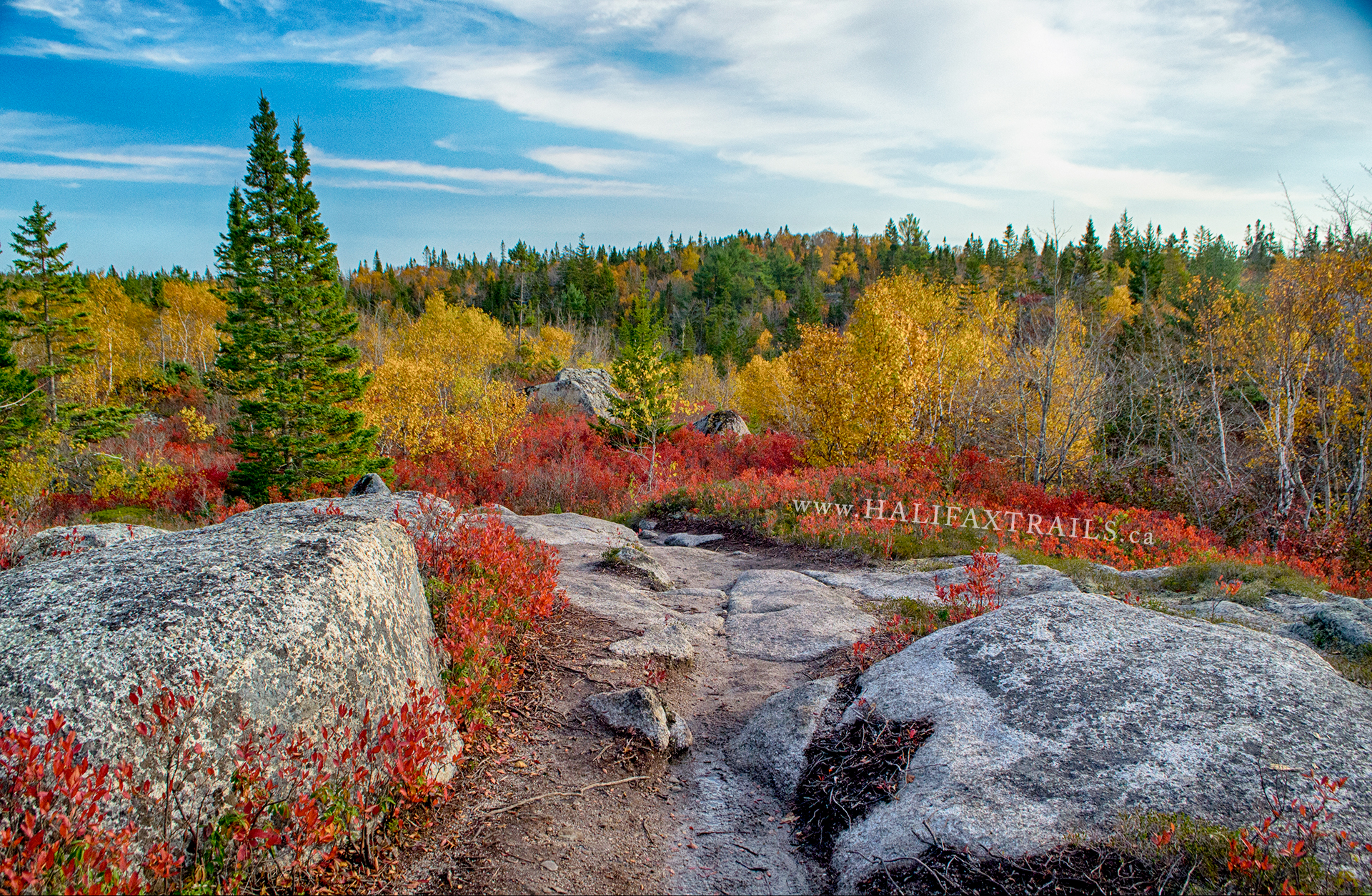
The first half of the trail has a couple of great views of Cranberry Lake as you make your way through the rocky forest terrain. The geologic landscape throws plenty of great scenery at you, just be mindful that safe footing begs your attention. The crowning masterpiece of the trail is the elevated clearing at the far end of the loop. One of the best scenes in all of the Halifax Regional Municipality (especially in autumn), makes the challenging hike worth every well-earned step, so plan on spending lots of time taking it in while recharging for the second half of your hike.
The second half of the loop is dense with peaceful forest scenery pulled straight from the pages of a whimsical storybook. You’ll trek through mixed forest offering a kaleidoscope of scenery that keeps things interesting throughout. This part of the trail doesn’t have many views of the lake and you’ll come to the shoreline at only one point, so be sure to make a stop to check it out.
2) Mi’kmaq Hill Loop
Next is the Mi’kmaq Hill Loop which is a 14.5km return trip, or around 7-8 hours. Starting from the previously mentioned far end of the Pot Lake Loop, descending downhill towards a small pond, referred to as “the puddle“. The trail continues through dense rocky terrain until reaching an open, elevated area with your first views of Frederick Lake in the distance.
As you near the lake you’ll come upon 2 “leave no trace” approved campsites. The first is known as “Coyote/U’lukwej” and the site closer to the lake is known as “Crow/Ka’qaquj” (read further below for camping restrictions and regulations). This loop is also accessible via paddling on Frederick Lake (see map).
From this point on I can’t offer any great insights as you’ll be venturing into the unknown (to me), and to me, venturing (preparedly) into the unknown is the most fun part of any trip.
3) The Bluff Loop
The Bluff Loop is a 20.5km return trip into remote wilderness. Another leave-no-trace camping site known as “Squirrel/Atutuwej” lies at the mid-point of the trail. Venturing into these further back loops requires considerable preparation and conditioning, so make sure to take all safety precautions. A satellite communicator should be something you own if you’re into these kinds of adventures.
4) Hay Marsh Loop
The Hay Marsh Loop is the longest route with a 28km return trip. Choosing to do this route involves a full 2-day hike from the parking lot. This farthest back loop can also be accessed by a series of natural portages from nearby lakes (see map). Along the portage trail from Upper Five Bridge Lake is the final Leave No Trace Campsite known as “Moose/Tia’m”.
My Bluff Wilderness Trail Photos


Leave No Trace Camping Sites
Camping is discouraged, but legal. Refer to the map for the 4 approved leave-no-trace campsites. Campfires are not allowed, so use a backpacking stove, if anything. If you’re looking for somewhere geared towards traditional camping, check out these suggestions instead. As is the case throughout this trail system, following strict Leave No Trace principles is a must.
A donation to the volunteers who maintain this trail system would be a nice thank-you for the stay. Signage in the parking lot indicates that overnight parking is prohibited, so plan accordingly or take your chances by leaving a note on your windshield that you’re overnighting it.
A Community Creation
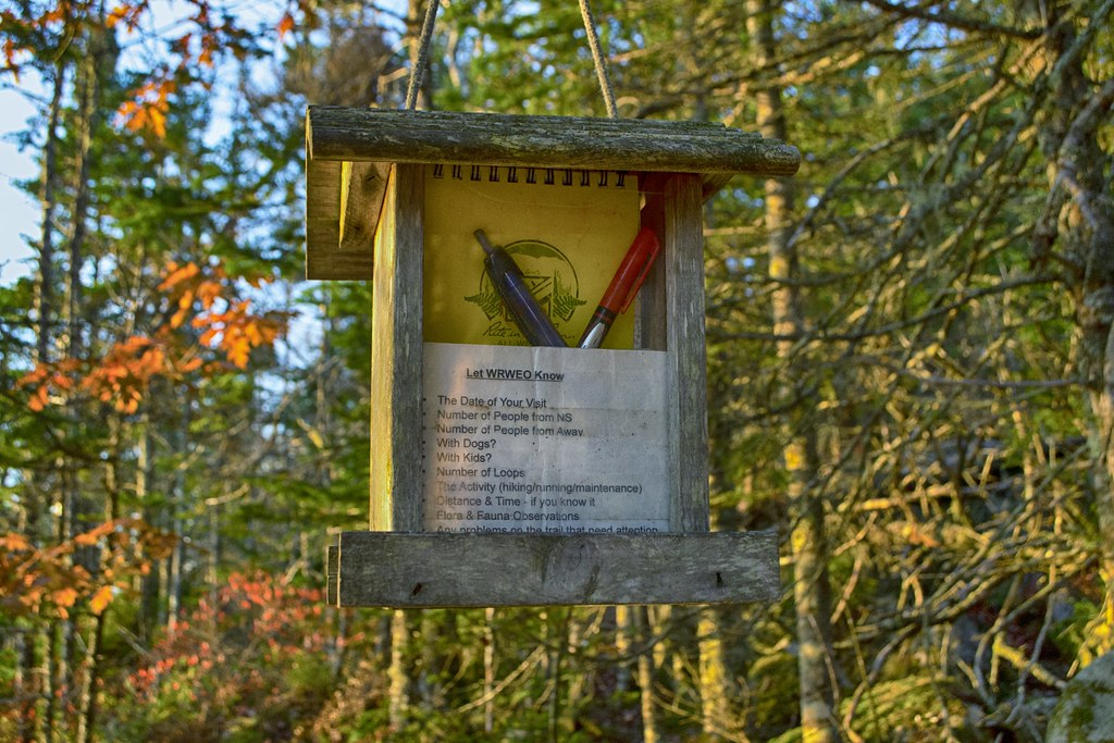
The trails are a top-notch backcountry hiking destination due to their thoughtful design and maintenance by volunteers with the Woodens River Watershed Environmental Organization. This group of volunteers maintains, monitors, and educates. All of the things that make this trail as popular as it is are because of these volunteers. Becoming a member and/or donating any amount goes a long way to show your appreciation. 1km into the trail, the WRWEO have placed a notepad for you to leave valuable feedback, so do them a favour and fill it out on your way out.
Backcountry Beauty
Algorithm based on thermal lag and seasonal averages.
During Hunting season (End of October-beginning of December), you should make yourself visible by wearing hunter’s orange. It’s always wise to be aware of your surroundings, as bears, coyotes, and even moose have been known to make an occasional appearance. You can gain extra peace of mind by carrying a bear bell or pepper spray when venturing into any remote area in Nova Scotia.
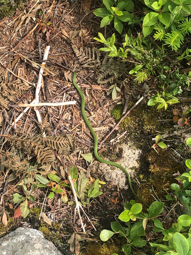
Nature & Wildlife
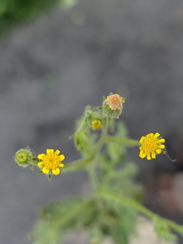
The Bluff Wilderness Trail offers hikers an immersive experience in one of the most ecologically diverse regions in Halifax. As you traverse the varied terrain, you’ll encounter a classic Acadian forest canopy dominated by majestic Eastern White Pine and Red Spruce. The understory features a carpet of Red-stemmed Feather Moss and resilient shrubs like Sheep Laurel and Bog Labrador Tea. In the spring, the forest floor comes alive with the delicate blooms of Trailing Arbutus and Painted Trillium, creating a colourful display that signals the awakening of the wilderness.
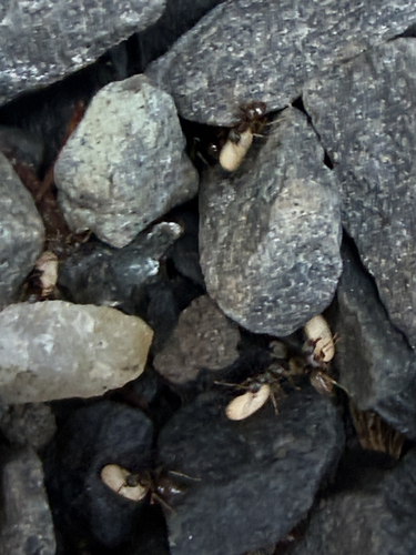
The area is also a haven for local wildlife, often heard before seen. You’ll hear American Red Squirrels darting through the branches and catch glimpses of American Toads and Green Frogs near the trail’s many sheltered wetlands. From the fascinating carnivorous Purple Pitcher Plant thriving in nutrient-poor bogs to the sturdy presence of Northern Red Oak on the ridges, every section of the trail provides a unique look at the complex biological interactions that give life to this hike.
Some of the trail’s most extraordinary wildlife cannot even be seen with the naked eye. In 2018, dirt collected on a whim along the Bluff Wilderness Trail led to a groundbreaking scientific discovery that added an entirely new branch to the evolutionary tree of life. Dalhousie University researchers discovered rare microscopic organisms known as hemimastigotes in the soil, including a previously unknown species they named Hemimastix kukwesjijk, named after a hairy, ravenous ogre from Mi’kmaq mythology. These tiny predators are so genetically distinct that they don’t fit into the established plant, animal, or fungi kingdoms, instead forming their own unique “supra-kingdom.” It’s incredible to think that with every step you take, you are treading over unique chapters of Earth’s biological history. To see if you’ve discovered a new life form, record your Bluff Wilderness Trail observations on iNaturalist:
Recent Community Sightings
Live wildlife and plant observations logged along this route:

Spot something interesting while out on the trail?
View & Log SightingsTrip Tips
Respect the ruggedness. The Bluff is not your typical groomed trail; it is a true backcountry experience characterized by “rooty,” uneven, rocky terrain. Because the trail consists of four connecting loops, it’s easy to underestimate the time required to complete the journey. A common mistake is starting a loop too late in the afternoon. On this trail, your pace will likely be 30–50% slower than on a flat rail-trail. Note the current sunset time, and plan for at least 3-4 hours for the first loop alone. Always carry a physical map and a downloaded offline version, as cell service can be spotty once you drop into the valleys.
Given the exposed nature of the granite barrens, weather conditions here can shift rapidly. You’ll be buffeted by wind on the high ridges and find yourself in muddy bogs in the low points, so waterproof footwear with solid ankle support is highly recommended. As this is a protected Wilderness Area, the “Leave No Trace” principles are vital to its preservation. There are no trash bins or facilities once you leave the trailhead, so pack out everything you bring in. Stick strictly to the marked trails to avoid damaging the sensitive lichen and mosses that take decades to grow on the granite.
My recommended packing list for The Bluff Wilderness 30km trek, including essential gear for safety, navigation, and endurance on the rugged terrain: Water (at least 3 litres + filtration method). High-calorie snacks & emergency rations. Topographic map & compass (offline GPS backup). First aid kit (with blister care). Sturdy, broken-in hiking boots. Weather-appropriate layers (no cotton). Rain shell & emergency bivvy/space blanket. Headlamp with extra batteries. Multi-tool or knife. Sun protection & bug spray.
Eats, Supplies & Stays
Pre-hike supplies can be sourced nearby in the Timberlea area with grocery stores, markets & gas stations to choose from. For refreshments and tasty rewards after your long hike, be sure to check out North Brewing Company, a 5-minute drive from the Bluff Trail in Timberlea. A standout choice that offers a craft brewery taproom, full-service restaurant with a diverse menu, tasty wings, and a retail shop for beer to go. Similarly, check out The TBR (Timberlea Beverage Room), a long-standing local favourite known for its hearty portions, relaxed lounge setting and community vibes. It offers a variety of comfort food staples perfect for post-hike hunger.
Turn your hike into a getaway; use this interactive map to find the best accommodations and unique stays just minutes from the Bluff Trail trailhead.

Featured Products
Purchases help fund these guides