


Welcome to Halifax Trails, your definitive guide to Nova Scotia outdoor adventures. Discover 100+ personally scouted hiking trails, field-tested maps, biking and paddling routes—complete with immersive 360° virtual tours to help you explore the province with confidence.

How to use my trail maps & virtual tours.
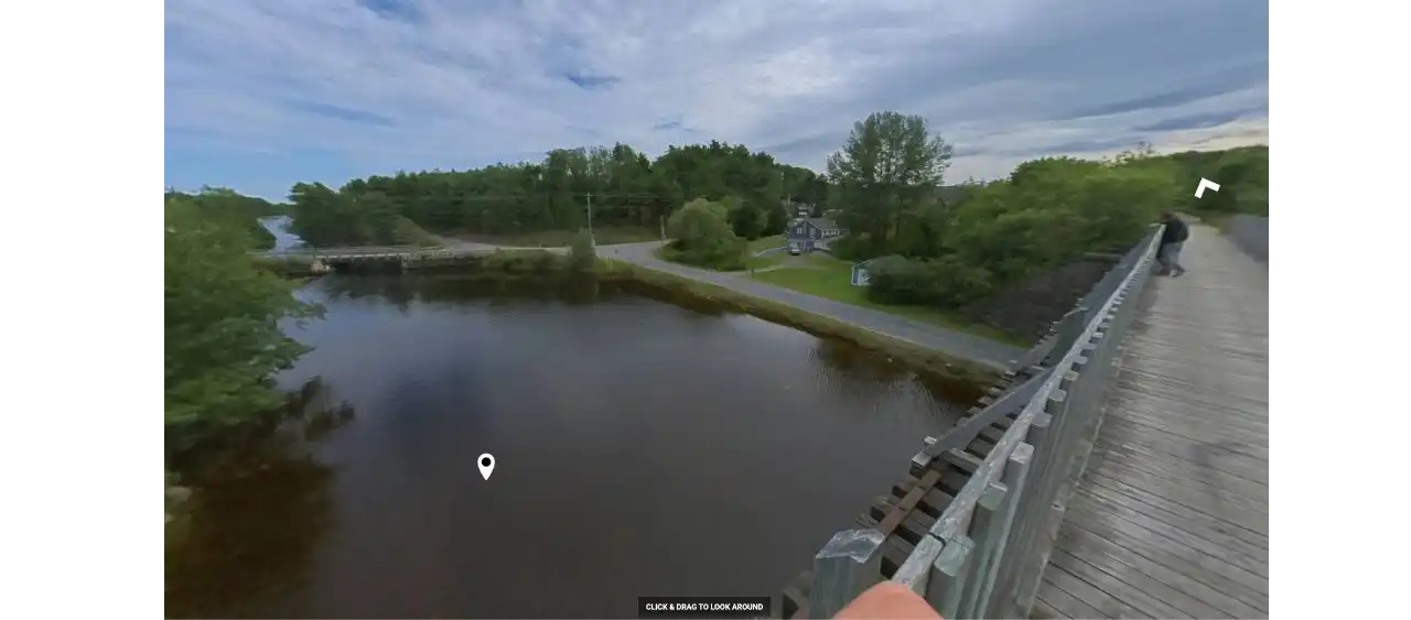
360° View Of The Week
Scout this week's featured Nova Scotia outdoor adventure. Click the image below to pan around and scope out the terrain before your next hike, bike ride or paddle.
Guided Hikes & Events
Support This Site & Join The Private Facebook Group!
Want to connect with fellow Nova Scotia adventurers? For local Q&A, trail updates & events, join the exclusive Halifax Trail Talk Facebook Group! I offer personal invites to everyone who helps keep this project independent.
Share Your Nova Scotia Adventures!
🌲📸 Hiking a rugged coastline, biking a local rail trail, or finding the perfect hidden waterfall? I want to see it! Tag your Instagram photos and reels with #halifaxtrails to get featured in the community gallery below.