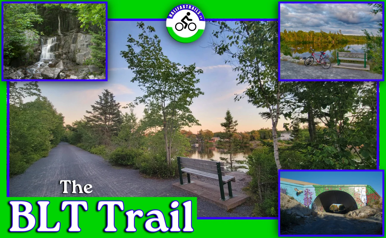
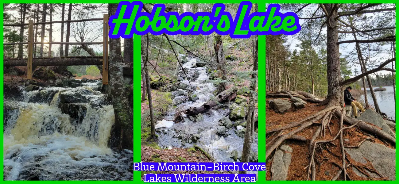
fbpx
Top
  >  Posts tagged "Waterfall"

Difficulty: Moderate (rugged, muddy terrain). View elevation profile. Facilities: Parking. Signage: Trail map at the trailhead. Interpretive panels on local natural features. Features: 4.2km (1hr) up & back. 10ft high waterfall & scenic river gorge. Biodiversity: Tamarack Trees, Pickerel Frog, Snowshoe Hare, Eastern White

Difficulty: Easy (some navigation challenges). Facilities: None. Signage: None (some flagging & markings). Features: A short hike with a waterfall, lake access & scenic forest. Categories: #Easy, #Family-Friendly, #Fishing, #Lake, #Loop, #River, #Short, #Snowshoeing, #Swimming, #Waterfall Webber Lake Falls Hiking Trails      Webber Lake Falls

Difficulty: Easy-Moderate (Terrain, Navigation). Facilities: (Minimal) Parking. Signage: None. Features: 3.2km, 1hr return trip to "Grand Lake Run".  Rugged, narrow, un-marked trails.  Popular swimming hole with plenty of scenic access points. Biodiversity: Gaspereau | American Mink | Bunchberry |

GPS Files | How-To Guide. Difficulty: Moderate-Difficult. Facilities: Some adjacent private campgrounds. Signage: Minimal, at East & Main Branches. Features:  3 converging branches; Main (14km), West (36km), and East (17km).  Live water level reporting to help plan your trip. Biodiversity: Atlantic

Difficulty: Moderate. Facilities: Parking. Signage: None. Features: Picturesque cascade waterfall hike, doable in as little as 1 hour.  Small sandy beach, pristine lakes, and rivers. Biodiversity: Loon | Osprey | Striped Skunk | More

Difficulty: Easy to Moderate (distance, hills). Facilities: Parking, canteen, pool, restrooms, bandstand, picnic areas, playground. Signage: Interpretive panels, maps, and trail markings throughout. Features: Over 1000 acres to explore.  Family-friendly destination with public pool (closed for upgrades), splash pad &

Difficulty: Moderate (Rugged Terrain/Unmarked Trails). Facilities: None. Signage: None. Features: Part of a 1900 hectare wilderness area.  A short 3km (~1hr) return trip to a scenic waterfall.  Requires caution; live hunting traps and snares are sometimes in the area.

Difficulty: Moderate to Difficult (hills, rugged terrain, distance). Facilities: Parking, camping, washrooms. Signage: Adequate signage throughout. Features: Over 10km of hiking trails with views of the Minas Basin.  Home to some of the world's highest tides.  Fully equipped provincial park campground (click

Difficulty: Easy to Moderate (distance). Facilities: Parking. Nearby bicycle & paddling rentals at Lunar Adventures. Signage: Distance markers, periodically posted maps, info panels & info kiosk at the trailhead. Features: A 13km section of the 123km Rum Runners Trail. 

Available for Amazon Prime