- Difficulty: Easy to Moderate (distance dependent).
- Facilities: Parking. Nearby bicycle & paddling rentals at Lunar Adventures.
- Signage: Distance markers, periodically posted maps, info panels & info kiosk at the trailhead.
- Features: A 13km section of the 123km Rum Runners Trail. Access to the Bluff Trail. Connects directly to/from the Chain Of Lakes & St. Margaret’s Bay Trail. Waterfall and other scenic stopping points.
- Biodiversity: Vibrant green corridors supporting mixed plant life, insects, and local waterfowl. (View the Nature section below)
- Trail Conditions: View & sign the logbook for recent updates from fellow explorers.
BLT Rails To Trails
The Beechville-Lakeside-Timberlea or “BLT Trail” is a 13km converted rail trail and part of a 123km trail known as the Rum Runner’s Trail that connects Halifax to Lunenburg. The BLT Trail is ‘sandwiched’ between the communities of Beechville, Lakeside & Timberlea (hence the “BLT”). Like the sandwich, the trail has all the basic ingredients needed for an easy, satisfying bike ride, walk, or jog. Biking from one end to the other can be done in approximately 1 hour, but there are plenty of nice stops along the way to justify spending much more time than that.
As a former railway, there are no big hills, only gentle grades. Though they may be imperceptible to the eye, these slight grades can extend for a kilometer or two, as you will notice if you’re pushing your limits. This mixed-use trail is also used by ATVs, so it requires everyone to share the trail by yielding to others (a bicycle bell is a must!) Keep your ears open for the ding of a bell and move over to the right-hand side to allow others to pass.
Parking Lots & Access Points
The main access point is the trailhead adjacent to the old Coke plant in Lakeside. The parking lot sits between the end of the Chain of Lakes Trail and the beginning of the BLT Trail. This area has an information panel for community notices and a large trail map. There’s a picnic table at the trailhead as well as a garbage can that volunteers maintain. If you’re driving an EV, there’s a fast charger available in an adjacent lot.
1km from the Lakeside parking area is the first access point to Governor Lake. On the opposite side of the lake is the community of Lakeside. At the far end of the lake, in Lakeside, is a bicycle and paddling rental business called Lunar Adventures. They have direct access to the lake for paddling, as well as a nearby connection to the BLT Trail behind Trinity United Church.
Another designated parking area is the Bluff Wilderness Trail parking lot in Timberlea. This access point is directly connected to the BLT Trail. It’s a good mid-point along the trail with lots of nice spots close by, like scenic Cranberry Lake. This lot can also be very busy during peak times (on nice weekdays in summer & weekends), so plan accordingly. When the lot is full, people often park on St. Margaret’s Bay Road, but as a sign in the lot reads, “Keep Bay Road sight lines clear. No parking on Bay Road within 130 feet of (parking lot) entrance. Violators ticketed and/or towed at owner’s expense”.
At the Hubley end of the BLT Trail is a pull-off from St. Margaret’s Bay Rd. with a small parking area. This is located at the end of the BLT Trail and the beginning of the St. Margaret’s Bay Trail. From the parking lot to the BLT Trail, you will cross a fairly busy part of St. Margaret’s Bay Road with vehicles going at high speeds. There is no marked crossing, so use plenty of caution when doing so.
There are access points with bigger parking areas further along the St. Margaret’s Bay Trail, in Jerry Lawrence Provincial Park (closed in winter), and a main trailhead behind a shopping plaza in Timberlea, near the Bike & Bean Cafe.
The linear nature of the rails-to-trails system means you’ll have to do an up-and-back trip or make transportation plans. Though this can be a bit of a pain to plan around, there are plenty of ways to accommodate trips of any length thanks to the ease of accessing the trail from various points throughout. I hope soon there will be a shuttle service up and down the rails-to-trails at various pick-up and drop-off points as the popularity of the entire Rum Runners Trail system continues to grow.
Metro Transit routes serve the nearby St. Margaret’s Bay Road from the Lakeside Industrial Park parking lot at one end to St. Andrew’s Church, across from The Bluff Wilderness Trail parking lot at the other end. From the Bluff Trail parking lot onward, there are no public transportation options. Bike racks on buses can hold a maximum of 2 bikes and are on a first-come, first-served basis.
BLT Trail Sections
The BLT Trail has 5 informal sections, each section is roughly 2- 3 km, without marked starting or ending points. The trail sections, beginning from the Lakeside Industrial Park, are as follows:
Blue Jay Way is a 2km stretch that follows along Governor Lake. There are benches to take in the views of the lake. With the best lake access points being at the near & far ends. This stretch of trail follows the length of the lake, the far end of which has a connection behind Trinity United Church, where nearby Lunar Adventures has rentals for paddling & biking.

The Six Mile Falls section covers 2km of trail that follows along a brook. The eye-catching Six Mile Falls waterfall makes for a popular stopping point. You’ll end this section of the trail by crossing an old rail bridge with a view.
The 2.5km Fraser Mill Walk section begins after crossing the busy St. Margaret’s Bay Road, and a nearby convenience store, true to its nature, is conveniently located next to the trail. The area gets its name from Halifax’s last water-powered sawmill, which was located at a pond that you will pass along the way.
The 3km Cranberry Run is a section more secluded than the rest. It also connects to the Bluff Trail, which is a top-notch system of rugged, challenging wilderness hiking trails (for experienced hikers). Adjacent to the Bluff Trail trailhead are great views of Cranberry Lake, along with access to the lake.
The final 3.5km of trail, known as the Coach House Trail, crosses Five Island Lake on its way to the end of the BLT Trail and the beginning of the St. Margaret’s Bay Trail.
Points of Interest
For simplification, I’ll be stating distances starting from the Coke plant trailhead in Lakeside. Just over 1km along the trail, you’ll come to the first pit-stop along Governor Lake with two benches and an additional one on the lake. These benches are the first of a few others along the lake. This first stop and one area at the opposite end of Governor Lake are the best trailside lake access points.
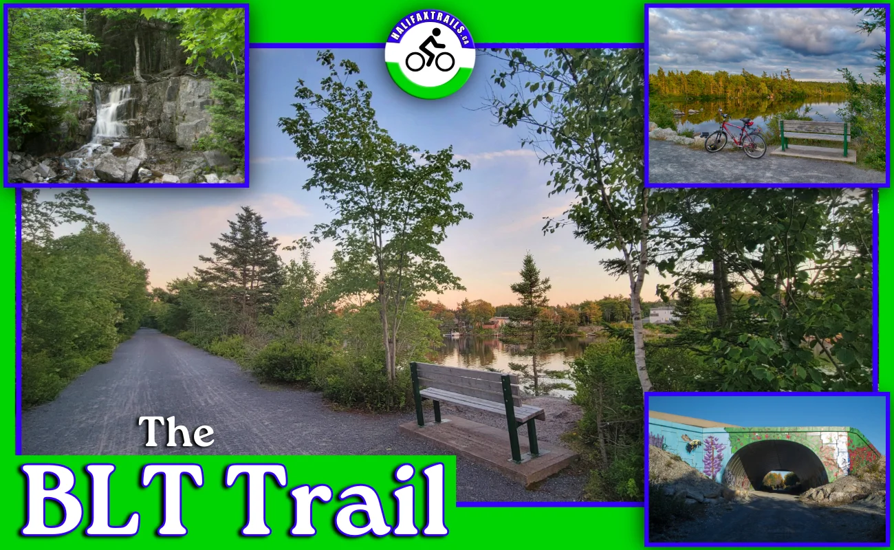
Waterfall
 2.5km from the trailhead, you’ll come to Six Mile Falls. This waterfall is perhaps the most iconic stop along the trail, and as such, it will likely be busy during peak times. As with all local #waterfalls, the flow is highly dependent on recent weather and season. During dry periods, it can be nothing more than a trickle, but usually, it’s flowing steadily, even in winter. Garbage cans and a trail map are also located at this stop.
The falls should be running, but expect a lighter, gentler flow. More rain is needed for a heavy cascade.
Algorithm based on 31.8mm of rain and 21.1°C average highs over the last 96 hours.
Just a few paces beyond the waterfall, on the opposite side of the trail, is a posted sign which discusses the Nine Mile River/Governor Brook River restoration project. Next to the sign is a small path leading to a scenic viewing point of the river. I always make a stop here whenever I stop at the falls, or as I wait for the crowd at the falls to dissipate.
3.8km along the trail, you’ll come to a former railway bridge that’s been transformed into a fantastic stopping point overlooking a small lake. The railway bridge is parallel to a busy part of the St. Margaret’s Bay Road, where a mural depicting the area’s past railway has been painted onto the road’s overpass. Just a few meters beyond this bridge, you’ll come to a point on the trail where it crosses St. Margaret’s Bay Road. There is a well-marked crosswalk that connects to the trail. This crossing is the busiest of all, so be sure to use plenty of caution. Just after this crossing, you’ll pass by the back end of Fitzgerald’s Grocery, which is a great place for snacks, supplies, and vital ice cream cones.
Near the 5km mark, the next notable stop is Fraser Mill Pond. A bench and nearby information panel give you information on a lumber mill that was located here, dating back to 1922.
After Fraser Mill Pond is an especially isolated stretch of trail where the noises of civilization disappear. A sole, unassuming bench at the 6.5km mark is one of the most peaceful stops. The scenery is unremarkable, but the ambiance is something to soak in. The bench bestows calm and peacefulness in a loving memorial of life taken far too soon. It serves as a good reminder to always take time to stop and smell the roses.
What To Expect
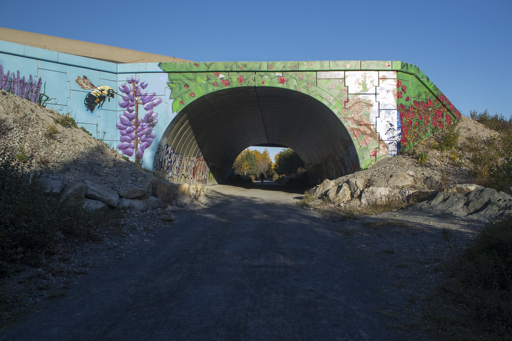
7.5km along is Cranberry Lake and the trailhead for the Bluff Wilderness Trail. The trail passes underneath busy Highway 103 in style as the otherwise ugly underpass has been spruced up with some great artwork on either side. This artistic underpass is a well-known icon of the BLT Trail.
500m before the underpass is the parking lot for the Bluff Wilderness Trail, with the trailhead located just after the underpass. At the Bluff trailhead is a bike rack to lock your bike should you decide to go in for a hike. Keep in mind these trails are for experienced hikers and require plenty of time and pre-planning, as you can read in my Bluff Trail guide. Just past the Bluff trailhead is a small bridge crossing the head of Cranberry Lake. This area has benches overlooking the lake, as well as a rocky area that provides good swimming/paddling access.
Algorithm based on thermal lag and seasonal averages.
The next body of water comes at 9km into the trail as you reach the head of Black Point Lake, and another well-situated memorial bench. Just past the 10km mark is a scenic, flowing stream-fed pond and bench with a great view that often includes ducks and other birds. This stop is a good often a good #bird-watching pit-stop.
As you enter the final stretch of the BLT Trail, at 10.5km in, you’ll come to a bridge spanning a narrow point of Five Island Lake. Benches at either side of the bridge offer scenic, opposing views of the lake.
BLT Trail Photo Gallery


The Rum Runners Trail
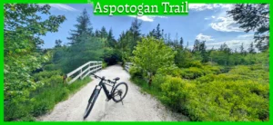
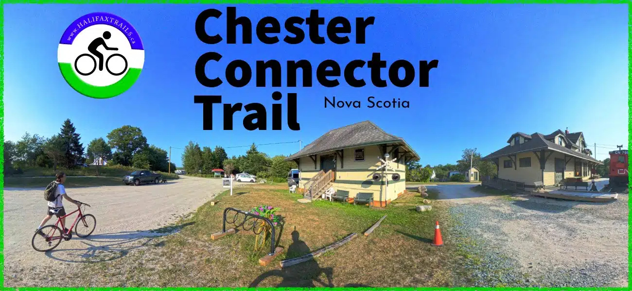
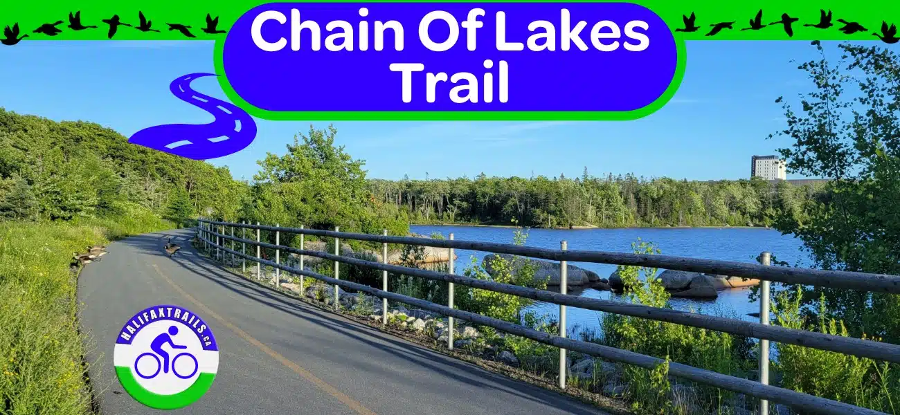
The B.L.T. Trail can be great by itself, or as part of a long, unbroken #rails-to-trails journey from Halifax to Lunenburg. This 123km trail begins from Halifax to Lunenburg with the Chain of Lakes Trail, BLT Trail, St. Margarets Bay Trail, Aspotogan Trail, Chester Connector, Dynamite Trail, and Bay-To-Bay Trail in Lunenburg. With plenty of lakes, sandy ocean beaches, and a very scenic provincial park campground along the way, this route makes for a great multi-day bike-packing adventure.
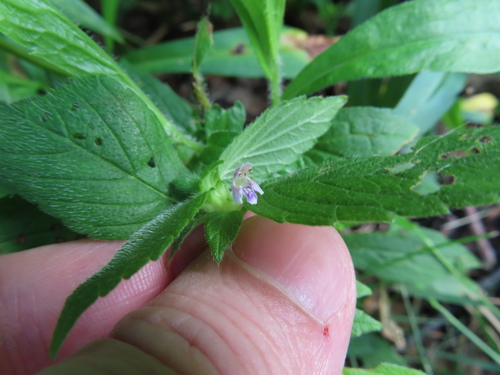
Nature and Wildlife
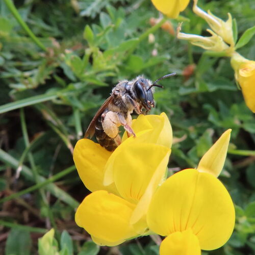
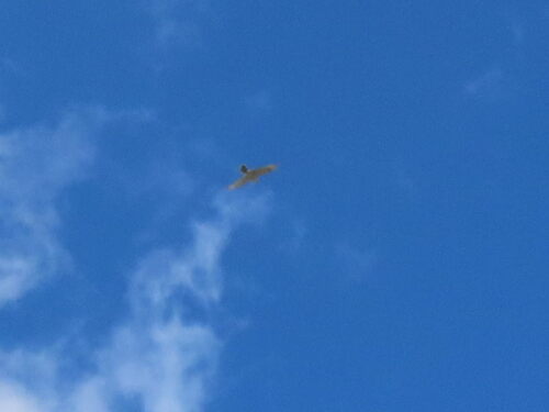
The BLT Trail is a vibrant hub for local biodiversity, offering a rich snapshot of the region’s ecosystem. Community science data highlight a fascinating variety of wildlife along the path, ranging from common waterfowl like the Mallard and Canada Goose to familiar perching birds like the American Robin and Song Sparrow.
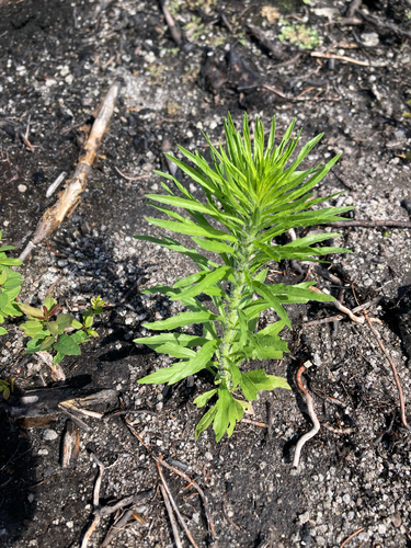
The trail’s diverse landscape also supports a wide array of insects, arachnids, and native flora. Visitors frequently encounter pollinators like the Common Eastern Bumble Bee, alongside plant species such as Sheep Laurel, White Meadowsweet, and Lowbush Blueberry. This thriving natural corridor serves as an accessible window into local wildlife.
Recent Community Sightings
Live wildlife and plant observations logged along this route:
Spot something interesting while out on the trail?
View & Log SightingsTrip Tips
A new nearby rental business has opened in recent years, offering bikes, canoes, kayaks and paddleboards. Lunar Adventures provides paddling access to Governor Lake, which runs directly alongside the trail. This convenient location also rents bicycles for hassle-free access to the trail. Located off of St. Margaret’s Bay Road, they offer direct access to Governor Lake. The BLT Trail is less than 500m away via an access trail behind Trinity United Church (marked on my map). With very reasonable rates, their services are well worth looking into if you don’t have your own equipment.
It’s worth noting that certain areas of the BLT Trail can have lots of mosquitoes, so come prepared in Spring and early Summer. In winter, the trail is great for fat biking as ATV traffic usually quickly lays tire tracks into the snow. If you’re planning on cross-country skiing or #snowshoeing, you’ll want to do it soon after a fresh snowfall, as there is usually plenty of traffic to lay an uneven base of snow.
In Summer, the trail hits peak traffic. It’s important to be mindful of sharing the trail during peak times, so be sure to stick to the right-hand side to let others pass. A bicycle bell is a must-have for all local rails-to-trails to make others aware when you pass. The “ding” of a bicycle bell is not an angry honk; it’s a courtesy to let others know of your presence. Keep an ear free from your noise-cancelling headphones, stay to the right and give a thumbs up if you hear one. Trail rules also state that dogs must be kept on a short leash.
The flat, wide, compacted crusher dust surface, lakeside breezes & swim spots make the BLT popular with runners. If you’re interested in joining a running group, check out the BLT Runners. If you’re serious about training, I highly recommend investing in a smartwatch (Amazon links help support this site). I have a Garmin Fenix, and it’s the most-used, most reliable piece of equipment I own.
Be aware that ATVs share the trail. ATVs must obey the speed limit of 20km/h. Most are safe and courteous, but it’s still up to you to be aware of your surroundings (keep your head up if you’re zoning out with earbuds). These rules & recommendations allow everyone to enjoy the trail safely, especially during peak times when it can be quite busy.
Looking for a fun, outdoor adventure to complete with family and friends on the BLT Trail? Try “Wild Party” to become a weasel and figure out a gift to bring to Mother Nature’s wild party! The step-by-step instructions for this 2.4 km (return) trail adventure and a route map can be downloaded at earthadventures.ca. The approximate time to complete the adventure is 2 hours.
There are lots of garbage cans along the trail, all of which are maintained by volunteers with the BLT Rails to Trails Association. If you come across one that’s overflowing, please don’t add to the volunteers’ workload by adding to the mess. Better yet, donate to help out. The latest updates, including any trail work closures, are on their Facebook page. Update: the BLT Trail Association has returned its letter of authority to the province, and the trail is no longer actively managed by the former BLT Trail Association. The St. Margaret’s Bay Trails Association is providing BLT Trail updates on their Facebook page.
Have you been on the BLT Trail recently? Sign the logbook below!

Gear Up For Your Next Adventure
Purchases help fund these guides
❄️😎🌷🍂 My #virtualtours now have many spots where you can see how it looks in each of the 4 seasons!
📍Here's Cranberry Lake, along the BLT Trail in #Halifax, #NovaScotia.
👀 Check out my virtual tour, here: https://kuula.co/share/78DSr/collection/7999Y?logo=1&card=1&info=0&fs=1&vr=1&sd=1&autorotate=0.02&thumbs=3