- Difficulty: Easy – Moderate (Terrain, Navigation).
- Facilities: (Minimal) Parking.
- Signage: None.
- Features: 3.2km, 1hr return trip to “Grand Lake Run”. Rugged, narrow, unmarked trails. Popular swimming hole with plenty of scenic access points.
- Biodiversity: Gaspereau | American Mink | Bunchberry | More…
Pennant River
Hiking Trails & Swimming Holes
Rocky and narrow for the first hundred meters, you’ll want to mind your ankles. With 2 or 3 access points to the river within the first 100m, you don’t have to walk far to find a nice spot to enjoy. If you intend to head any further, you will definitely want to wear some good, sturdy, waterproof hiking boots.
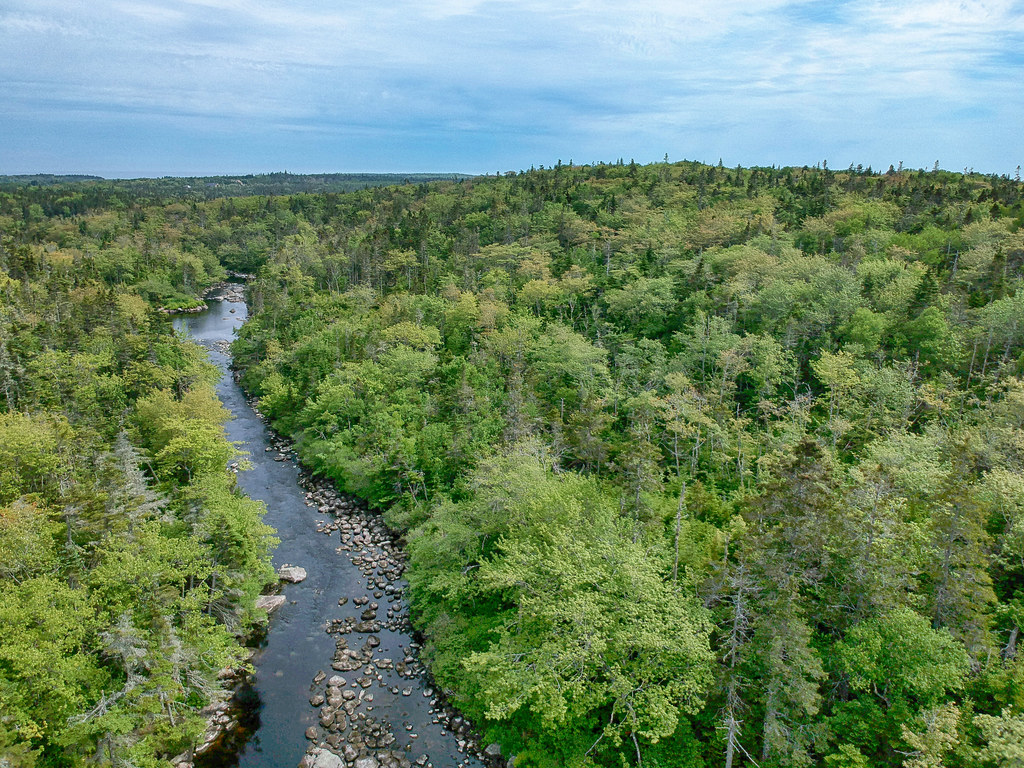
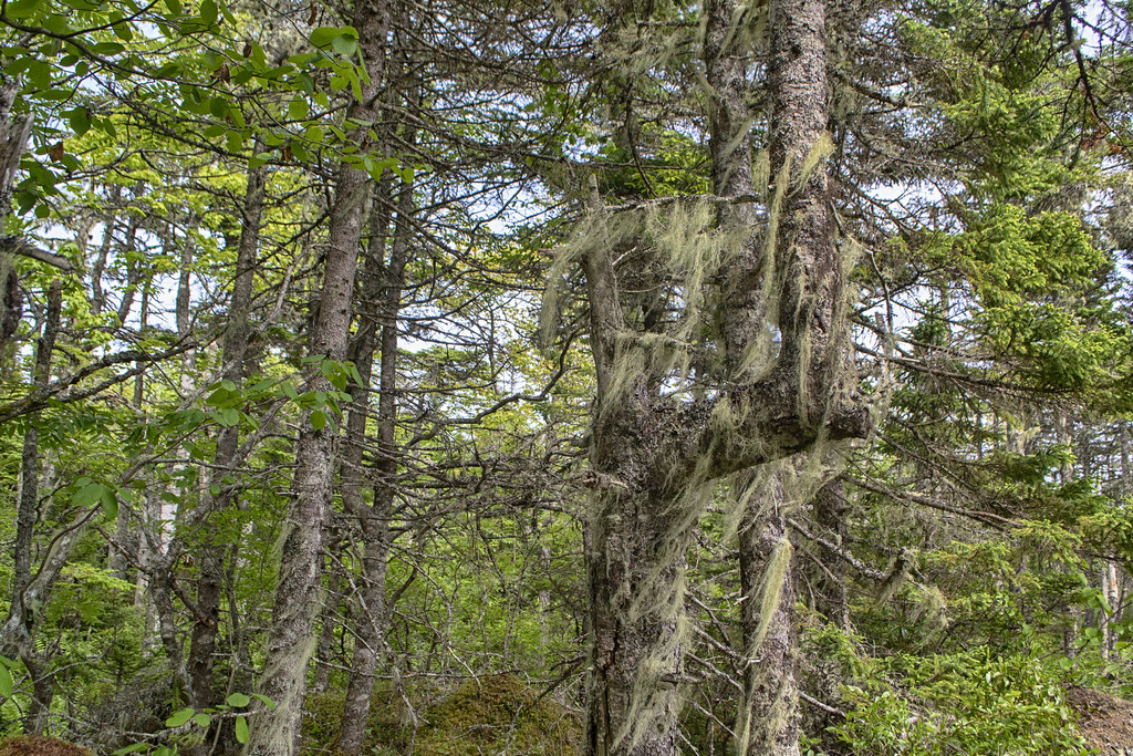
As you progress along the trail, you’ll encounter alternating, varying degrees of overgrown vegetation, mud & uneven rocky terrain. Forks in the trail can lead you in different directions, so you do need to pay attention to where you are going. The main trail, however, is quite easy to follow if you are paying proper attention, as it never strays very far from the river.
160m along the trail is a rocky access point for a popular swimming hole. Here, the river has a small, deep pool sandwiched between rocky areas. A rope helps facilitate getting out, or as an anchor to keep you from washing downriver if you’d like to just sit in the current. Always be extra cautious and check the water level before jumping in.
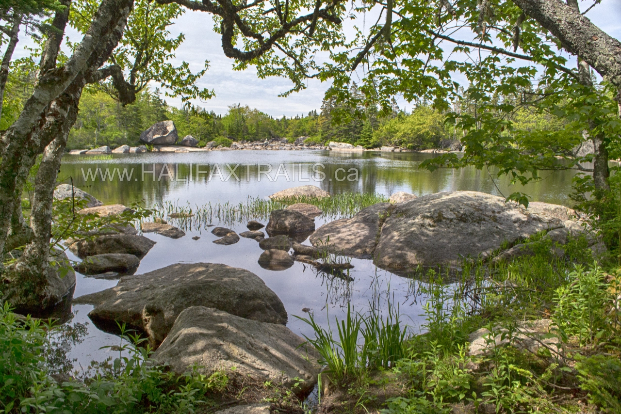
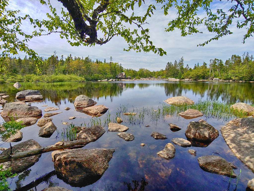
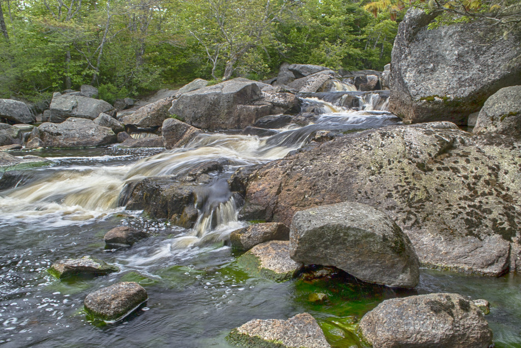
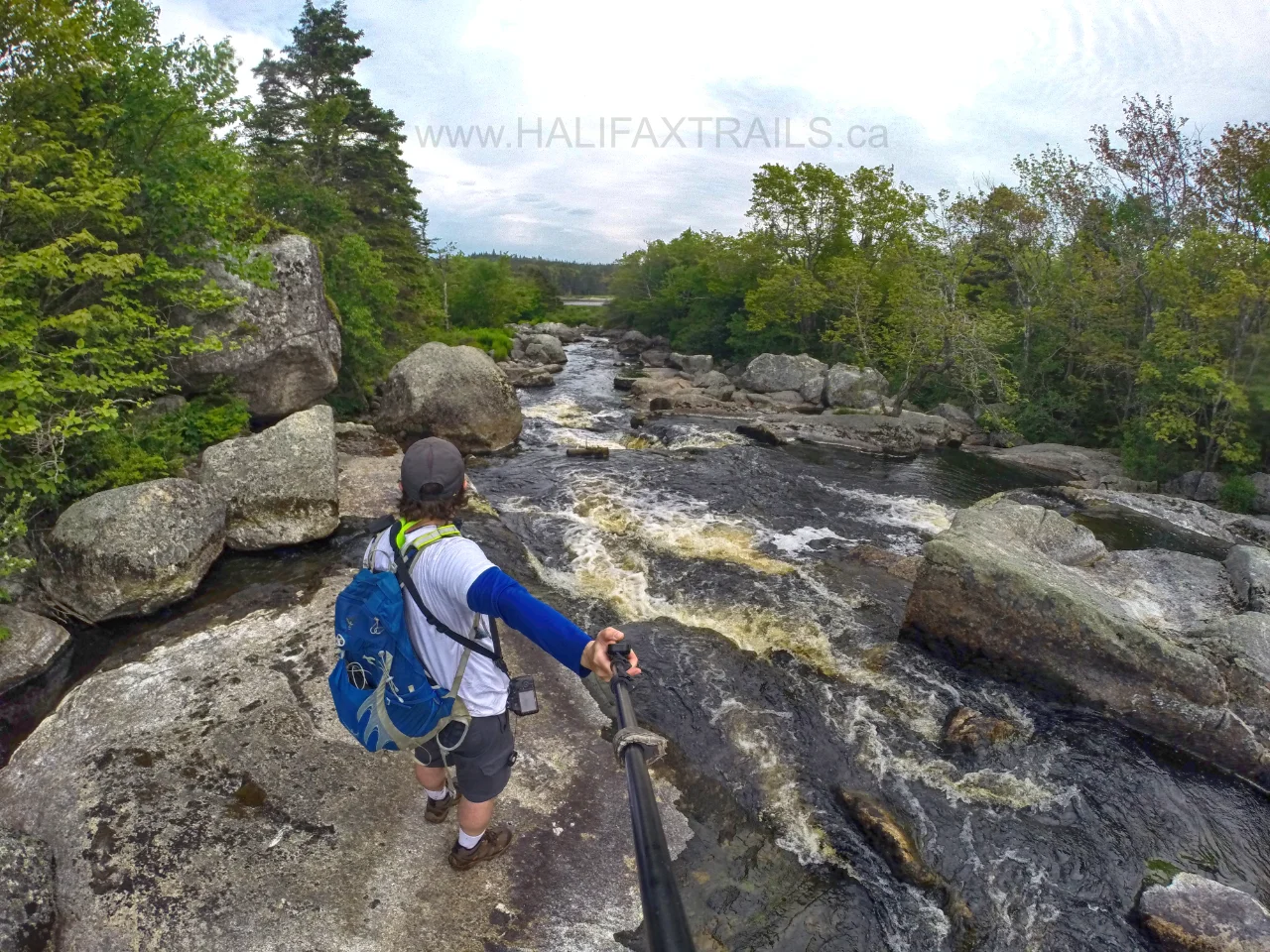
275m in, you’ll come to a pond where the river collects into a large open area. You’ll be greeted with ultra-scenic, camera-friendly views as well as a perfect access point with a flat rock platform to stand on as you carry on another 100m.
 For the last 600m stretch, the trail gets more rugged, narrow, and muddy. You’ll head a little bit further inland, away from the river, and encounter a few inclines and declines. Reaching the end of the trail (as far as I could tell) at “Grand Lake Run“, you’ll come to a small clearing with a fire pit and canoe portage sign. Always be aware of local burning restrictions, opt to use a fire dish, camp stove or better yet, don’t burn at all.
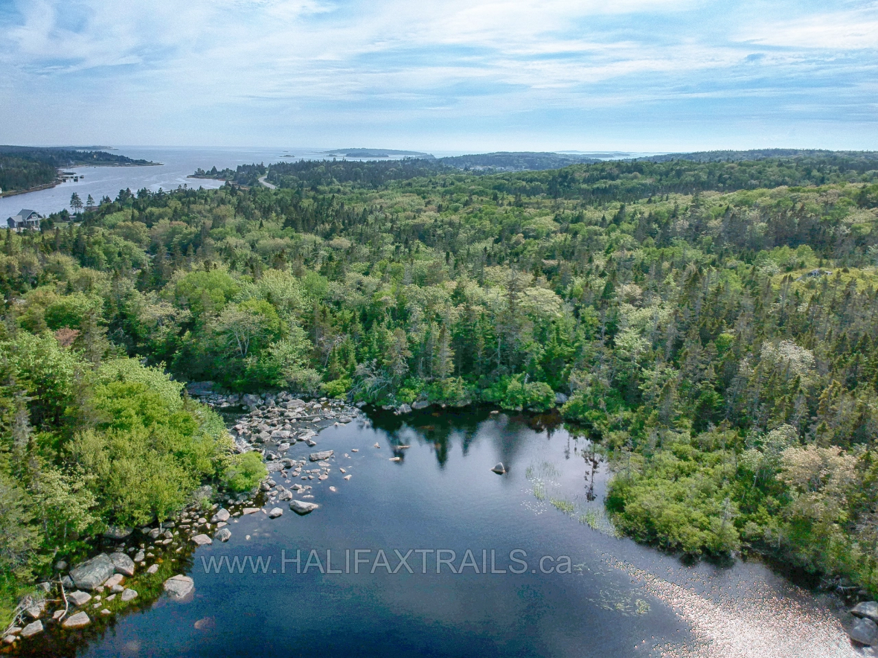
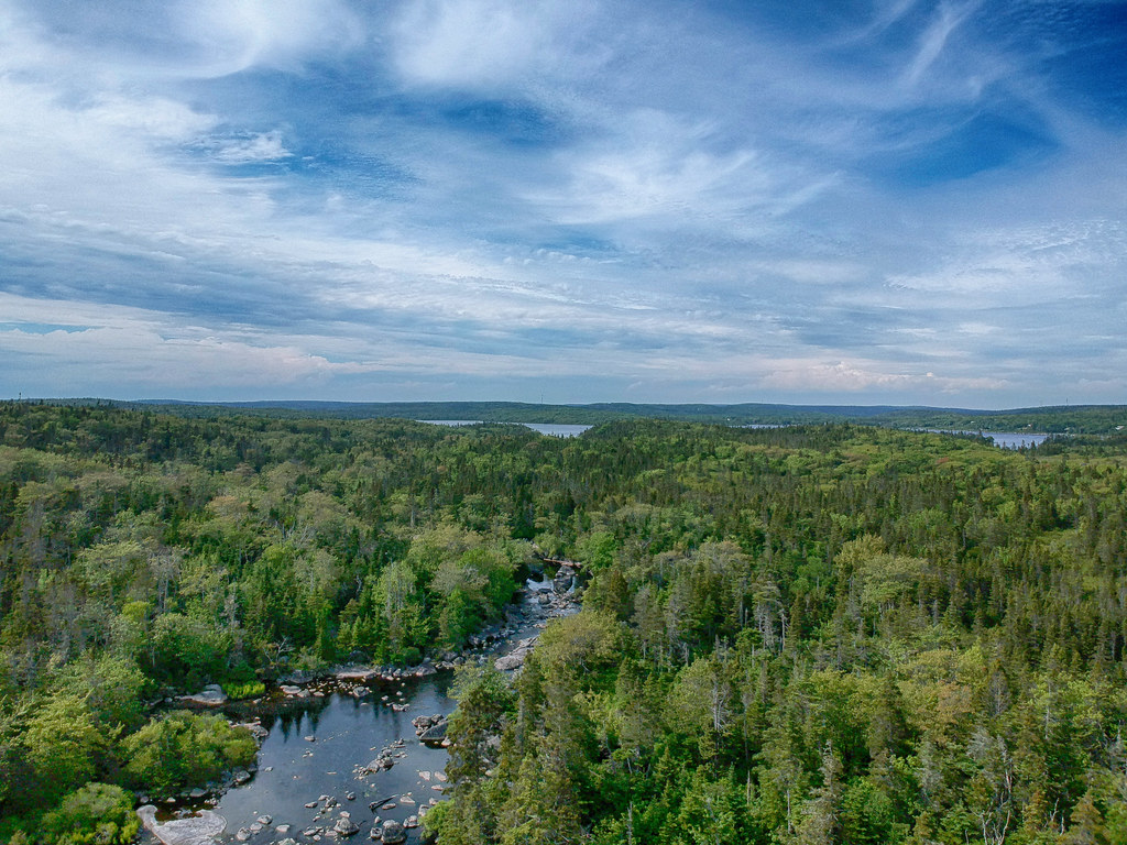
From here, you can see a scenic view of Grand Lake in the distance, reminiscent of the scenery in Kejimkujik National Park. With no ideal access point to the lake or any obvious trail extensions, this is where I stopped and headed back.
Pennant River Conservation Area
This priceless area has been valued for generations for its unique, biodiverse beauty. For generations, this area was loved by the public, while being privately owned. Fortunately, the family who owned the land knew full well how important it is to the well-being of people and nature alike. In 2018, the family kindly entrusted their land to the Nova Scotia Nature Trust through a land donation. Their kindness ensures 300 acres encompassing lakes, rivers, wetlands and coastal barrens will be protected for generations to come. Thank them by donating.
 More than a treasured swimming hole for people, the land is an important migratory corridor for birds, fish, and mammals like the mainland moose. The area is an important connection between nearby Crystal Crescent Provincial Park and the Terence Bay Wilderness Area (which also has its share of similarly rugged, un-marked hiking trails). In Spring, the river is a hotbed for Blue Herons & Osprey as they feed on Gaspereu fish. Endangered American Eels and American Mink are also found in this important biodiverse #wetland habitat.
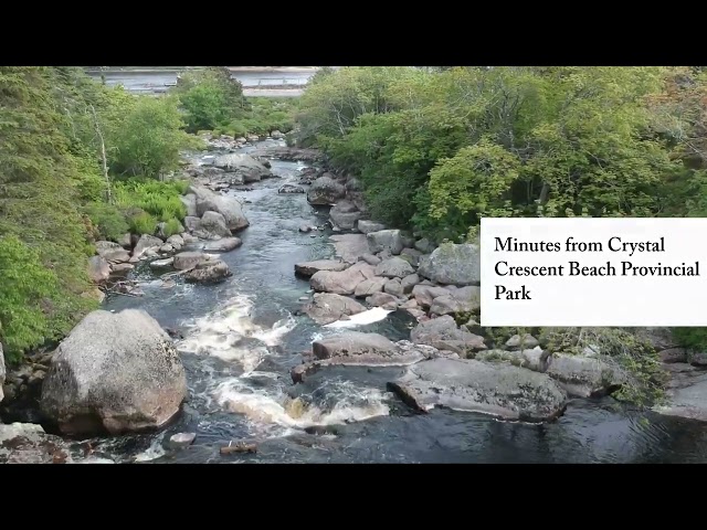
Crystal Crescent Side-Adventure
Nearby Crystal Crescent Provincial Park is the most popular beach in Halifax, but what’s lesser known is the extensive hike along Pennant Point. Crystal Crescent is a great place to spend a day hiking, swimming, and sunbathing. The Pennant River Conservation lands are just a 5-minute drive from the beach making it great for as an additional pit stop. Whether you want to clean the salt and sand off with a freshwater dip, or cool your feet in the running water after a long hike at Pennant Point, it’s easy to work in a reason to stop by. Alternately, Crystal Crescent provides a good backup plan should there be no available parking space at the river.
Pennant River Photos


Pennant River Trip Tips
 The rugged nature of the area requires measured caution when it comes to preparation. First and foremost, it’s not the kind of trail you’ll want to wear your beach flip-flops for. Proper footwear is a must.
Its proximity to the coast means temperatures can rise and fall drastically, complete with fog banks and other rapid, unexpected changes. Being prepared for these changes by bringing extra layers is a wise course of action. With plenty of rocks to slip, fall or twist an ankle on it’s not a trail to take lightly despite its #short distance. As with any hike, make sure you tell someone where you’re going, should a worst-case scenario develop.
In Spring and early summer, mosquitos, black flies, and deerflies love the area as much as humans do. If there’s no breeze, it can get to intolerable levels if you don’t have any bug protection gear. On my visit in early summer, I didn’t encounter any ticks but you should always try to avoid them by doing regular checks and carrying a tick remover on all your hikes in Nova Scotia. Pack a towel and something to sit on to enjoy both Crystal Crescent and the swimming holes along the Pennant River.
Cellular phone & data reception is spotty, with one bar of service through much of the hike. You don’t need a GPS to do the hike, but for peace of mind its always better to bring a dedicated GPS unit along with the survival basics you should take on all hikes. If you intend to hike the entire length of the trail, experience with un-marked wilderness hiking is highly recommended, as the trail can be overgrown in parts, with forks and wildlife trails leading off in different directions away from the main trail.
On my last visit to this area, I didn’t encounter any litter so let’s keep it that way. Please bring an extra plastic bag to safely pick up any litter you see out with you to help make sure it stays pristine. There are no garbage cans at the trailhead so pack out what you pack in.
![]() Gear | Books | On Sale
Gear | Books | On Sale