- Difficulty: Easy – Moderate (distance-dependent).
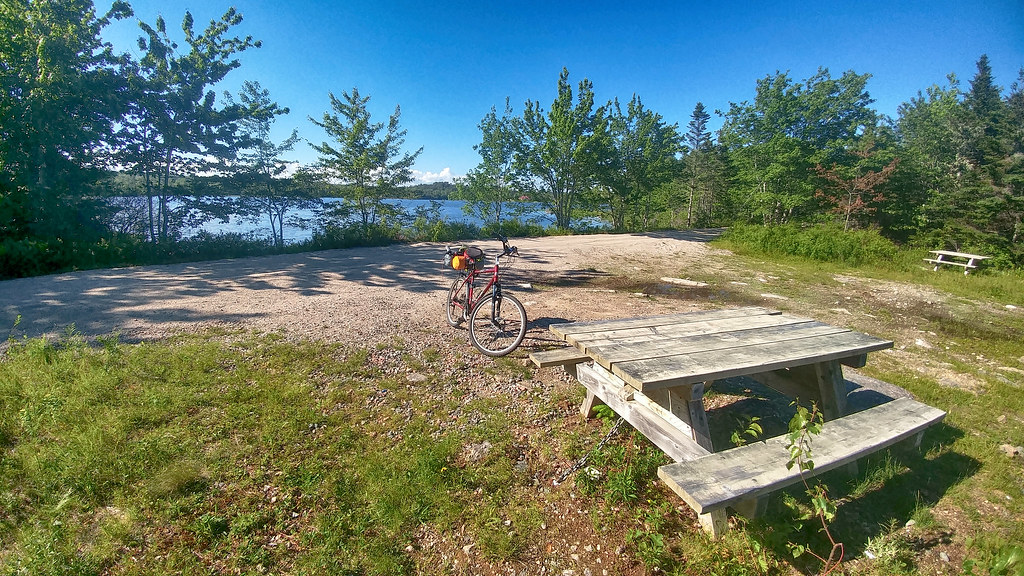
- Facilities: Parking, picnic tables, Porta-A-Pottie.
- Signage: Info kiosks with large, detailed maps at trailheads.
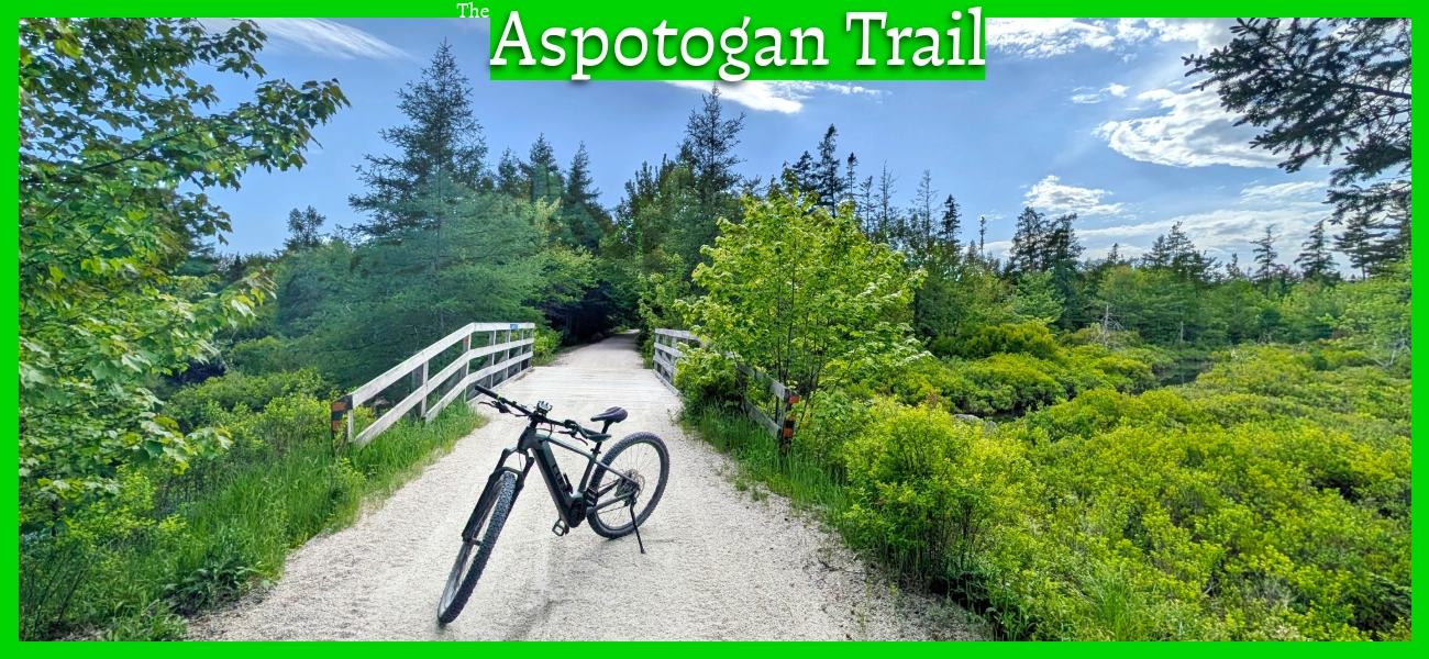
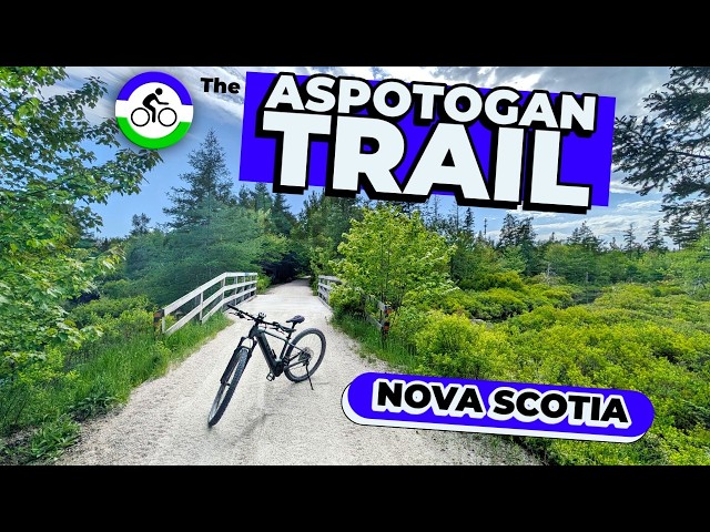
- Features: 13km of multi-use rails-to-trails. Compacted crusher dust base. Part of the 123km Rum Runners Trail that connects Halifax to Lunenburg. Access to Noonan Lake & Meisner’s Beach.
- Biodiversity: A vibrant mix of coastal and Acadian forest habitats, supporting a wide range of flora and fauna, from woodland Downy Woodpeckers in the dense tree canopy to pelagic Shearwaters visible near the coastal access points (view the Nature section below).
- Trail Conditions: View and sign the Logbook for updates from fellow explorers.
The Aspotogan Trail
Connecting Hubbards to East River, the Aspotogan Trail is a scenic 13km multi-use route built on a historic railway bed. As a vital link in the 123-km Rum Runners Trail network connecting Halifax to Lunenburg, this multi-use, former railway line is a favourite for walkers, joggers, cyclists, and ATV riders alike. While it is an inland trail, water is a constant companion here. The trail curves alongside picturesque rivers, brooks, and lakes.
Whether you are walking, biking, or travelling by OHV, the trail provides a beautifully secluded corridor that connects directly to the St. Margaret’s Bay Trail to the east and the Chester Connector to the west.
🧭 Want Offline GPS Navigation for the Rum Runners Trail?
Don’t get caught without cell service on the old railway stretches. Grab the verified Rum Runners Trail GPX & Waypoint Package over on the shop—includes the full 123 km track, individual segments including the Aspotogan Trail, custom POIs (parking, access points), and a step-by-step device loading guide.
Aspotogan Trail Parking
Hubbards Trailhead (East End)
- Location: Where the St. Margaret’s Bay Trail Ends & the Aspotogan Trail begins, near the intersection of Highway 3 and Highway 329 (click here for 360° view).
- Parking Capacity: Limited roadside parking for 5-6 cars, and a small gravel shoulder turnaround.
- Amenities: Large trail map at the entrance and a picnic table. Nearby amenities in Hubbards.
East River Trailhead (West End)
- Location: Where the Aspotogan Trail and Chester Connector Trail meet in East River, near the intersection of Highway 3 and Highway 329 (click here for 360° view).
- Parking Capacity: Large dedicated trail parking lot with room for 20+ cars. A popular staging area for cyclists and ATV riders alike. Has plenty of dips & potholes, so take it slow (still ok for any vehicle).
- Amenities: On-site portable toilet, garbage can & dog waste bag dispenser.
Rails-to-Trails History
Before it became a scenic multi-use corridor for cyclists and hikers, the Aspotogan Trail was a vital section of the Halifax and Southwestern Railway (H&SW). Constructed between 1901 and 1906 to connect Halifax to Yarmouth along the province’s rugged South Shore, the railway was a massive undertaking. However, navigating the challenging coastal and inland topography meant the tracks were built with significant, winding curves. Because the journey was notoriously bumpy and unhurried, the H&SW quickly earned the local nickname “Hellish, Slow, and Wobbly.”
When the last freight trains ceased operations on this line in the early 1990s, the tracks were eventually dismantled, making way for the extensive rails-to-trails network we have today. Exploring the Aspotogan Trail now offers a chance to experience a piece of Nova Scotian transportation history, providing a much smoother, quieter ride through the Acadian forest than the train passengers of the previous century experienced.
Biking The Aspotogan Trail
The crusher dust can be uneven with soft piles (usually in the middle) on some parts of the trail due to ATV traffic. Keep your head up, keep your ears open, and move to the side to let them pass. ATVs and bikes must yield to pedestrians. Helmets are required, and bike bells are highly recommended to let others know before you pass.
While the Aspotogan Trail may not have a lot of standout stopping spots, it makes up for that with the sheer volume of tranquillity all along the trail. While other parts of the Rum Runners Trail can be broken up with lots of road crossings, yields and otherwise urban distractions, the aspotogan has much longer stretches where you can truly lock in, zone out and achieve that utopian flow state that comes with any good bike ride. One minute you’re coasting through light, airy birch, and the next you’re plunged into dark, dense pine. It’s a striking contrast that gives the trail the dynamic, fast-changing energy of a Mario Kart track.
The terrain is gently rolling rather than perfectly flat, but don’t expect any gruelling climbs. The minor inclines are short-lived, never forcing you into your lowest gear. It’s the perfect setup for dropping into a comfortable rhythm, locking into a steady cadence, and just cruising.
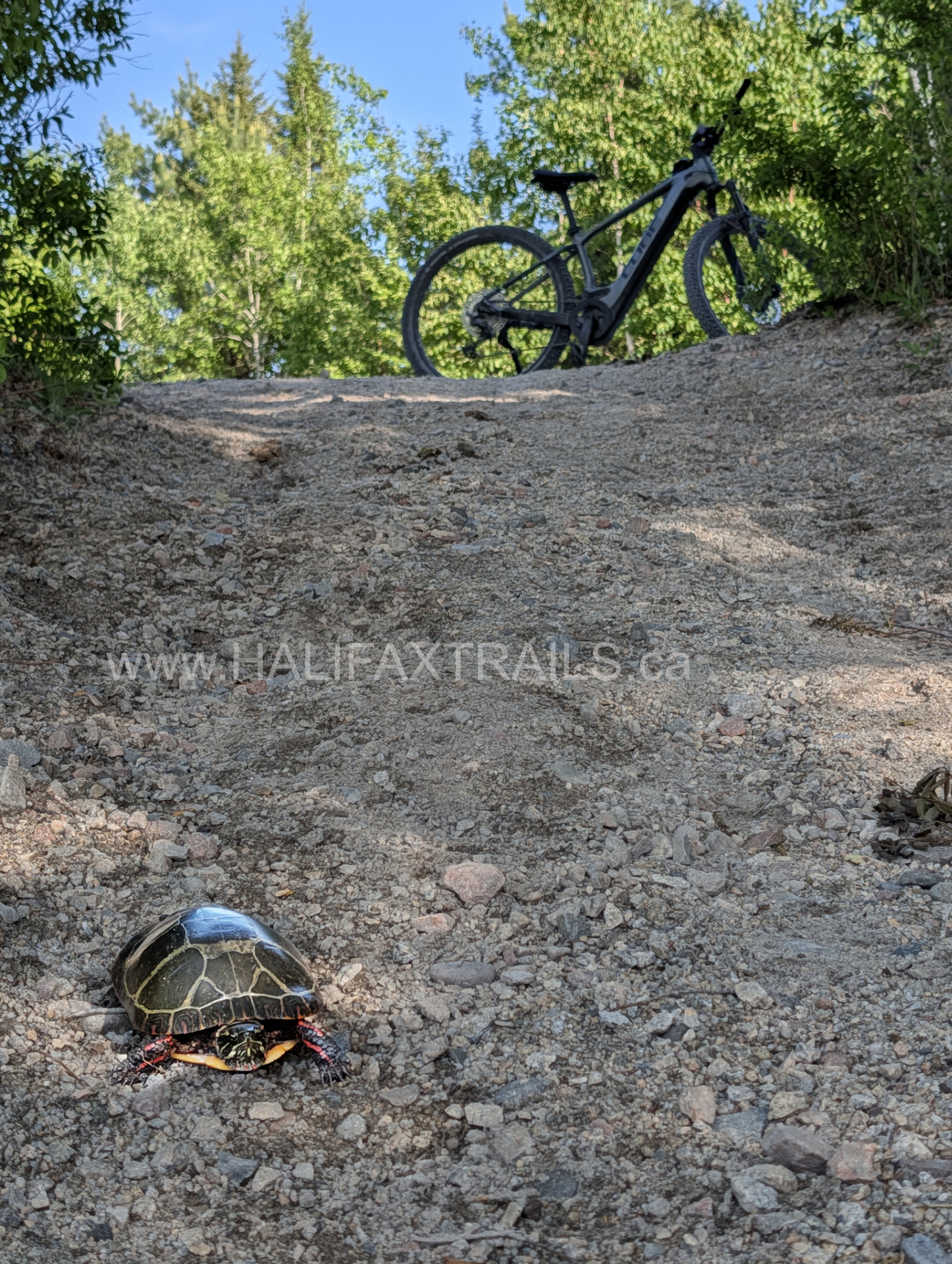
Aspotogan Trail Photos


Scenic Stops & Side Adventures
There are small but scenic bridges along the trail, like Fox Brook Bridge, that offer peaceful views. There’s also a picnic area on Noonan Lake and a picnic table near a scenic river view. A short access road leads off-trail to Meisners Beach, where you can take a dip or get a fresh breath of cool ocean air.
The 13km trail takes about an hour (one way) by bike, but I would allow 2 hours if you want to take your time and enjoy the scenic areas. To plan your own route on the rails-to-trails by bicycle, you can use my average moving speed of 15km/h as a ballpark time estimate for moving at a good pace.
Nature & Wildlife
 The Aspotogan Trail offers a fantastic cross-section of the region’s diverse habitats, transitioning smoothly from dense Acadian forests to refreshing coastal vantage points. As you ride or walk the compacted crusher dust path, you are guided through vibrant green corridors heavily influenced by the constant presence of water from nearby brooks, rivers, and Noonan Lake. The forest canopy is a resilient mix of deciduous growth and towering conifers like Eastern White Pines and Eastern Hemlocks, which provide ample shade and a thriving, damp understory of ferns and mosses. As the route skirts closer to the Aspotogan Peninsula and the coastline, the vegetation shifts to include hardy, salt-tolerant shrubs and classic coastal barrens flora.
This dynamic, multi-use corridor is an excellent place for wildlife observation. The sheltered, inland sections echo with the rhythmic tapping of Downy Woodpeckers and the calls of various woodland songbirds, while the dense brush provides cover for White-tailed Deer and foraging American Red Squirrels. As the trail approaches shoreline access points like Meisner’s Beach, the avian life changes dramatically, offering unique opportunities to spot marine birds such as Shearwaters gliding over the ocean swells and Great Blue Herons hunting patiently in the shallows.
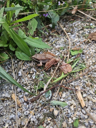
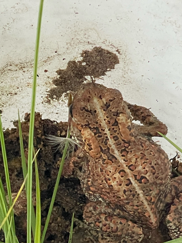
Recent Community Sightings
Live wildlife and plant observations logged along this route:


Spot something interesting while out on the trail?
View & Log SightingsTrip Tips
- Surface Check: The trail features a compacted crusher dust base. While it’s excellent for hybrid or mountain bikes, the surface can occasionally be uneven due to shared ATV traffic, making it less ideal for thin-tired road bikes.
- Share the Route: This is a multi-use corridor frequently used by ATVs. Always keep your head up, listen for approaching vehicles, and step to the side to let them pass safely. Have a bike bell to alert others before passing, and helmets are required by law.
- Parking & Access: Parking is primarily limited to the main trailheads in Hubbards and East River, with few access points in between, so plan your starting point and route length accordingly.
- EV Friendly: For those driving electric vehicles, there is a convenient Level 3 fast charger located at the JD Shatford Memorial Public Library right in Hubbards to top up before heading home.
- Bike Rentals: The JD Shatford Memorial Library also has free bike-lending (during operating hours), and next door to the library is Scotia Cycle, which offers bike repairs and rentals.
- Nearby Stays: Turn your trip into a getaway! Check out Hubbards Beach Campground & Cottages or browse this interactive map for unique local stays just minutes from the trailhead.
Local Eats & Refreshments
-
- The Trellis Cafe: A quintessential South Shore landmark since 1985. It’s an ideal spot right in Hubbards to stop for a fresh coffee, a hearty breakfast, or their signature seafood chowder.
- The Tuna Blue: Located right on the water in Hubbards, offering fantastic marina views from their Beer Garden. It’s the perfect place to relax on the patio with fish tacos, a great burger, and a cold drink.
- Shore Club: A true Nova Scotian institution. If you are wrapping up your ride later in the day (Wednesday through Sunday from May to October), you can treat yourself to their world-famous, traditional lobster supper.
- Sheila’s Canteen: If you are looking for a quick, satisfying post-ride take-out meal, this seasonal food truck has been serving up maritime soul food since 1991.

Featured Products
Purchases help fund these guides