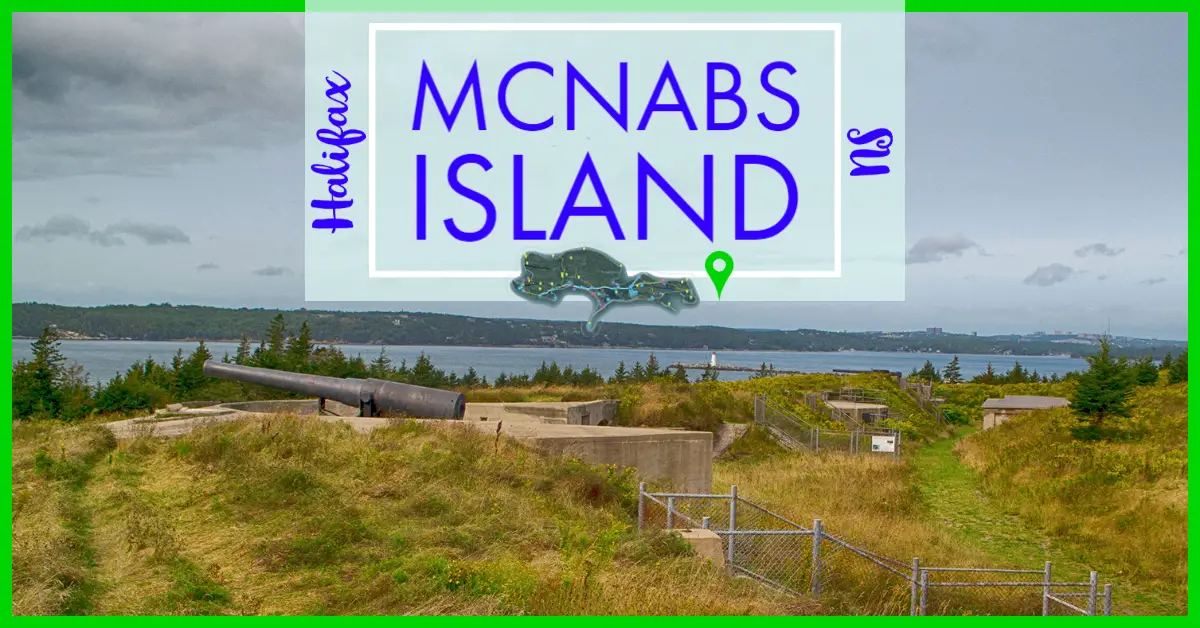
McNabs Island Provincial Park
Difficulty: Easy - Difficult (Distance). Elevation profile. Facilities: Covered picnic area, toilets, and benches throughout. Signage: Info kiosk, signposts with maps and distances marked at every key juncture. Features: 400 hectares of wilderness with over 20km of hiking trails.
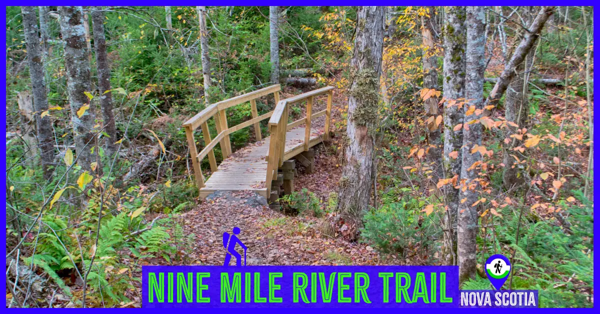
Nine Mile River Trails
Difficulty: Easy - Difficult (Distance). Elevation profile. Facilities: Parking, benches. Signage: Excellent. Features: Up to 10km (~3-4hrs), with options as short as 1km. Easy to navigate with excellent signage & trail construction. Remote wilderness with unreliable cell phone coverage. Tags: #Backcountry,
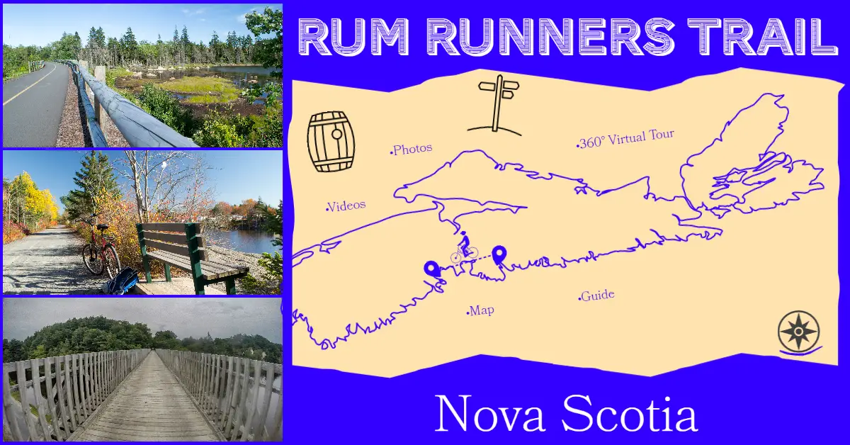
The Rum Runners Trail
Difficulty: Difficult (distance). Facilities: Parking lots, picnic tables, benches, public beaches & parks. Signage: Minimal, info kiosks at each section's trailhead. Features: 123km route connecting Halifax to Lunenburg. Converted railway with compacted crusher dust base (except paved Chain Of Lakes Trail). Scenic
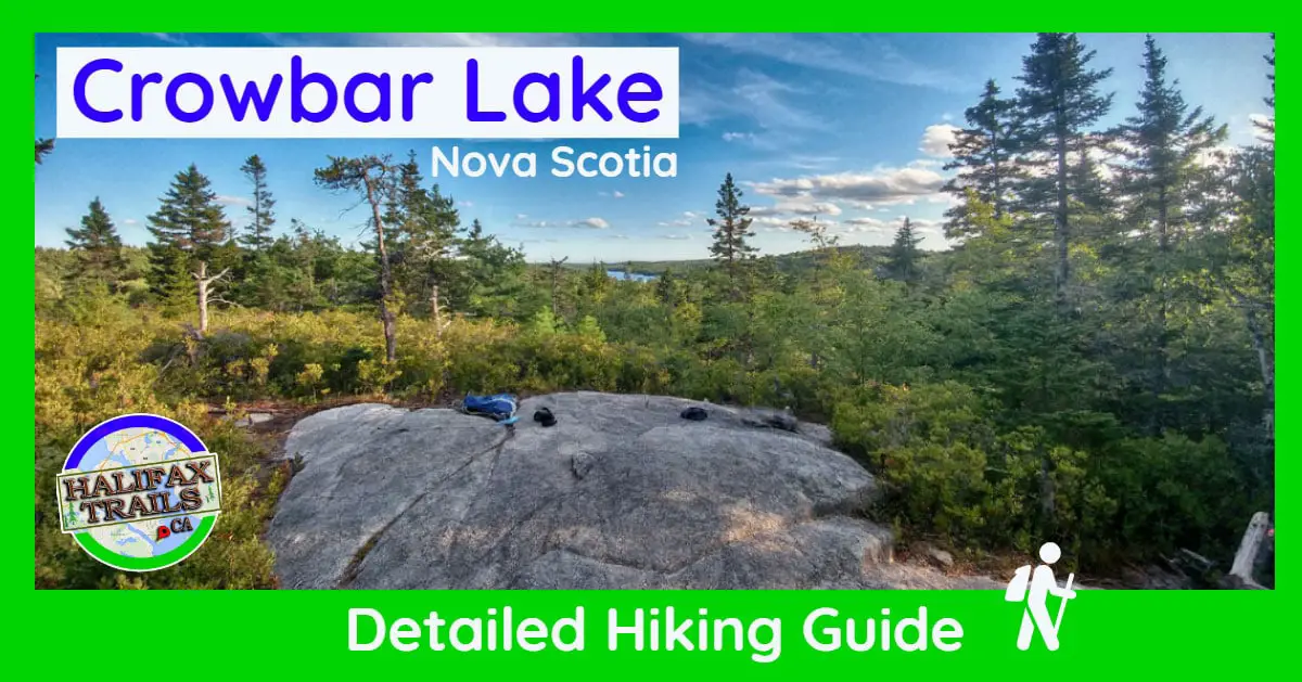
Crowbar Lake Hiking Trail
Difficulty: Difficult (terrain, hills, navigation). Facilities: Parking. Signage: Sparse trail markers, little-to-no signage. Features: Challenging hike with rewarding scenery. Various trails and loops extending 18km+. Categories: #Backcountry, #Lake, #Long Distance, #Old-Growth. Crowbar Lake Trails Part of the much larger Waverley
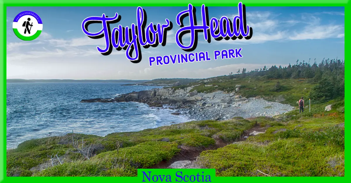
Taylor Head Provincial Park
Difficulty: Moderate - Difficult (Terrain/Distance). Facilities: Parking, outhouses, covered picnic areas, and benches. Signage: Information kiosks, interpretive panels, map, and trail markers throughout. Features: Over 20km of coastline with 15km of hiking trails. Day-Use park with days worth of adventures.
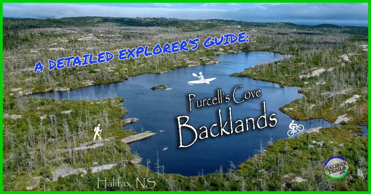
The Purcells Cove Backlands
Difficulty: Difficult (Navigation/Terrain/Hills/Distance). Facilities: None. Signage: Only via McIntosh Run Trails & Shaw Wilderness Park, other trails unmarked. Features: 1350 hectares of highly unique landscapes and ecosystems. A top-notch mountain biking and hiking location without leaving the city. Categories:
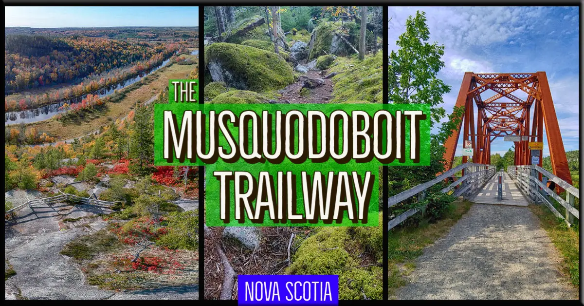
Musquodoboit Trailway
Difficulty: Moderate to Difficult (distance/elevation/terrain). Facilities: Parking Lot, sheltered picnic areas, toilets. Signage: Trailhead information kiosk, map, trail markers. Features: 5 different wilderness hiking trails. 15km multi-use, rails-to-trails spine trail. Spectacular views from various lookoff points. Categories: #Backcountry, #Biking,
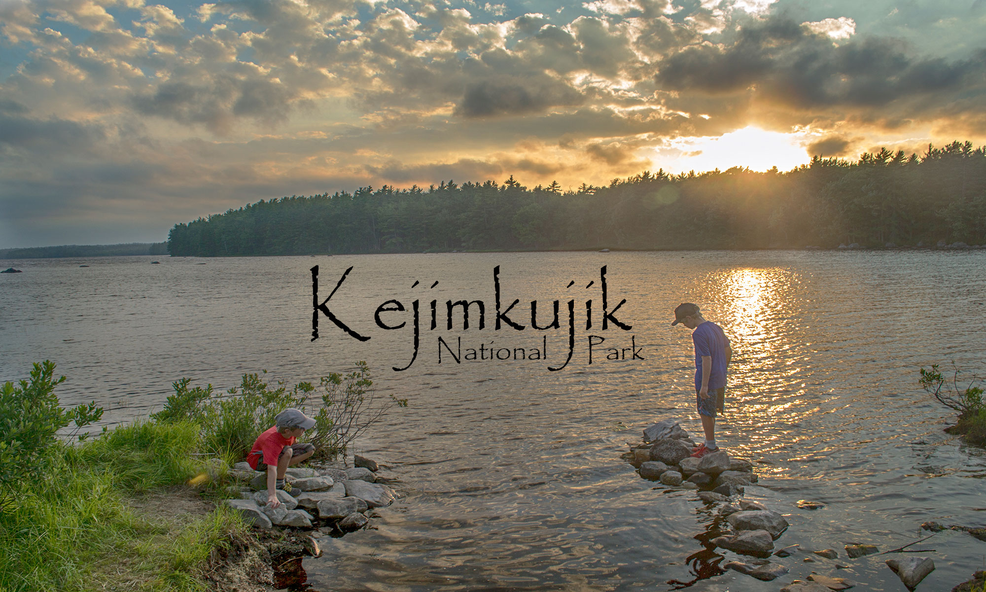
Kejimkujik National Park
Difficulty: Easy - Difficult (destination dependent). Facilities: Parking, canoe rental, washrooms, food, campsites, showers, supervised beach, sky observatory, visitor center. Signage: Excellent signage, trail markers & information panels throughout. Features: Nova Scotia's top camping destination. Accommodates adventures large and small. On-site
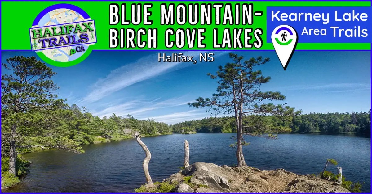
Blue Mountain-Birch Cove Lakes: Kearney Lake Trails
Difficulty: Difficult (Terrain/Navigation). Facilities: None. Signage: Minimal markings & signage. Periodically posted trail maps. Features: Part of the extensive Blue Mountain-Birch Cove Lakes Wilderness Area. Rugged, unmarked #Backcountry trail system for experienced hikers. Trails encompass Charlies, Fox, Ash & Hobsons
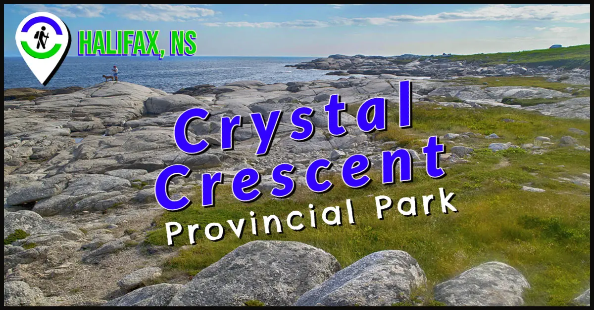
Crystal Crescent Beach Provincial Park
Difficulty: Difficult (Length/Terrain/Navigation). Facilities: Parking, outhouses. Signage: None. Features: Over 11km of stunningly beautiful, rugged coastal hiking. Unmarked trails, rocky coastal dangers & rapidly changing weather require preparation. Sensitive coastal ecosystem demands you stay on trail & Leave No Trace. Habitat:
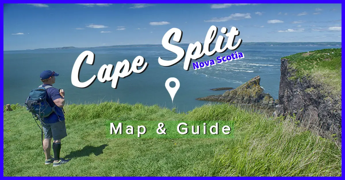
Cape Split Provincial Park
Difficulty: Difficult (distance, periodic 4-5° sloping incline/declines). Facilities: Parking lot, toilets. Signage: Trail markers & info kiosk at the trailhead, well marked and signed throughout. Features: 13.5km (4-5 hour return trip) of forested trails with spectacular coastal views. New "Scots Bay
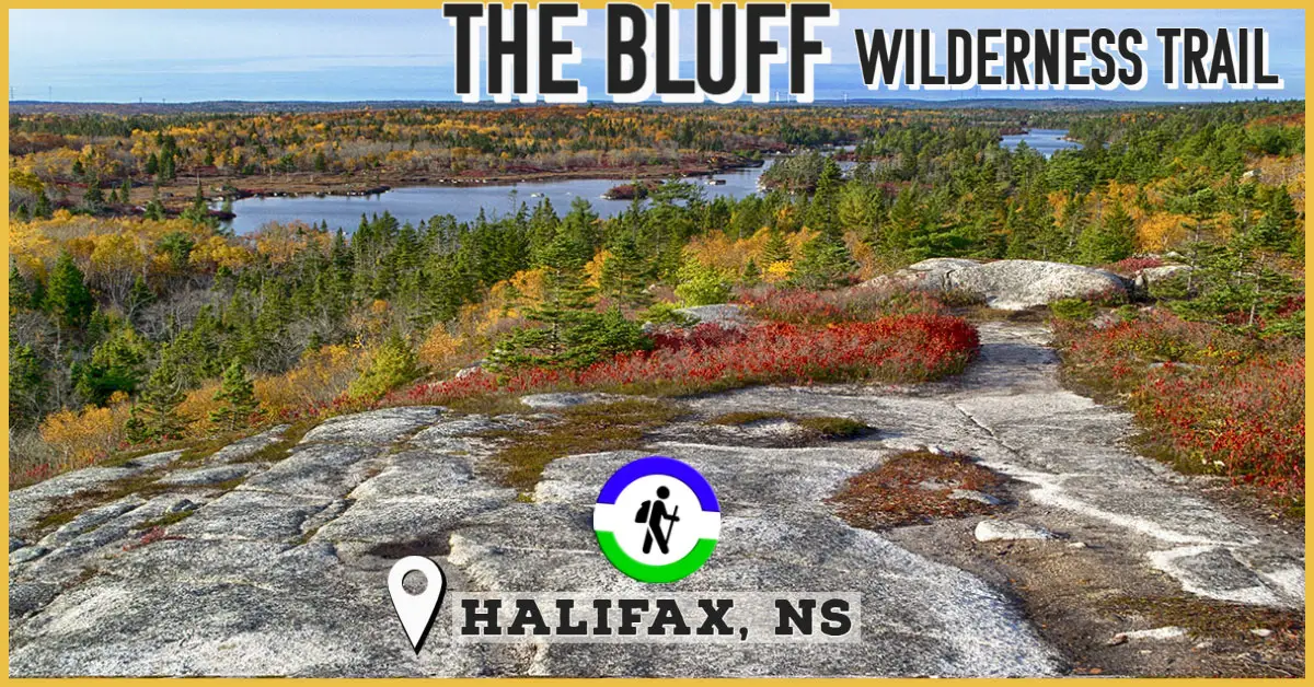
The Bluff Wilderness Trail
Difficulty: Moderate - Difficult (Distance/Terrain). 4 stacked loops (~4 hours each). Facilities: Parking, bike rack, and garbage cans at the trailhead. Signage: Info kiosk at the trailhead, periodic maps, and trail markings throughout. Categories: #Backcountry, #Full-Day, #Lake, #Lookoff, #Nature-Reserve, #Old-Growth, #Paddling,
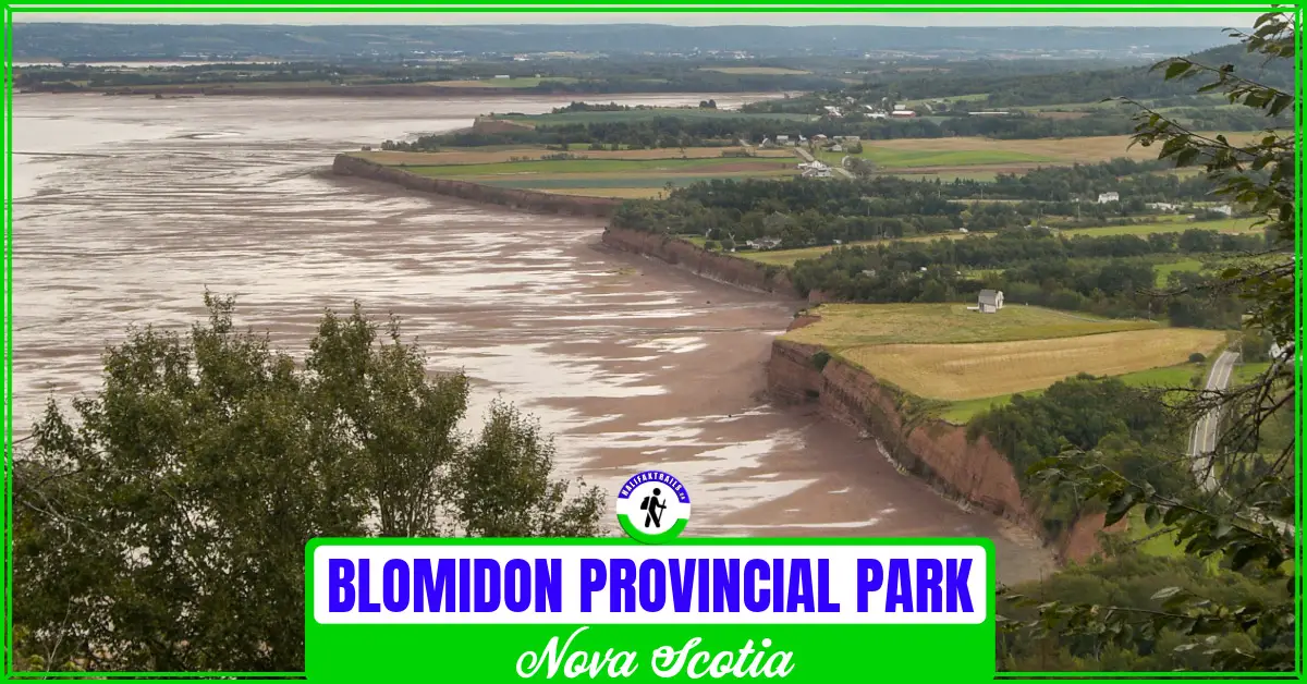
Blomidon Provincial Park
Difficulty: Moderate to Difficult (hills, rugged terrain, distance). Facilities: Parking, camping, washrooms. Signage: Adequate signage throughout. Features: Over 10km of hiking trails with views of the Minas Basin. Home to some of the world's highest tides. Fully equipped provincial park campground (click
Fire Tower Trail
Trail Map | GPS Map Files Kejimkujik Info Maps & Resources - How To. Difficulty: Difficult (Distance). Setting: Old logging road leading to the fire observation tower. Facilities: Camping cabin, parking. Signage: Adequate. Basic 2 person cabin with stove, kitchen and bunk beds. Fire tower is in