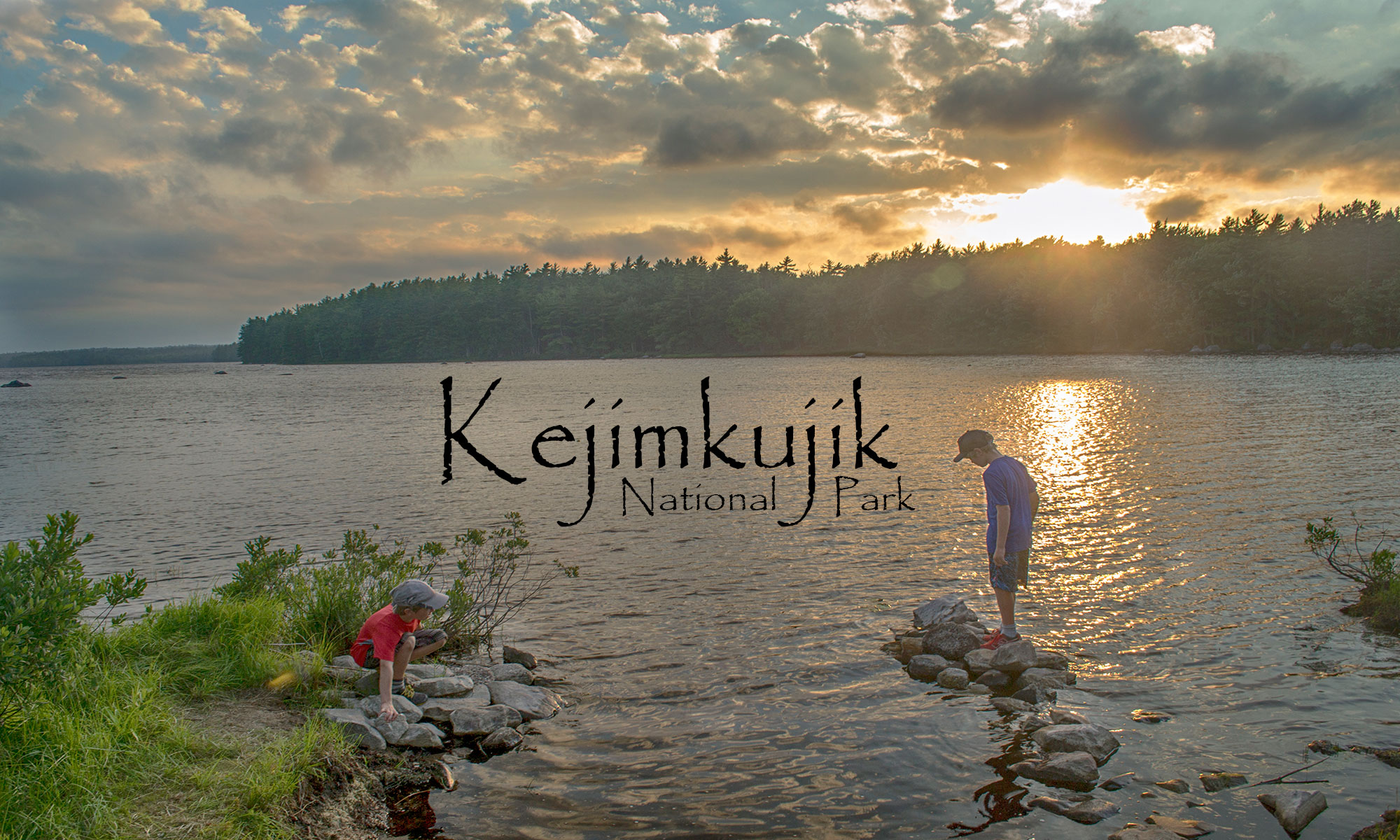
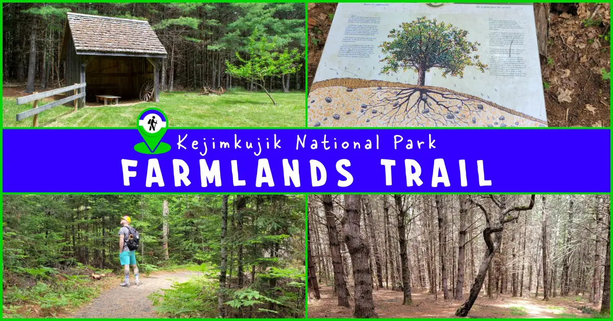
Top
  >  Destination Posts Archive
Queens County

Difficulty: Easy (gradual elevation ascent of 40m). Infrastructure: Parking. Signage: 4 information panels which narrate a guided cultural & natural history of the area. Features: 1.5 km (30-minute) semi-looped hike up a drumlin to a plateau, the site of a 19th-century farm. Categories: #Backcountry,

Halifax Regional Municipality

Difficulty: Moderate (rugged, muddy terrain). View elevation profile. Facilities: Parking. Signage: Trail map at the trailhead. Interpretive panels on local natural features. Features: 4.2km (1hr) up & back. 10ft high waterfall & scenic river gorge. Biodiversity: Tamarack Trees, Pickerel Frog, Snowshoe Hare, Eastern White

Halifax Regional Municipality

Difficulty: Easy - Moderate (Hills). View elevation profile. Facilities: Parking. Signage: Trail map at the trailhead. Interpretive panels on local natural features. Features: 5km loose gravel trail. Scenic pedestrian bridge. Hilly terrain, winding through wetlands & alongside Lake William. Still under construction with

Halifax Regional Municipality

Difficulty: Easy - Moderate (Distance). Facilities: Dedicated parking lots. Signage: Trail maps on info panels at main entry points. Interpretive panels on local nature & cultural history. Features: 7.4km compacted crusher dust trail. Converted railway with no significant

Halifax Regional Municipality

Difficulty: Easy (some navigation challenges). Facilities: None. Signage: None (some flagging & markings). Features: A short hike with a waterfall, lake access & scenic forest. Categories: #Easy, #Family-Friendly, #Fishing, #Lake, #Loop, #River, #Short, #Snowshoeing, #Swimming, #Waterfall Webber Lake Falls Hiking Trails      Webber Lake Falls

Lunenburg County

Difficulty: Moderate (Distance/Inclines) Elevation profile. Facilities: Parking & benches. Signage: Map kiosks, kilometer markers & basic info. Features: 11km (one way) section of the Rum Runners Trail which extends from Halifax to Luneburg (123km).  Scenic Railway bridges with lofty

Halifax Regional Municipality

Difficulty: Easy - Moderate (Distance). Facilities: Parking. Signage: Map at trailhead, interpretive panels & trail distance markers. Features: 8.5km (30 minutes by bike, one way).  Connects Shearwater to Bissett Road & the popular Salt Marsh Trail. Well maintained, flat,

Lunenburg County

Difficulty: Moderate (Distance, terrain, elevation). Elevation profile. Facilities: Parking, garbage cans, picnic table & bike lock rack.  Signage: Excellent.  Maps, info & markings throughout. Features: 9.3km (~3hr) return trip on foot, including 6km along bicycle-friendly rails-to-trails.  Easy to navigate with 3

Halifax Regional Municipality

Difficulty: Moderate (terrain). Facilities: None. Signage: None. Features: 3.5km (1hr) return trip to Jack Lake.  Easy to navigate along an old logging road. Rugged, wet, muddy terrain dotted with rocky features & old-growth trees. Biodiversity: Barred Owl | Pitcher

Lunenburg County

Difficulty: Moderate (distance & rugged terrain). 7.5km (~2.5hrs). Relatively flat elevation profile. Facilities: Parking, benches, and toilets. Signage: Minimal, adequate trail signage with an info panel at the trailhead. Features: One of the province's best beaches followed by a looped coastal

Lunenburg County

Difficulty: Difficult (distance). Facilities: Parking lots, picnic tables, benches, public beaches & parks. Signage: Minimal, info kiosks at each section's trailhead. Features: 123km route connecting Halifax to Lunenburg.  Converted railway with compacted crusher dust base (except paved Chain Of Lakes Trail).  Scenic

Lunenburg County

Difficulty: Easy - Moderate (distance). Facilities: Parking, picnic tables, benches. Signage: Minimal, info kiosks at trailheads. Features: Multi-Use #Rails-To-Trails with compacted crusher dust base.  A 13km section of the 123km Rum Runners Trail that connects Halifax to Lunenburg.  Access to Noonan Lake,

Guysborough County

GPS Files | How-To Guide. Difficulty: Moderate-Difficult. Facilities: Some adjacent private campgrounds. Signage: Minimal, at East & Main Branches. Features:  3 converging branches; Main (14km), West (36km), and East (17km).  Live water level reporting to help plan your trip. Biodiversity: Atlantic

Halifax Regional Municipality

Difficulty: Difficult (terrain, hills, navigation). Facilities: Parking. Signage:  Sparse trail markers, little-to-no signage. Features: Challenging hike with rewarding scenery. Various trails and loops extending 18km+. Categories: #Backcountry, #Lake, #Long Distance, #Old-Growth. Crowbar Lake Trails      Part of the much larger Waverley

Colchester County

Difficulty: Easy to Moderate (distance, hills). Facilities: Parking, canteen, pool, restrooms, bandstand, picnic areas, playground. Signage: Interpretive panels, maps, and trail markings throughout. Features: Over 1000 acres to explore.  Family-friendly destination with public pool (closed for upgrades), splash pad &

Hants County

Difficulty: Easy to Moderate (distance). Facilities: Parking, toilets, picnic tables, tea room, estate museum. Signage: Interpretive panels and trail markings. Features: 930 hectares with 7 hiking trails. Estate Museum open daily until 5pm June 1-Oct. 5 (admission under $5).  Park

Halifax Regional Municipality

Difficulty: Easy. Facilities: Interpretive Center/Museum with refreshments (Open May-October). Lots of benches and picnic tables. Coastal boardwalk. Small sand beach nearby. Signage: Interpretive panels and info throughout. Habitat: Blue-Eyed Grass | Sunburst Lichen | Common Yarrow |

Halifax Regional Municipality

Difficulty: Easy. Facilities: Visitor's center, boat rentals, canteen, campground, benches, bathrooms. Signage: Interpretive panels and trail signage throughout. Features: Fully equipped campground.  Paddling destination with on-site rentals. Off-leash dog area. Categories: #Bird-Watching, #Camping, #Dog-Friendly, #Off-Leash, #Historic-Site, #Paddling, #Park, #Paved, #Picnic, #Playground, #Wheelchair-Accessible,

Halifax Regional Municipality

Difficulty: Easy - Moderate (distance/navigation). Facilities: Parking Lot, Beach, Change rooms/Bathrooms, picnic area, and beach volleyball court. Signage: Minimal. Features: Supervised beach.  Change room & bathroom facilities.  Popular dog-friendly park with off-leash trails (see rules below). Biodiversity: Sackville River Watershed | American

Halifax Regional Municipality

Difficulty: Easy - Moderate (distance). View the elevation profile here. Facilities: Parking, Toilets, Benches, Dog Bags, Garbage Cans. Signage: Information kiosks at trailheads, interpretive panels, and other signage. Categories: #Biking, #Bird-Watching, #Bridge, #Coastal, #Picnic, #Rails-To-Trails, #Wetlands. Salt Marsh Trail Guide  

Halifax Regional Municipality

Difficulty: Easy - Moderate (distance). Facilities:  Bathrooms, parking, benches & picnic areas. Signage: Information kiosks, maps interpretive panels, and trail signage.  Features: Off-leash trails. Centuries-old fortifications.  Open to cyclists (restrictions on weekends/holidays).  Open-air theatre in summer. Categories: #Park, #Dog-Friendly, #Biking,

Halifax Regional Municipality

Difficulty: Moderate (Rugged Terrain/Unmarked Trails). Facilities: None. Signage: None. Features: Part of a 1900 hectare wilderness area.  A short 3km (~1hr) return trip to a scenic waterfall.  Requires caution; live hunting traps and snares are sometimes in the area.

Halifax Regional Municipality

Difficulty: Easy. Facilities:  Parking, Visitor Centre, Benches, Restaurants, Gallery/Museum (Open May-Oct). Signage: Interpretive panels, signage, and maps. Features: Tourism-focused shops & facilities.  On-site chartered boat tours. Habitat: Leatherback Turtle | Right Whale | Aplite Granite | More

Halifax Regional Municipality

Difficulty: Easy  (some hills) Facilities: Parking, benches, garbage cans. Signage: Trail signs at most major intersections with distance info (in KM's). Features: 4km linear, multi-use trail. Compacted crusher dust surface. Direct & nearby access to many different parks, playgrounds, trails

Queens County

Difficulty: Moderate (distance) Setting: Riverside, Waterfalls, Old-Growth Forest. Facilities: Parking, Picnic Shelter, Benches, Outhouse. Features: 1.3km (linear) Mill Falls trail connected to Beech Grove trail (2km loop) via a bridge with scenic views of the Mersey River. Biodiversity: Drumlin |

Queens County

Difficulty: Easy. Setting: Diverse forest and wetlands. Facilities: Parking, bike rack. Signage: Minimal. Features: Two 1.6km loops.  Dense Hemlock & Pine Forest.  Lush #wetland views. Biodiversity: Eastern Hemlock | Bulrush | White Pine Categories: #Hiking-Short  #Bird-Watching  #Kejimkujik  #Lake  #Wetlands Grafton Woods Trail      Grafton woods

Queens County

Difficulty: Easy. Setting: Forest, old gold mining pits. Facilities: Parking Signage: Interpretive panels and displays throughout. Tags: #Hiking-Short  #Historic-Site  #Kejimkujik GPS Files | Maps & Resources - How To. A short 3km (Approximately 1 hour) hike. Flies & ticks can be bad. Fully interpretive trail with

Halifax Regional Municipality

Difficulty: Moderate (Terrain/Distance). Facilities: None. Signage: Interpretive panels at the trailhead. Features: 30 minutes from downtown Halifax.  Iconic Nova Scotia coastal hiking.  Spectacular sunsets.  Sensitive nature reserve (tread lightly). Tags: #Bird-Watching, #Coastal, #Nature-Reserve, #Hiking, #Peninsula. High Head Hiking Trail      If you’ve ever

Halifax Regional Municipality

Difficulty: Easy to Moderate (hills).  Elevation profile. Infrastructure: Parking lot, garbage cans, benches, wide trails with crusherdust base. Signage: Trail signage throughout (little-to-none on Ravine Trail), maps at entrances & key intersections. Features: #Bird-Watching, #Biking, #Bus-Access, #Dog-Friendly, #Family-Friendly, #Historic-Site, #Loop, #Off-Leash,

Halifax Regional Municipality

Difficulty: Easy. Facilities: Parking, Bathrooms, Playground, Picnic Areas, Public Wharf & Boat Launch. Signage: Excellent - Interpretive panels and other posted info. Features: Popular Northwest Arm waterfront destination. Great views from (and of) the Memorial Tower (Open May-Nov. 9am-3pm daily).  A family-friendly picnic park with plenty to

Halifax Regional Municipality

Difficulty: Easy (distance-dependant). Elevation profile. Facilities: Parking & porta-potty in Bayers Lake. Signage: Interpretive panel at First Chain Lake, kilometer markers & distance signage. Features:  The longest paved trail in Halifax (7.3km).  Maintained in winter.  Access to Chain Lake Park. 

Halifax Regional Municipality

Difficulty: Moderate (rugged terrain) Setting: Coastal barrens, lighthouse, nature reserve. Facilities: None. Signage: None. Features:  Iconic Nova Scotia coastal beauty with lighthouse and foghorn navigation aids for ships entering Halifax Harbour.  Access road now closed (must park before, but not block, the gate). 

Kings County

Difficulty: Difficult (distance, periodic 4-5° sloping incline/declines). Facilities: Parking lot, toilets. Signage: Trail markers & info kiosk at the trailhead, well marked and signed throughout. Features: 13.5km (4-5 hour return trip) of forested trails with spectacular coastal views. New "Scots Bay

Halifax Regional Municipality

Difficulty: Easy. Setting: Urban marsh, pond, gravel paths. Facilities: Benches, garbage cans, dog bag dispensers. Signage: Educational info panels, maps, and signs. Features: An easy, #Accessible trail for all. Great look-off in the middle of the marsh, an ideal spot for birdwatching.

Halifax Regional Municipality

Difficulty: Easy to Moderate (distance). Facilities: Parking. Nearby bicycle & paddling rentals at Lunar Adventures. Signage: Distance markers, periodically posted maps, info panels & info kiosk at the trailhead. Features: A 13km section of the 123km Rum Runners Trail. 

Halifax Regional Municipality

Difficulty: Moderate (Terrain/Navigation). Facilities: None. Signage: Minimal signage, unmarked trails. Features: 29-hectare urban wilderness park.  2km, 1hr return trip. Beautiful views of the Bedford Basin. Biodiversity: Old-Growth Forest | Osprey | White Pine | More

Halifax Regional Municipality

Difficulty: Easy. Facilities: Parking, washrooms, picnic tables. Signage:  Interpretive panels. Features: Great views of the mouth of Halifax Harbour, opposite McNabs Island. 200-year-old fortifications, a key part of Halifax's harbour defence system.  Scenic #coastal bluffs and walking trails. Biodiversity: Fiddlehead

Queens County

Trail Map | GPS Map Files Kejimkujik Info Maps & Resources - How To. Difficulty: Difficult (Distance). Setting: Old logging road leading to the fire observation tower. Facilities: Camping cabin, parking. Signage: Adequate. Basic 2 person cabin with stove, kitchen and bunk beds. Fire tower is in

Halifax Regional Municipality

Map | Photos | Videos Tags:  #Blue Mountain-Birch Cove  #Mountain-Biking Maps & Resources - How To. Difficulty: Moderate-Difficult (Terrain). Setting: Wooded, rugged singletrack. Facilities: None. Signage: Periodic signage and markings. One of the best mountain biking trails in the HRM. Connects to the BLT trail system or other trails in the

Halifax Regional Municipality

Maps & Resources - How To. Difficulty: Moderate (Terrain/Hills). Facilities: None. Signage: None. Biodiversity: River Otter | Lake Trout | American Robin Categories: #Lake #Mountain-Biking Not Marked or Maintained. Linear ATV trail. Good for off-road biking and fishing. Access To Big Indian Lake.      Off of Prospect Road, just

error: Content is © protected !!