
5 Autumn Vibe Hiking & Biking Trails In Halifax, NS
5 Adventures, each accomplished in 2 hours or less. The custom-made maps are intended to be opened on your phone’s Google Maps app for use as a real-time GPS reference (how to).
Never rely solely on your phone for navigation and always carry a compass. It’s wise to carry an extra battery and a printed map as well. Fall is hunting season, so be visible by wearing hunter’s orange.
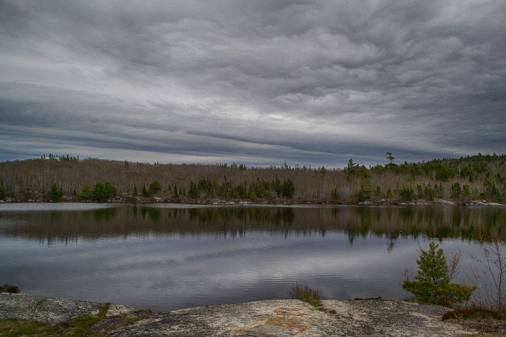
Sandy Lake Park (Hiking)
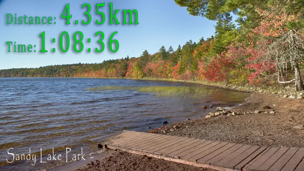
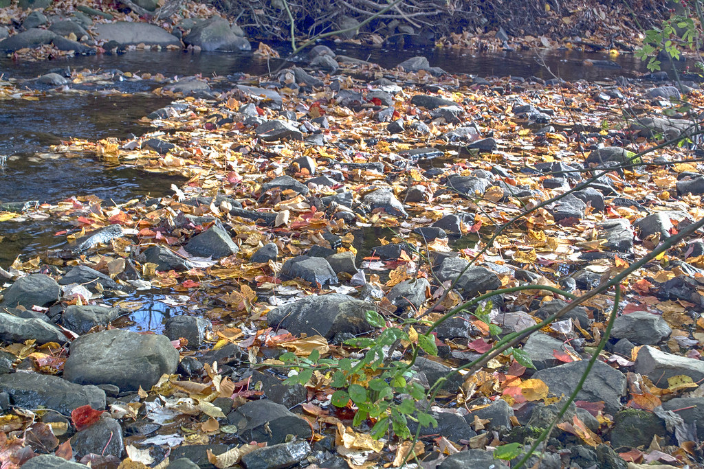
Sandy Lake Park in Bedford is a popular swimming spot in summer, and off-leash dog walking park in the off-season. In Autumn it comes alive as the forested trails create a vibrant array of colour as diverse as the foliage. With old-growth trees mixed in, it’s an urban nature experience that amateur arborists will appreciate. The trail is mostly rugged and unmarked.
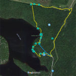
Reaching Sandy Lake you’ll be treated to bands of colour surrounding its shores. A great spot for a picnic, the beach area is an ideal place to spend some relaxation time.
Next, you’ll head into the woods as the trail becomes more narrow and rugged. A quiet, shady environment full of squirrels preparing for the long winter to come. This stretch is under 1km and a gradual uphill slope.
My favourite part about this hike is when you come out of the dense forest and onto the power line trail. The moment you step out of the woods you’ll enter into a colourful vista fit for painting. This part of the trail can be quite wet and muddy so proper footwear is a must.
Turning 90° off of the powerline trail onto a narrower version, you’ll walk a corridor of colour as you head downhill back towards the park. Many birds inhabit this area, including Osprey who fish the lake.
You’ll veer off the power line trail and head into the woods again for a short stretch before meeting up with the main road leading the parking lot which is a scenic area in itself.


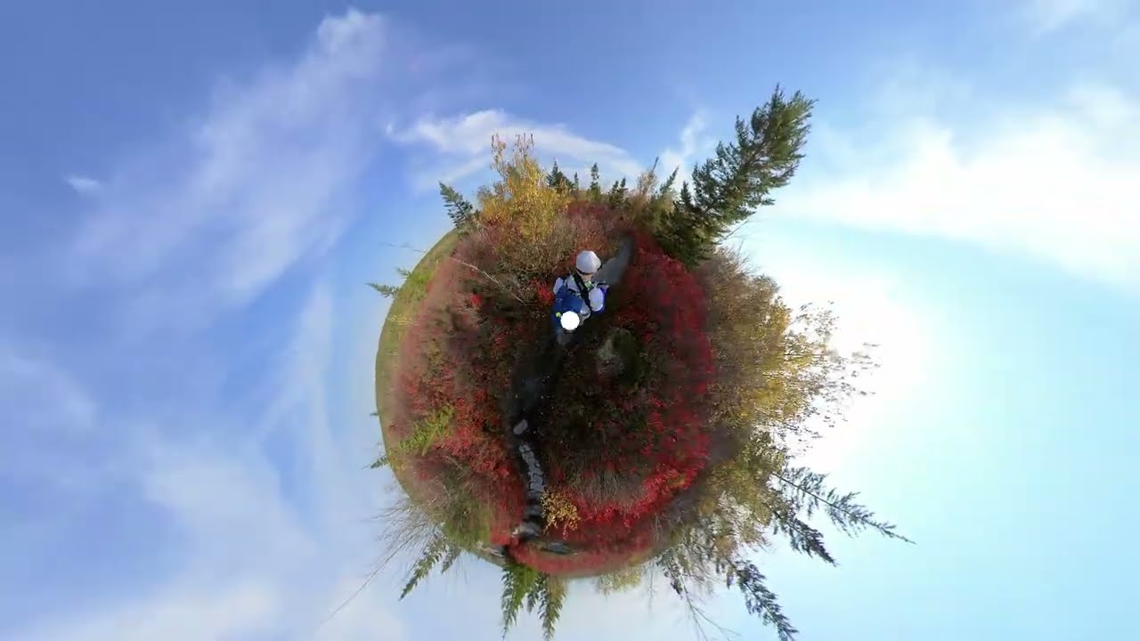
360° View
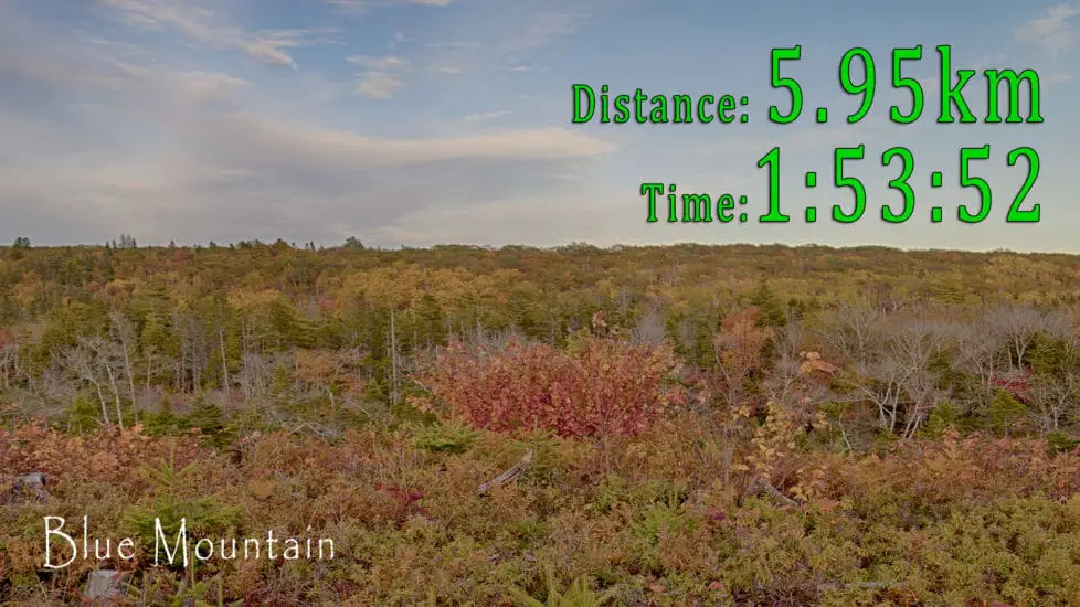
Blue Mountain Trail (Hiking)
Part of Halifax’s long-promised #Blue Mountain-Birch Cove Lakes Wilderness Park, this trail leads to the highest point of the Chebucto Peninsula. A proposal for an absurdly expensive, redundant highway through the heart of this trail, place it on the front-line of the battle for protection. What could become North America’s largest wilderness park includes this area in its planned boundaries. It would be great to see it created once and for all (see the Friends Of Blue Mountain-Birch Cove Lakes Facebook group to stay current).
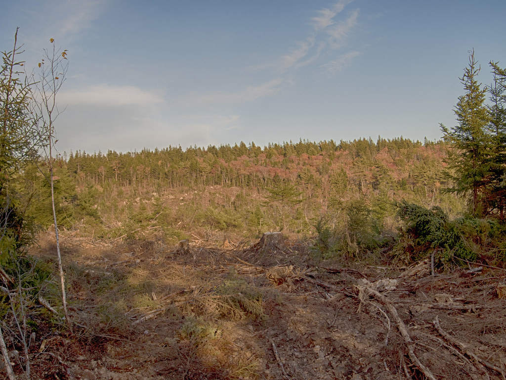
The trail runs through some recently clear-cut areas that are a stark contrast to the colourful views atop Blue Mountain. The province’s valuable forestry industry is an important economic driver that is occasionally at odds with the protection of wild spaces. Hopefully, this area gets the protection it deserves, while the industry functions sustainably in the rest of the province.
Starting from the end of the cul-de-sac on Anahid Drive you’ll head into the woods along a gravel logging road lined with wildflowers and colourful vegetation. The road skirts an uncommonly scenic clearcut that reveals the hilly terrain. The cut is at an early stage of re-growth, as it is reclaimed by wildflowers, shrubs and the next generation of trees.
Eventually, you’ll encounter the first fork in the road where you’ll turn to the right alongside the cut until you reach another fork. Heading to your right will take you on the full loop that involves more time, effort and obstacles than the more direct route by heading to the left.
•#BlazeOrange •Hiking Gear • Guide Books •On Sale
The full loop will lead you along the logging road and onto more clearcut land. The open nature of this area makes for some scenic vistas My first explorations led to wrong turns and unintentional side trips that ended up being rewarded by some great Fall scenery. Following the loop involves crossing a stream that can be a raging river at times as well as muddy areas. The rugged clearcut section requires treading carefully. Perhaps the hardest part of this route is finding the spot to head into the woods and upward to the Blue Mountain lookoff. This wooded trail heads uphill at a fairly steep incline. Use plenty of caution navigating on this route.
Taking the previously mentioned direct route to the Blue Mountain lookoff leads into a densely wooded trail with streams and impromptu footbridges. The steady uphill climb involves a couple of deep knee-bending traverses. In the midst of this trail, you’ll encounter a fork where it’s important to keep right. At this fork, there was a sign created by concerned citizens pointing out that this spot has been identified as a location for the proposed highway.
As you approach the top of Blue Mountain you’ll encounter a large boulder followed by a rock outcrop, complete with climbing rope. A short walk through a brushy area soon opens to a vast 360° vista of the area. You are now at the highest point. You’ll see the buildings of Halifax in the distance, rising from a sea of autumn colour.


360° View
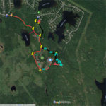
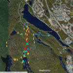
Fox Lake Trail (Hiking)
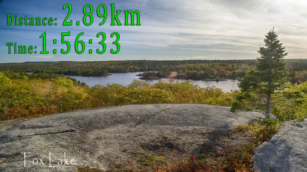
Another important part of Halifax’s proposed Blue Mountain Birch-Cove Lakes Wilderness Park, Fox Lake is a gem amidst a treasure. Reaching the elevated granite outcrop overlooking the lake is an exhilarating moment. The breathtaking view is even more impressive when the Autumn colours are in full swing. Framed by oranges, yellows and red’s, the view is like stepping directly into a painting.
This hike can either be a linear trail involving backtracking or a longer loop that skirts Ash and Hobsons Lake as well (see my Hobsons Lake Trail page for info on that). The linear route described here is rugged and largely unmarked.
You can begin from two different starting points. The main parking area by the Maskwa Aquatic club is the typical way to access this area, but a more direct route begins at the end of Colins Road. The Maskwa route ends up being about 2kms longer. As with all the trails in this area, it’s important to pay attention to where you’re going as there are many paths that lead in various directions.
Each route involves a steady incline with a few places where extra squats at the gym will pay off. The trails are packed with rock formations amongst the dense forest. The forest composition changes with the varying topography. From the Colins Road trail, you’ll reach “Coyote Bog” where the only coyotes you’re likely to see are of the wooden kind. The bog is full of deep reds and bright yellows during this season. A large boulder overlooking the bog makes a great place to sit and take a break before continuing on.
The final approach to the Fox Lake lookoff involves some steep inclines and declines where you’ll want to be wearing sturdy footwear. The path can be hard to see when you enter rocky clearings but the correct path is unmistakable when you’re on it. Stone steps and other helpful human-built improvements will keep you on track throughout.
As previously described, the view from the elevated lookoff is the crescendo of this hike. Be warned that this exposed location can be windy and colder than the rest of the hike. It’s always wise to carry extra layers for that reason.


360° View
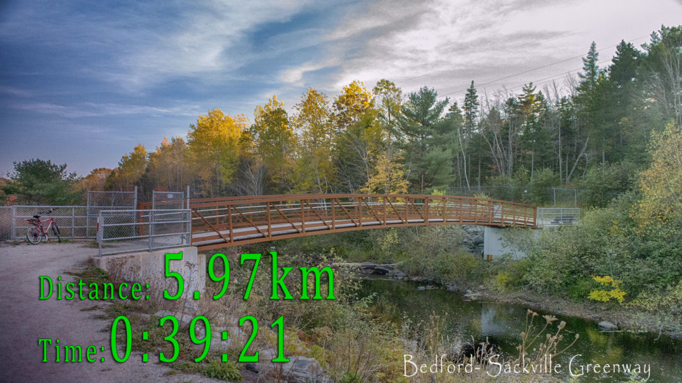
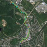
Bedford – Sackville Greenway (Biking)
An important greenway that follows alongside the Sackville River, one of the province’s few remaining salmon rivers. Unfortunately, the salmon in this river have been on a sharp decline in recent years. You’ll witness ongoing efforts to help restore the salmon habitat to its natural glory thanks to work by the Sackville Rivers Association. Scenic and well-built bridges, benches, picnic tables line the route. Informative and educational information panels explain the habitat and the efforts to restore it.
This active transportation trail is ideal for biking, jogging and walking. My favourite way to do the trail is by bicycle, starting from either the Superstore parking lot or Bud Bremner Park. The park can be fairly busy at times as the sports fields are a hub for sporting events. Biking the trail involves back-tracking to your starting point once you reach the end.
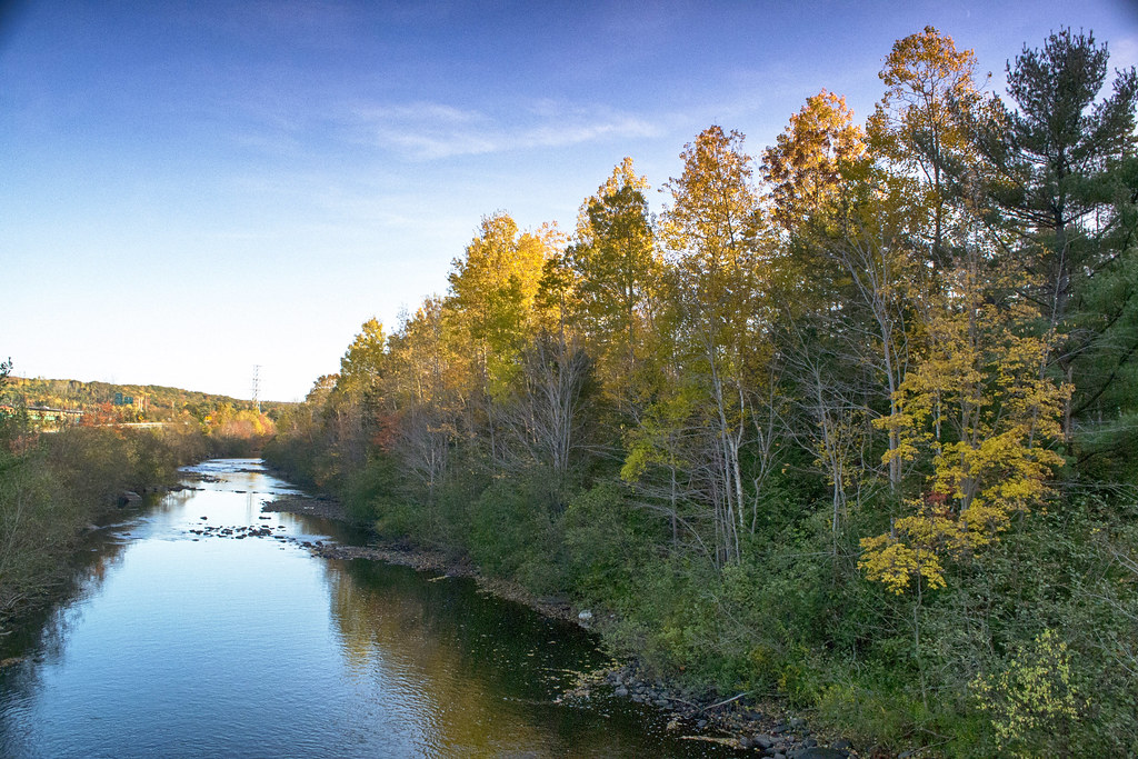
The crusher dust lined trail crosses the river at various points and each spot is a great place to take in the autumn colours that line the river. A small pedestrian walkway tunnel by the Bedford Rifle Range that might otherwise be ugly, is one of the highlights of the trail thanks to some young artists. Beyond the tunnel, there are two especially scenic bridges which make the best stopping points to get great views of the colourful trees lining and reflecting off of the river.
The trail comes to somewhat of an abrupt end on the Old Sackville Road as plans for its expansion in the near future will extend it as far as funding and public support will allow. The Sackville Rivers Association has detailed plans for this expansion and has recently contributed to the opening of a 500m paved section for phase 1 of new construction. Leading from the Sackville Lions Club to the Little Sackville River, its a great start to what will become one of the city’s best biking routes.


360° View
The BLT Trail (Biking)
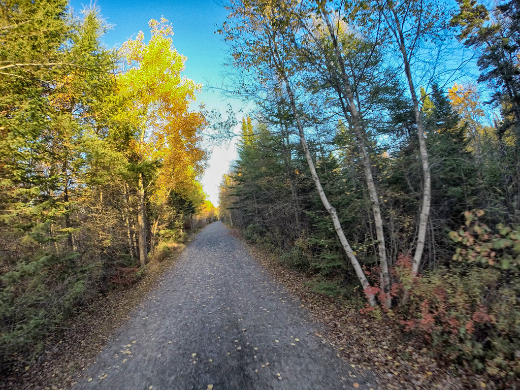
The Beechville, Lakeside, Timberlea Trail aka the B.L.T. is one of Halifax’s most popular converted “rails-to-trails“. Aptly named, it connects the 3 communities and continues as far as Lunenburg on a route known as the Rum Runner’s Trail. The entire trail is lined with a cornucopia of Autumn colour, making this ride feel like Mario Kart’s “Rainbow Road“.
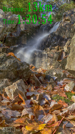
The trail starts from its dedicated parking lot next to an old Coca-Cola plant in an industrial park and ends in scenic Saint Margaret’s Bay (where it continues as the Saint Margaret’s Bay Trail). Comprised of 5 named sections, the total length of the trail is 13km. Unless you have vehicles at the starting and ending point, you’ll have to backtrack, doubling the total time and distance listed.
The first section, known as “Blue Jay Way” follows alongside Governor Lake, with numerous stopping points with benches to sit along the shore. The next section known as “Six Mile Falls” is named for the small but scenic waterfall which is one of the best stopping points of the trail. A bridge, that spans a river a short distance beyond the waterfall is another such stopping point. Especially scenic in the Fall, the river is a great place for some photos.
“Fraser Mill Walk” is the next section, where the site of a former mill is now a scenic stopping point with a bench and information panel with information on the mill. After crossing the Saint Margaret’s Bay Road, you’ll head towards a highway underpass. Similar to the Bedford-Sackville Greenway, some great artistry has turned this would-be eyesore into an eye-catcher. Artistic murals decorate the overpass and act as a gateway to the final section of the trail.
The most notable spot on the final two sections is where the trail meets Cranberry Lake and the Bluff Wilderness Hiking Trail. With benches, a picnic table and a place to lock your bikes, it’s perhaps the best stopping point to take in the fall colours. Cranberry Lake, often smooth as glass, calmly reflects its colourful surroundings while nearby highway 103 acts as a reminder that you’re still in the city.


360° View
Halifax is blessed with many great places to experience the province’s most scenic season, and it’s impossible to limit them to just 5. These 5 are some of my personal favourites but there’s not a bad choice in my full list of trails.
Fall is hunting season, so it’s important to be visible by wearing hunter’s orange whenever you head into the woods.
Shop.HalifaxTrails.ca – Blaze Orange Clothing & Equipment
I personally explore and document these trails with photos, videos and recorded maps. I share with the public in the form of these free guides. My goal is to introduce people to the places that set Halifax apart and make it a great place to live and visit. With no government or corporate backing, I rely on support from people who appreciate my work. With support, I aim to create more trail reviews and blog posts like this one.
Happy Trails!
Autumn Adventures Near Halifax, NS:

- The 5 Most Popular Parks & Trails of 2025 (And Why You Should Hike Them in 2026) - February 12, 2026
- The Best Hiking Trails Near Halifax For Every Kind Of Hiker - July 8, 2021
- Nova Scotia’s Climate Emergency - March 26, 2021
One reply on “5 Colourful Autumn Hiking & Biking Adventures In Halifax, Nova Scotia”
The Halifax area is truly Amazing… any time of the year! Looking forward to another visit soon for various activities and entertainment at the pubs and diners, as well as the scenery! Cory