- Difficulty: Moderate (Distance, terrain, elevation). Elevation profile.
- Facilities: Parking, garbage cans, picnic table & bike lock rack.
- Signage: Excellent. Maps, info & markings throughout.
- Features: 9.3km (~3hr) return trip on foot, including 6km along bicycle-friendly rails-to-trails. Easy to navigate with 3 different trail options & difficulties to choose from. Spectacular view perched atop large rock outcrop.
- Biodiversity: Diverse microhabitats, transitioning from marshy lakesides and dense mixed woodlands to exposed granite outcrops that support unique local species like pine barren golden heather, wood frogs, and snowshoe hares (view the Nature section below).
- Trail Conditions: View & sign the Logbook for updates from fellow explorers.
Castle Rock Trail

This adventure begins directly off the Chester Connector rails-to-trails. The nearest parking area is part of the Aspotogan Trail in East River. The Castle Rock trailhead is 3km along the rails-to-trails from that parking area, a good opportunity to warm up and ease into your hike, but it adds 6km to your journey. Fortunately, you don’t have to do the entire journey on foot, as these rails-to-trails are great for biking & the Castle Rock trailhead has a rack to lock them up.
The rail trail crosses a couple of busy roads with blind curves near the Aspotogan Trail parking area, so proceed with caution, keeping children and pets close at hand. After the second road crossing, you’ll come upon an info kiosk for the Rails-to-Trails. A detailed map shows the entire Rum Runners Trail and all of its segmented trails.
From here on, you won’t have to cross any roads as you continue along the rails-to-trails. 500m past the info kiosk is one of the most scenic parts of the hike, and a place worth stopping to enjoy the view on the East River Bridge. Another 500m along, you’ll pass underneath Highway 103. “Barry’s Brook Bridge #1” spans a flowing brook, followed 300m further by “Barry’s Brook Bridge #2“.
Continuing another 650m (30 minutes from the parking lot) you’ll reach Labrador Lake and a picnic table situated along the shoreline. A perfect place to stop for a break on the way in, on the way out, or both. During my visits to this area, it’s been a great place for #bird-watching, including osprey on the hunt, with an audience of ravens. Each visit has included some unusual vocalizations from the resident ravens. These calls are amplified by the local topography and add a wonderful ambiance to the peaceful surroundings.
4 Trails To Choose From
Just past the end of Labrador Lake is the trailhead for Castle Rock with a large info kiosk, detailed map & bike lock rack. This is where you can decide your route. Veering right will take you on the most rugged, narrow trail and challenging climb typical of most wilderness hiking trails. Veering left will take you on a wide ATV path (trail #1) with a more gradual climb. All of the trails are well-marked; some are easier to follow than others, especially in full summer foliage.
On my trip, I opted to do a full loop, ascending via the more difficult trail (3) and descending via the easiest trail (1). I didn’t do the half-kilometre, intermediate trail (2) but I would recommend doing it for a more varied mix of scenery. Trail 1 begins on a wide ATV path but narrows 200m in as you start heading onto a narrow, wooded trail with rugged terrain and a steady climb. The most scenic of the trails, it has a few camera-friendly views as you approach Castle Rock. Trail 2 is a much easier, smoother, and more gradual climb. If you plan on snowshoeing or mountain biking, this is the trail to choose. The only difficult part is at the foot of Castle Rock, where you will have to climb 50m along a rugged, steep trail until you reach the top.
Epic Views

As is the nature of such an elevated and exposed feature, it can be very windy and significantly colder than its surroundings. You’ll want to bring some extra warm windproof layers to throw on to enjoy it fully. For a break from the wind, you can take shelter on the back side of the rock along Trail 1, a spot where I used to make a quick coffee with my backpacker’s stove to enjoy the view at the top.
If you’re making this hike with children or pets, you will have to keep an eye out while on top of Castle Rock, as its steep rock face requires abundant caution. A pair of binoculars or a telephoto lens will let you get closer to the coastal scenery, but be cautious not to lose balance by looking through a viewfinder while near the rock’s edge. It’s well worth bringing something to sit on to keep your butt off the unforgiving rock, so you can fully enjoy the view.
Nature & Wildlife
As you journey along the Castle Rock trail, the landscape shifts to reveal Nova Scotia’s characteristic ecological diversity. The trek begins near the wetland edges of Labrador Lake and winds through thick, mixed woodlands where conifers and deciduous trees create a sheltered canopy. Along the forest floor, hikers can spot vibrant plant life, including hobblebush, winterberry holly, and striking blue clubmoss. As the elevation gradually increases toward the summit, the woodland gives way to open coastal barrens and exposed granite outcrops. This rugged, windswept environment hosts hardy, specialized species adapted to the rocky terrain, such as pine barren golden heather, bright gold dust lichen, and delicate strands of Usnea longissima (old man’s beard) clinging to the branches and stones.
This varied terrain provides a thriving sanctuary for a wide array of native fauna, making it a rewarding experience for wildlife enthusiasts. You’ll catch glimpses of red squirrels darting between branches or snowshoe hares navigating the dense thickets, while ruffed grouse frequently forage in the underbrush. The wetter areas and marsh channels near the trailhead are excellent places to spot wood frogs, common garter snakes, and painted turtles. The trail is also a fantastic destination for birdwatchers; keep an eye on the sky for bald eagles riding the coastal thermals high above East River Bay, or listen for the calls of American black ducks and mallards echoing near the water. View and record Castle Rock Trail observations on iNaturalist, where the latest observation recorded in this area was "Fishnet Cladonia".
Trip Tips
I have biked from Halifax to Graves Island Provincial Park in Chester along the Rum Runners Trail, and it’s a fantastic day trip. Packing light, I camped overnight at Graves Island before returning by being picked up by car. I would recommend allowing the majority of the day to do that trip due to its distance and plethora of scenic stopping points. At an average moving speed of 15km/hr, I wasn’t pushing myself to make good time. Using that 15km/hr avg speed as a ballpark figure, you can calculate your own route, as the rails-to-trails maintain minimal grades and differences in trail conditions throughout.
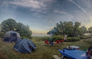
Graves Island Provincial Park is an ideal home base for this trip. Situated about 4km from downtown Chester and 6.5km from the Castle Rock trailhead, you can explore the surrounding area by bike. The ultra-scenic island (actually a peninsula with a road attaching it to the mainland) offers a sea-level view of much of the same area as is visible from atop Castle Rock. Its coastal beauty and convenient location make it one of the hardest provincial parks to reserve a camping spot due to its popularity. With drive-in campsites as well as more secluded tenting sites, it accommodates all types of campers. The tenting sites, while still close to each other, are buffered and feel more private than many similar camping parks.
My Castle Rock Trail Photos


If you’re hiking this trail in Winter, you’ll want to wear some traction spikes, as the trail, especially the more challenging route, can have plenty of ice that can be especially challenging when ascending and descending. In warmer months you’ll want to be prepared for muddy trail conditions, ticks, and flies, especially in Spring.
Packable clothing layers are your friend, especially on this hike. The difference in temperature and wind conditions from the rail trail to the top of Castle Rock can be drastic. You won’t want the view ruined by the chill of the unrelenting wind, so pack a windbreaker and an extra warm layer as a rule of thumb for this location, especially. As I said earlier, a stove for a hot drink, a cooler for a cold one, and something to sit on are ideal pieces of kit for full enjoyment. Be sure to Leave No Trace, and safely bring out any trash you find. The trail was kept nice and pristine during my last visit. Let’s keep it that way.
If you’re biking, don’t forget a bike lock for the provided bike rack at the trailhead, and have a bicycle bell to safely and courteously pass others. Also, be aware that bicycle helmets are required by law in Nova Scotia. Biking the rails-to-trails is best done with an off-road capable or hybrid bike. Dedicated road bikes will struggle with parts where the crusher dust isn’t evenly packed due to ATV traffic. Be cautious and mindful that ATVs share the trail, but it has almost always been my experience that ATV riders are also responsible and cautious.
Gear Up & Support Local!
Featured Products
Purchases help fund these guides