
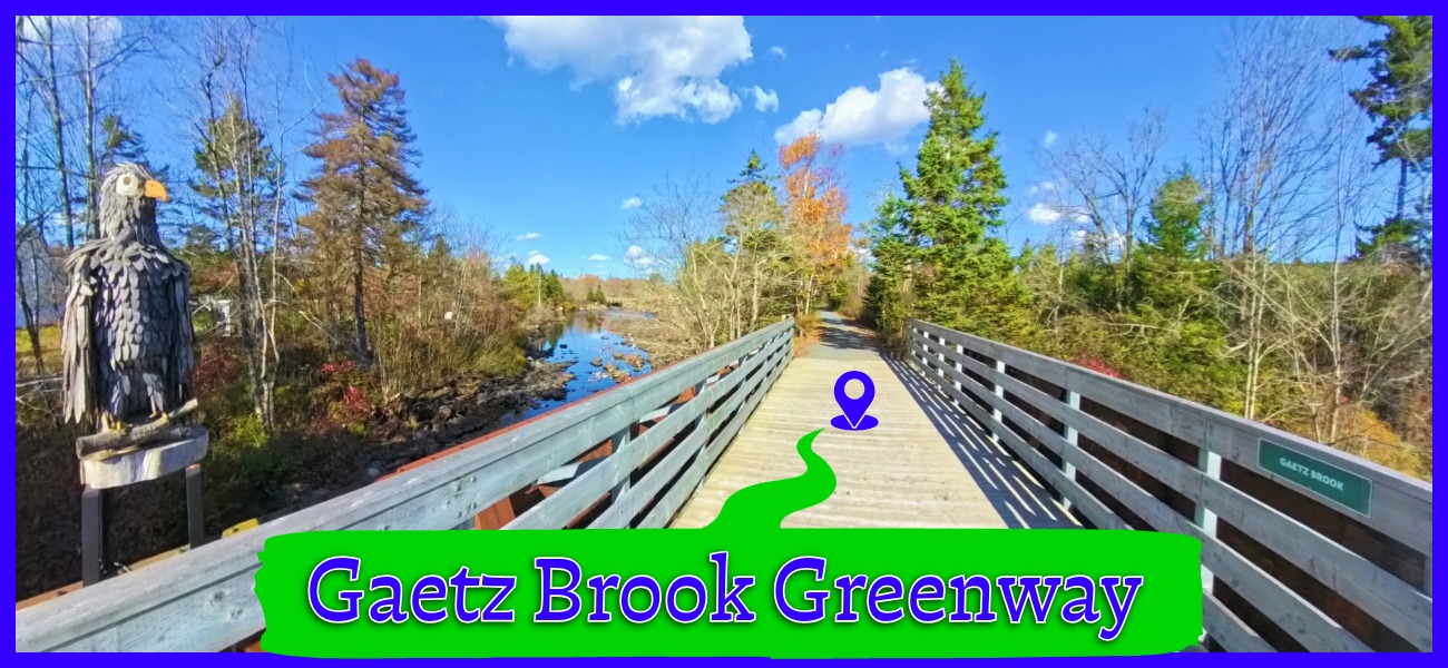
-
- Difficulty: Easy – Moderate (Distance).
- Facilities: Dedicated parking lots.
- Signage: Trail maps on info panels at main entry points. Interpretive panels on local nature & cultural history.
- Features: 7.5km compacted crusher dust trail. Converted railway with no significant hills. Benches, picnic tables & unique artwork throughout the trail. Limited winter maintenance.
- Biodiversity: Alewife, Blueback Herring, Goldenrod, Swamp Milkweed, Orange Jelly | Observations on iNaturalist.
Gaetz Brook Greenway
The Gaetz Brook Greenway is a 7.5km (one-way), linear, multi-use (non-motorized), compacted crusher dust trail. This greenway leads from East Chezzetcook, through Gaetz Brook ending near Musquodoboit Harbour. This trail harmoniously links small communities nestled in the enchanting, untouched coastal vistas of Nova Scotia’s Eastern Shore. The natural scenery combined with the amount of love, work & creativity these communities have put into the trail makes it a masterpiece amidst nature’s own gallery, which is the Eastern Shore. If you love art, community, pristine natural beauty & authenticity, then you owe this trail & Nova Scotia’s entire Eastern Shore a visit.
These rails-to-trails were formerly a route known as the “Blueberry Run” because the train had a reputation of being so slow that you could get off and pick blueberries as you went along. Being a former railway, there are no hills to slow down your progress, just a slight incline from West to East, as you can see by clicking here to view the trail’s elevation profile.
Parking & Access
The dedicated parking lot at the Western end of the trail is off of Debras Way in East Chezzetcook. This parking lot has room for about 15 cars and is located a short distance away from the trailhead. Conveniently located close to halfway through the trail is Royal Canadian Legion Branch 161 and an adjacent parking area for the trail (no need to take up space in the Legion’s lot). Less than 1km from the Legion is Gaetz Brook Junior High School, where you can park with direct access to the trail. At the trail’s Eastern end, there is a dedicated parking lot off Highway 7, approximately 3km away from the community of Musquodoboit Harbour.
Trail Features
Typical of most rails-to-trails in the province, the Gaetz Brook Greenway has a wide, compacted crusher dust base. Even by rails-to-trails standards, it’s remarkably flat with little up/downhill grading. The trail is extremely well cared for and is in great condition thanks to the SATA Trails Society (join them, it’s free & it helps). Beyond the great condition of this recently completed trail, volunteers have put a ton of work into numerous benches, a covered picnic table and play area, as well as public restrooms.
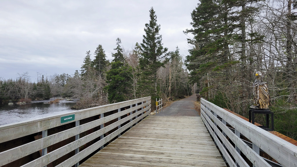
The trail has 2 converted railway bridges that cross the Chezzetcook River & a 200m causeway that stand as reminders of its railway past. At the Legion access point, you can read about the area’s cultural past, including the former railway on thoughtful interpretive signage. Another earnestly written panel greets you at the East Chezzetcook trailhead. Other panels teach visitors about the local natural habitat, from fish to flowers.
Sculptures & Artwork
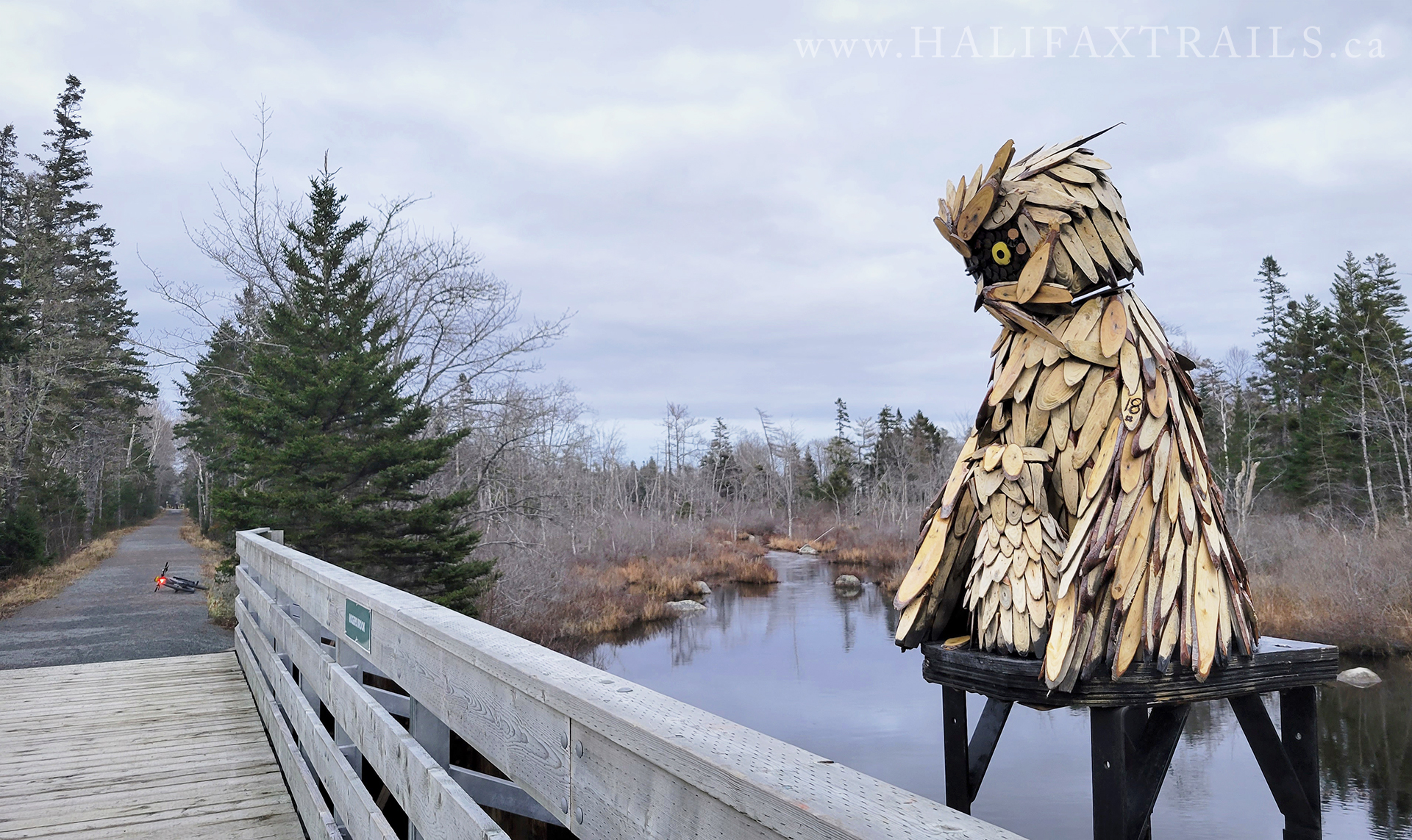 Artwork lines this trail from beginning to end. You’ll see beautifully intricate sculptures & seasonal decorations as you progress down the trail like a parade of creativity. The artworks perfectly complement the natural beauty & add a lot to the trail experience. The sculptures are by local artist Calvin McKay, using reclaimed material & natural materials collected from his own property. “Owlvin” overlooks Rogers Brook Bridge & “Lill” (in memory of his mother) atop the Chezzetcook River Bridge. “McEagle” sits on the Gaetz Brook Bridge, with its partner next to a nearby bench.
Part of The Trans Canada Trail
Currently, the Greenway is bounded to the North by a 3km stretch of unmaintained, rough trail that connects to the Musquodoboit Trailway. To the South is a similarly rough, unmaintained trail that stretches for 15km until it meets the Atlantic View Trail. Improving the connection to the Musquodoboit Trailway is planned and in the works for the near future. Hopefully, the southern “Blueberry Run Trail” will be similarly improved. Once completed, these trails will be especially scenic links in the chain that is The Trans Canada Trail, the world’s longest, stretching from coast to coast.
My Gaetz Brook Greenway Photos




Gaetz Brook Trip Tips
- Helmets & Bells: Required by law for cyclists. Give a polite “ding” before passing.
- Dog Etiquette: Must be on a leash. Please pack out all waste.
- Share the Trail: Keep to the right so runners and faster cyclists can pass safely.
Remember that this trail is maintained by volunteers. Please practice Leave No Trace ethics, pack out what you pack in. Volunteers shouldn’t have to pick up your dog’s waste, so don’t drop bags that you’re sure to forget to pick up on your way back (use a bag carrier).
Bicycle rentals are available nearby via “At Your Own Pace Bicycle Rentals” located near the Eastern Gaetz Brook Greenway trailhead off of Highway 7. They have pickup and delivery options available.
Nearby Parks & Trails
A small beach park is located 900m off the trail on Petpeswik Lake, a great place for a family swim with seasonal lifeguard monitoring, a small play area and picnic tables. It’s also a good access point for paddling this beautiful lake.
The Crowbar Lake hiking trail system is a 15-minute drive from the Western Gaetz Brook Greenway trailhead. The Crowbar Lake trails are extensive, rugged, backcountry trails that are best done by setting aside a full day. Similarly, near the Eastern end of the Gaetz Brook Greenway, the Musquodoboit Trailway offers extensive, multi-day backcountry hiking trails that are accessible directly off the Musquodoboit Trailway’s 14km rails-to-trails.
The Musquodoboit Rails to Trails, just 3km from the Eastern Gaetz Brook Greenway trailhead, is not yet connected by a finished trail. The connection currently involves crossing two highways and is a much rougher trail. This 3km connection is mostly used by ATVs & dirtbikes. I wouldn’t recommend it for anything but mountain bikes, and even then, it’s quite a slog. Plans to finish this connection are in the works, but the SATA Trails Society & Musquodoboit Trailway Association need support to do so.
Further up from the Musquodoboit Trailway is Elderbank Waterway Park & paddling opportunities on the Musquodoboit River. You can camp near the Gaetz Brook Greenway with a 20-minute drive to Porters Lake Provincial Park, or rent cabins & campers 5 minutes away at Sunset Inlet.
The province’s longest sand beach, Martinique Beach Provincial Park, is a 20-minute (15km) drive from the Eastern, Highway 7 Gaetz Brook Greenway trailhead. Lawrencetown Beach Provincial Park & the Atlantic View Trail rails-to-trails are a 25-minute (22km) drive from the Western Gaetz Brook Greenway trailhead. Both beaches are popular with surfers and offer rentals and lessons.
Eat, Drink, Shop & Browse
Browse & shop local artistry at the nearby Eastern Shores Gallery & Mike Lorette Wood Carvings, or walk by Calvin MacKay’s, all just a few minutes from the Western Gaetz Brook Greenway Trailhead (on Debras Way). For food, drink & supplies, head to the community of Porter’s Lake, nearest the Debras Way Trailhead.
The community of Musquodoboit Harbour is nearest the Eastern (Highway 7) Trailhead. The Harbour Brewing Company is conveniently located near the Musquodoboit Trailway trailhead, ideal for a cold one after a long ride. There are lots of other great little spots that are very well reviewed and worth checking out, like Harbour Fish ‘N Fries & Noor’s Mediterranean Kitchen. Browse the area on Google Maps to find something that suits your taste.

Featured Products
Purchases help fund these guides

🎃 Spooky season on the Gaetz Brook Greenway:
Gaetz Brook Greenway
Virtual Tour | Created by Greg Taylor. Please support my work: https://www.ha... | The Gaetz Brook Greenway in Nova Scotia. Trail Guide: https://...
kuula.co