- Difficulty: Easy (distance-dependent). No steep grades but steady incline/declines (view elevation profile).
- Signage: Interpretive panel at First Chain Lake, kilometer markers & distance signage.
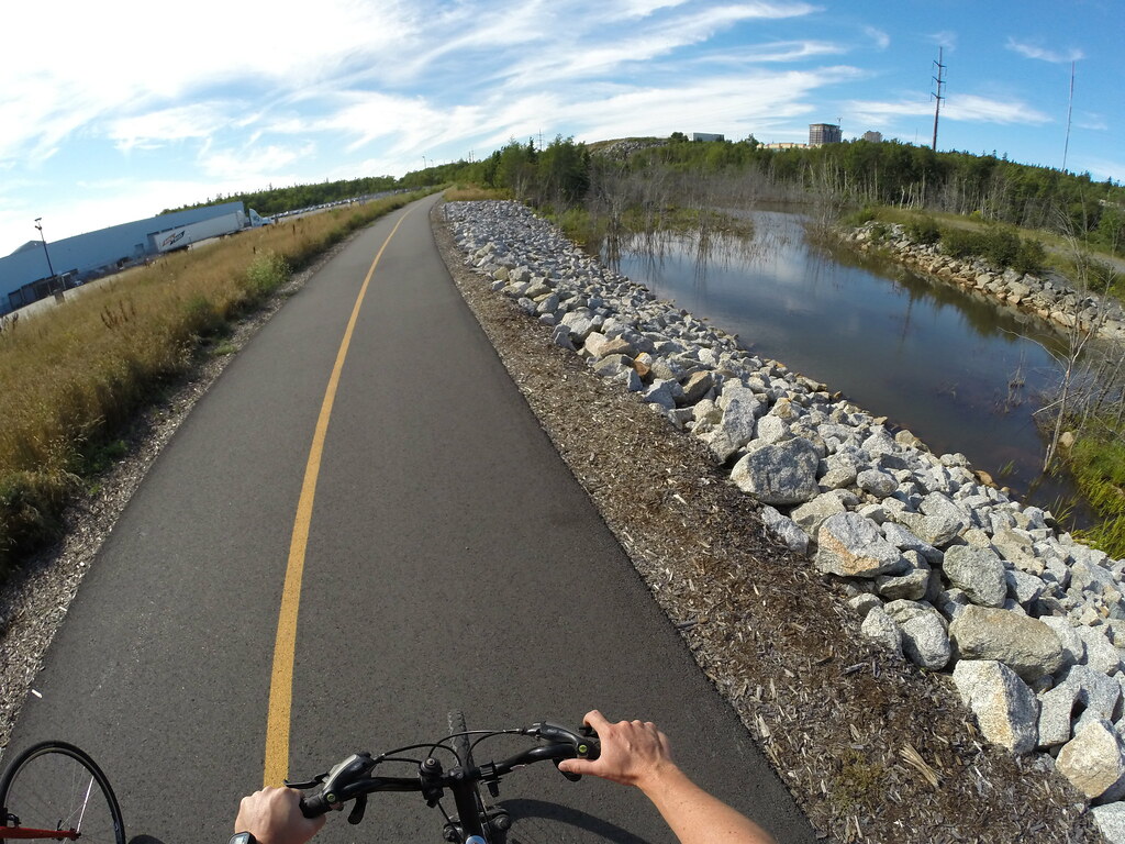
- Features: The longest paved trail in Halifax (7.3km). Alongside 4 lakes. Access to parks, shopping areas & food establishments. Active transportation route with winter maintenance. Part of the Rum Runners Trail from Halifax to Lunenburg.
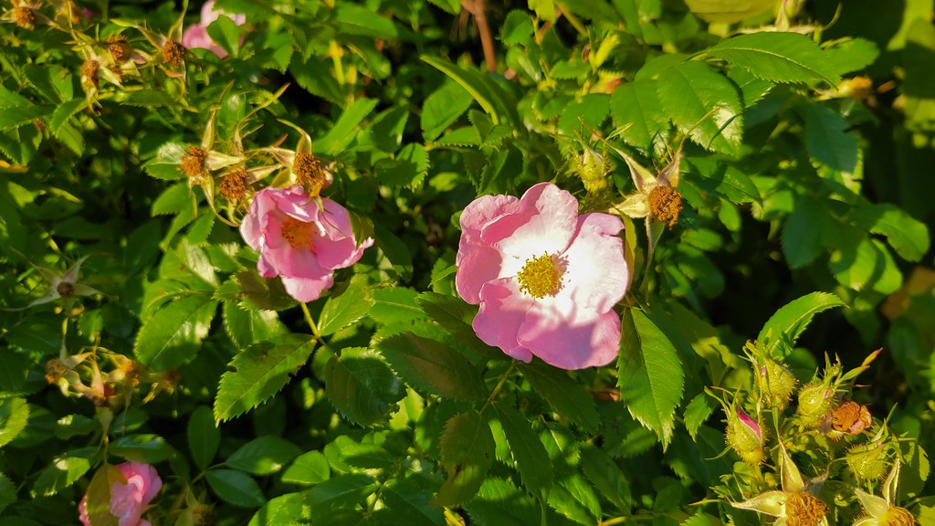
- Biodiversity: A diverse urban habitat featuring a mix of native trees like Eastern White Pine and Balsam Fir, alongside colourful seasonal wildflowers and local wildlife including White-tailed Deer (read more in the Nature section below).
- Trail Conditions: View & sign the logbook for recent updates from fellow explorers.
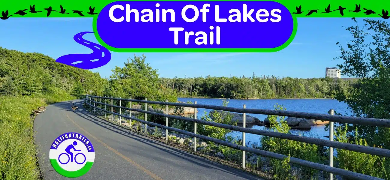
The Chain Of Lakes Trail
Part of a 123km route extending down Nova Scotia’s South Shore, connecting Halifax to Lunenburg, known as the Rum Runner’s Trail, the Chain of Lakes section is 7.3km one way.
For over 100 years (from 1848 until 1977), First Chain Lake was the main water supply for the city of Halifax. It’s still maintained and protected as an emergency backup. In 2011, the Chester Rail Spur, which ran alongside First Chain Lake, was converted into the Chain of Lakes Trail.
Parking & Access
There are a few ways to access the trail by car, though dedicated parking is limited to specific sections:
Official Trail Parking
- Midpoint (Bayers Lake): The primary dedicated lot is located off Chain Lake Drive.
- Western End (Beechville): You can use the dedicated BLT Trail parking lot where the two trails meet.
- Near First Chain Lake: Trail-adjacent parking is available at Crown Drive Park, located just under 3km from the trail’s easternmost starting point.
Unofficial Parking (Park at your own risk)
- Eastern Start (Joseph Howe Drive): Historically, visitors have parked on the shoulder of the road just before the Ashburn Golf Course entrance (ensure you don’t block it) or in the large Superstore parking lot. Please note: These are not official trail spots, and you do risk being ticketed or towed.
Halifax Transit Bus Stops
Accessing the Chain of Lakes Trail via Halifax Transit is easy, with convenient stops located near all three major access points (marked on my trail map). Check out this page for tips on how to load your bike onto the bus. View the current transit schedules here.
- Eastern Start (Joseph Howe Drive): If you are starting at the Halifax end near the Ashburn Golf Course and Superstore, look for Route 2 (Fairview) and Route 3 (Crosstown), both of which serve Joseph Howe Drive.
- Midpoint (Bayers Lake): To jump on the trail near its midpoint, take Route 28 (Bayers Lake), which runs extensively through the business park with stops along Chain Lake Drive and Washmill Lake Drive.
- Western End (Beechville / BLT Trail): For access near the BLT Trail parking lot at the westernmost end, take Route 21 (Timberlea) or Route 123 (Timberlea Express), which both service St. Margaret’s Bay Road.
Multi-Use Active Transportation Trail

There are signs posted along the way (including km markers) as well as plenty of benches to sit and take a break. Wooden guard rails also line some of the steep shoulders (great for keeping the kids safe). This trail has steadily improved and evolved since its beginning, making it into one of the city’s best assets. Whether for commuting or recreation on the city’s longest paved trail, it’s well used by an array of people.
Winter Maintenance
As an important link in the city’s active transportation network, the Chain of Lakes Trail is one of the few trails in the city with winter maintenance. The trail is regularly cleared to maintain a (mostly) ice and snow-free experience all winter long. If you spot any issues, you can report them by phoning 311.
Points of Interest
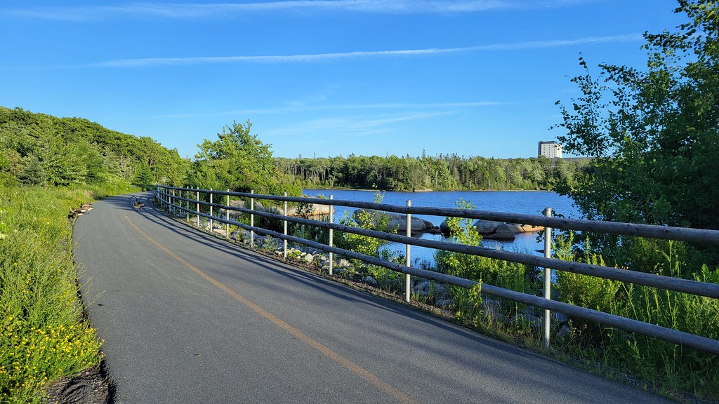
As the name suggests, the trail follows along 5 different lakes. Starting from Joseph Howe Drive, you’ll travel 2km of wooded trail with wooden rails guarding against areas of sloped drop-offs. Benches are regularly placed along the trail, more or less, every 500m.
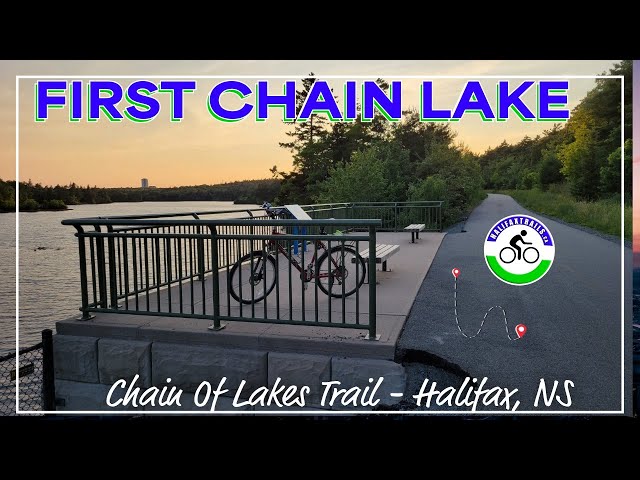
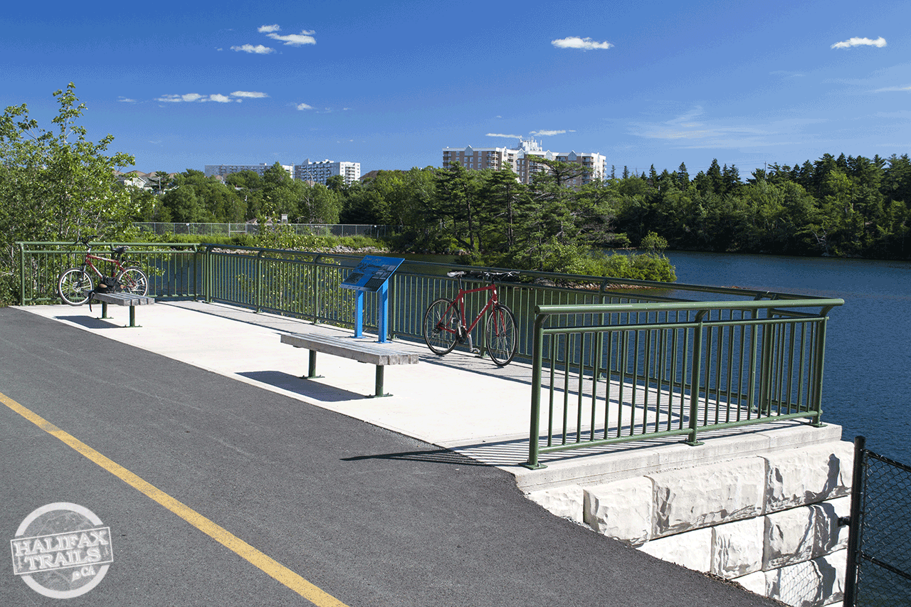
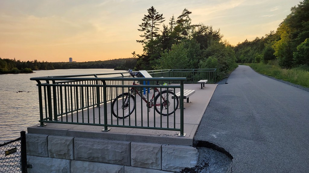
200m from the Ashburn golf course entrance, by the Dunbrack Street underpass, you’ll arrive at scenic First Chain Lake. This spot is the most popular stopping point with two benches overlooking the lake. An information panel discusses the trail’s railway past, as well as the historical importance of the watershed as a water supply for the city of Halifax. During World War I, the northeastern side of the lake was fortified to protect the city’s water supply and major road junctions. This fortification, known as Chain Lake Position – Locality 2, included trenches and machine gun emplacements.
The underpass of Dunbrack Street at First Chain Lake now has a paved greenway trail that leads from the Chain of Lakes Trail toward Hail Pond, terminating across the street from an entry point to Long Lake Provincial Park‘s Lakeview Trail. This new connection makes for easy, protected access to and from Long Lake, as well as direct access to Crown Drive Park (an open field), and a loop trail around Hail Pond.
Continuing past Chain Lake Drive, the trail enters the Bayers Lake Business Park and runs alongside Bayers Lake itself. A lookoff area enclosed with a railing provides another good stopping point just under 1km from Chain Lake Drive. Further down the trail, alongside the lake, are 2 more benches, which the lookoff doesn’t offer.
After passing Bayers Lake, you’ll cross Horseshoe Lake Drive and have a straight run of 800m until passing by Black Duck Pond & Lovett Lake. 400m beyond the lake you’ll cross Lakeside Park Drive and onto the trailhead parking lot for the B.L.T. Trail. From here the trail changes from asphalt paving to a compacted crusher dust (gravel) base.
Chain Of Lakes Trail Photos


Nature & Wildlife
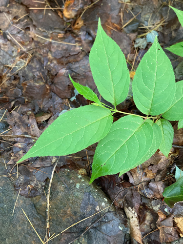
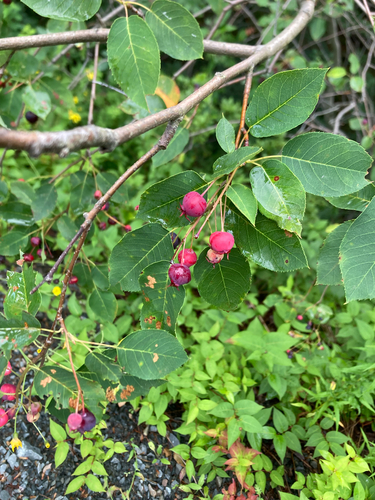
The Chain of Lakes Trail offers a unique window into an urban ecosystem where a mosaic of native forests and human-managed landscapes meets. As you follow the trail, you will traverse areas framed by resilient conifers such as Eastern White Pine, Balsam Fir, and Eastern Hemlock, which provide essential cover for local wildlife. Keep a keen eye out for the White-tailed Deer that are frequently spotted along the forest edges, or listen for the distinctive calls of American Crows echoing through the canopy.
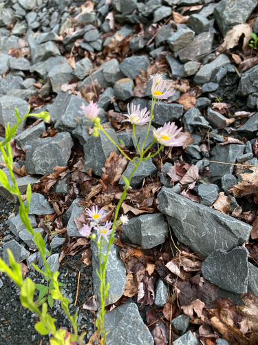
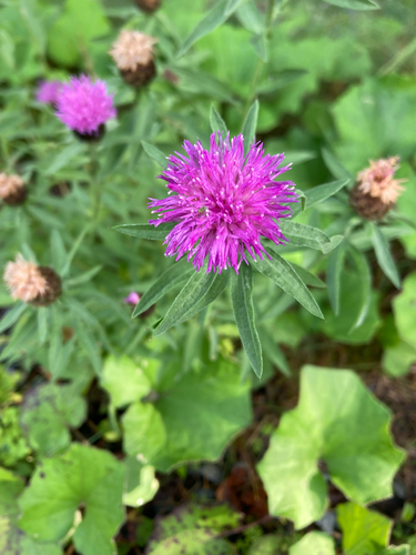
The trail’s varied open spaces and marshy fringes support a vibrant collection of both native and introduced flora, creating a haven for pollinators. During the warmer months, you can observe Common Eastern Bumble Bees and American Goldfinches feeding among colourful plants like Pearly Everlasting, Sheep Laurel, and Broadleaf Cattails. This thriving habitat showcases how nature persists and adapts within the suburban environment, providing an accessible and rewarding experience for nature enthusiasts.
Recent Community Sightings
Live wildlife and plant observations logged along this route:
Spot something interesting while out on the trail?
View & Log SightingsTrip Tips
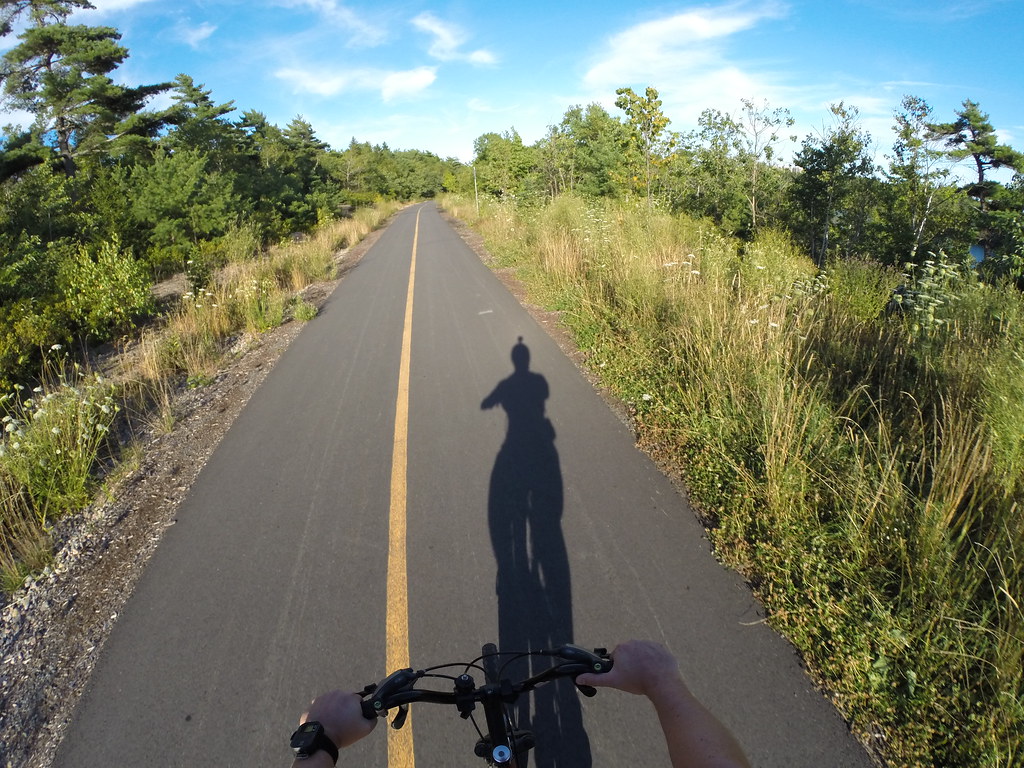
The Chain Of Lakes Trail is great as an active transportation route, or purely for recreation. As such, it’s an often-busy, popular trail used for many different activities. Great for training for a new personal best with your GPS smartwatch, a family outing with strollers, and bikes in tow, or a long, flat, smooth rollerblading adventure. With this mix of trail users, it’s important to be equipped with a bicycle bell to safely pass others, and helmets are the law. It’s also a good place to have a rearview safety device to see what’s going on behind you before you change lanes to pass.
As the trail continues on as the B.L.T. trail and the St. Margarets Bay Trail, it turns to a crusher dust base, so don’t plan on rollerblading to St. Margarets Bay just yet. Biking, however, is ideal. With connections to Cleveland & Queensland Beaches, it makes for a direct biking route of 47km from Halifax. Graves Island Provincial Park is a great place to camp, another 26km beyond the beaches.
First Chain Lake is a popular spot for local anglers. The lake is known for populations of Smallmouth Bass, Largemouth Bass and Yellow Perch. As part of a protected watershed legacy, the lake offers a quiet corridor for local wildlife right on the edge of the city’s urban business parks.
The linear fashion of these rails-to-trails routes means you have to plan your halfway point ahead of time so you have enough energy for your return trip. At 7.3km one way, it takes roughly 30 minutes (1hr return) by bike. Sometimes using two cars at your planned starting and ending points is the best plan for longer trips, or arranging for a pickup from a friend. City buses are also equipped with bike racks. When planning your route, using an average moving speed of 14km/h will give you a good ballpark estimate for any distance along the entirety of the Rum Runners route.

Gear Up For Your Next Adventure
Purchases help fund these guides