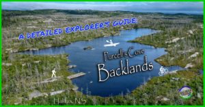
Shaw Wilderness Park
- Difficulty: Moderate – Difficult (Navigation, Terrain, Distance).
- Facilities: Parking.
- Signage: Trail markers for the main trail, little signage.
- Features: Ecologically diverse landscape. 153 hectares of urban wilderness with access to 2 lakes. Unique vistas of downtown Halifax. Borders the MacIntosh Run Singletrack Trail system.
UPDATE: The parking lot and trailhead on Purcells Cove Road will be CLOSED from May 11 until late October 2026 due to the construction of a new dam on Williams Lake. For updated information, visit this page.
Shaw Wilderness Park
For generations, Haligonians have trekked through wilderness paths off of Purcells Cove Road to find their favourite swimming hole on Williams Lake. These old access trails are now occupied by private property, which had ended centuries of public access. Enter the new Shaw Wilderness Park, which offers great access to 2 Lakes: Williams Lake and Colpitt Lake.
While Williams Lake has long been directly accessed by local residents and the public alike, Colpitt Lake and all of its shorelines are untouched by housing. These lakes are important aspects of the Backlands and part of a complex system of waterways comprising the McIntosh Run Watershed. Directly adjacent to the park, but not part of it, the McIntosh Run Singletrack Trail System runs along the Spryfield side of Colpitt Lake. This network of world-class singletrack mountain biking trails extends from Colpitt Lake, all the way to Norawarren Drive, with upwards of 20km of wilderness trails in between.
Parking & Access
The Park is full of places to explore with varying degrees of difficulty. Some trails are easily identifiable, like the marked, maintained trail leading from the main parking area off of Purcell’s Cove Road, directly across from the Royal Nova Scotia Yacht Squadron. From the new parking lot, a wide, compacted crusher dust trail leads runs for 380m toward Williams Lake.
Immediately upon heading up this entry trail, you’ll hear a stream to your right-hand side This stream outflows from Williams Lake at an unsustainable rate, causing water levels to drop year after year. At the end of this trail is the shore of Williams Lake. 90° to your left, is the beginning of a narrow, rugged wilderness trail. This trail, now officially designated “Etu’qamikejk Trail” is marked with periodic red markers on trees to let you know you’re on the right track. There are occasional side paths that can get you off track, so you do have to pay attention to where you’re going.
From the Williams Lake trailhead, it becomes a gradual uphill climb until you reach a few clearings. These clearings treat you to unique perspectives of the downtown Halifax skyline and Halifax Harbour. Roughly mid-way between Williams & Colpitt Lake and not yet a part of any official trails, you’ll come to an old foundation, the remains of a World War 2 anti-aircraft battery. Not the kind of structure you want to let your kids play on, it has dangerous footing amongst its ruins. The structure itself isn’t much to see, but it is interesting to consider its strategic placement atop the highest point in the area.
Continuing along a straight property line, the trail connects to a much more rugged and unmarked trail that loops around Colpitt Lake. Note: I haven’t hiked the full loop around Colpitt Lake since the official opening of the Shaw Wilderness Park, so it may now be better marked or have plans in the works to improve it.
Access to Colpitt Lake is considerably less official without any designated parking lots or access trails, though the well-marked McIntosh Run singletrack trail system runs nearby Colpitt Lake. Their cheekily named Clark Kent Trail begins from nearby Lois Lane, which has a small parking area for people to access the McIntosh Run trail system. From “Clark Kent,” you have to hike unofficial, unmarked side trails that lead to Colpitt Lake. The hike from the Lois Lane parking area to Colpitt Lake is roughly 1.5km, partly along Clark Kent Trail. A closer access point to Colpitt Lake is at the end of Drysdale Road, with no designated parking area.
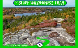
Etu’qamikejk Trail
The first officially designated wilderness trail in the Shaw Wilderness Park was recently completed and will soon be officially announced to the public in 2025. Climbing from Williams Lake to a high point between Williams & Colpitt Lake, it’s a distance of just under 1.5km. Click here to view the elevation profile of the entire up-and-back hike. Discrete red trail markers & new signs at the beginning and end will let you know you’re on the correct path. It’s a well-established trail from Williams to Colpitt Lake, and its official designation will help discourage unnecessary splinter trails in the area.
 You can tell this landscape is special without knowing anything about its past, but its geologic history makes it and this trail specifically, something truly unique. The trail is the center of two geologically distinct land masses coming together. On one side of the trail in the direction of Williams Lake is part of what is known geologically as the Meguma Terrane, with origins going back 500 million years ago. On the opposite side of the trail is the South Mountain Batholith with origins going back 380 million years ago.
The South Mountain Batholith is the largest geological formation of its kind in the Appalachians, of which Nova Scotia is a part. The Appalachian mountain range is amongst the oldest on earth, and the origins of the Backlands geology date back hundreds of millions of years, but this land was more recently sculpted by glaciers that retreated 12,000 years ago. The glaciers scraped the land and deposited giant boulders as they retreated. Known as glacial erratics, Nova Scotia and the Backlands in particular are blessed to have some of the best examples of glacial erratics in the world,
Tasked with naming this new trail, Dr. David Patriquin studied the landscape and walked the trail with anthropologist Trudy Sable and orthographer Bernie Francis. During this process, a wonderful confluence took shape, like the land itself. Just as the trail is located where two distinct eras of geological time meet, the naming of the trail involved a coming together of cultural & geographical considerations.
Patriquin took inspiration from the book “ which discusses how the “rhythms, sounds and patterns of the language are inextricably bound with the seasonal cycles of the animals, plants, skies, waterways and trade routes” and how “the ancient languages of Eastern North America are reflected in the language and cultural expression of its indigenous peoples, the Mi’kmaq.”
The name he settled on is the Mi’kmaq word “Etu’qamikejk”, spelled phonetically as “Eh doo hum i gehjk”, meaning “two sides meet”. You can read more about this sublimely appropriate trail name on a Backlands Coalition blog post where Dr. Patriquin discusses it in considerable detail, including audio of proper pronunciation. As he says, “Perhaps by practicing the pronunciation of the names as we walk the landscape, we can begin to understand how the ‘rhythms, sounds and patterns of the Mi’kmaw language are inexplicably bound with the seasonal cycles of the animals, plants, skies, waterways…’ and become ever better stewards of the land in the process.”
Unmarked Trails For Experienced Hikers
The rugged, unmarked, unmaintained trail which loops around 36-hectare Colpitt Lake, is accessible from various points along the McIntosh Run Singletrack Trail system. The newly constructed Clark Kent Trail runs parallel to Colpitt Lake with various non-system trails connecting to the lake. The Clark Kent Trail invites bikers & hikers of all skill levels, thanks to hard work by the McIntosh Run Watershed Association. Access to the trailhead of “Clark Kent” is via Hartlen Park, a small, neighbourhood park on aptly named Lois Lane. Other access points to “Clark Kent” are at the end of Theakston Avenue and at the end of Drysdale Road (the closest to Colpitt Lake). With limited parking in this residential area, be considerate by not clogging the roads (park on one side), don’t block driveways, and limit noise as you come and go.
Leading from the well-constructed and well-marked McIntosh Run Singletrack Trails are many interconnected paths and unmarked trails leading in every direction into the Backlands. These rugged wilderness trails can be harder to follow in the dense foliage of summer. Despite being rugged & unmarked, they are well-travelled, so you should not be bushwacking for any significant amount of time. These narrow trails require proper footwear, essential gear, and constant mindfulness to avoid ticks in this tick-friendly terrain. Don’t forget that open fires are a big no-no and basic Leave No Trace ethics apply.
Part of what makes Colpitt Lake so great is its wild, remote #backcountry feel, without having to leave the city. A true urban wilderness gem like the Blue Mountain-Birch Cove Lakes Wilderness Area, but with a unique, at times otherworldly granite barrens landscape. As the area becomes more popular to the public, it’s our collective duty to keep it beautiful, so please pack out what we pack in, and grab any extra garbage you see lying around.
Swimming & Paddling
There are many great spots to take in the surroundings, particularly along Colpitt Lake, where a rocky stream meets the lake. Adjacent to the stream is a small sandy area with great access for swimming, making it one of the easiest (and most popular) spots to go for a dip in Colpitt Lake. To add even more to this great spot, a towering granite outcrop (unfortunately often spray-painted) is tucked in behind.
Algorithm based on thermal lag and seasonal averages.
Williams Lake has long been a favourite place for Haligonians to go for a swim, particularly near the dam. Due to modern housing encroachment, this area is partly now on private land so you’ll have to venture further along the uninhabited side of the lake to find your new favourite swim spot.
You can access Williams Lake quite easily via the main trail that leads from the Shaw Wilderness Park parking area. The 380m long, compacted crusher dust trail makes for an easy carry. Williams Lake does have direct access for paddling at the other end of the lake via the end of Acorn Rd. While it is good access, the water levels in the lake have been so low in recent years that this area is more often than not a large mud flat.
The provincial government recently announced a long-overdue investment to rebuild the dam that has been failing for decades. The old dam’s construction dates back to the 1700s, with little done to it since. The failing dam is largely responsible for dwindling water levels in the lake resulting in its lowest levels ever recorded during recent dry spells. While the new dam won’t begin construction for another few years, it’s good to know that this problem has finally been addressed.
Be sure to Leave No Trace to keep this spot free from inconsiderate human impacts. Keep in mind that open fires are not allowed in municipal parks unless stated otherwise. To minimize fire impacts, it’s always better to opt for a backpacker’s stove or a portable fire dish in places where fires are allowed.
Uniquely Diverse
The area is a diverse array of ecological and geological rarities that come together to form often other-worldly landscapes. The unique rocky landscape was quickly apparent to the British settlers as they began quarrying rock from King’s Quarry, an area adjacent to the Backlands Wilderness Park. This quarry, likely the oldest in Halifax, has a history dating back hundreds of years when it was used to create some of the city’s most iconic places, including the Halifax Citadel.
While much of the backlands is large, open granite barrens, the Shaw Wilderness Park encompasses a diverse landscape of mixed forest, streams & lakes. You don’t have to hike far to find a spot by either lake to take in a good view. With different places to access each lake, every trip can be different. Both lakes offer a diverse array of shoreline scenery ranging from sandy coves, lilypad covered wetlands, to steep granite ledges.
This breathtaking landscape also offers unique angles of the distant downtown Halifax skyline which is conveniently only minutes away via car or public transit. It’s a nature lover’s paradise, whether you’re a hardcore naturalist, outdoor photography enthusiast, or casual enthusiast who enjoys identifying flora and fauna you won’t find in many other cities. View Shaw Wilderness Park observations recorded on iNaturalist by clicking here, and download the app to contribute your own.
Despite the urban surroundings, this area is sufficiently wild that Mainland Moose have been spotted here while they near human-caused extinction. The area is also a refuge for an array of migratory birds not seen anywhere else in the region. It’s a regular occurrence to see Osprey on the hunt in this bird-watching oasis. Equip yourself with knowledge from local guidebooks and you’re sure to spot plenty of rarities.
Shaw Wilderness Park Photos


Rugged & Wild
Many trails are not marked or mapped, especially if you enter anywhere other than the parking lot on Purcell’s Cove Road. If you plan to explore elsewhere, make sure you have sufficient preparation, experience & essential equipment. If venturing beyond the marked trail, it’s necessary to have proficiency in wilderness navigation (my custom maps are intended to be opened with your phone’s Google Maps app, to be used as a real-time navigation aid). Come prepared for the season; bugs in Spring/early Summer, slippery & cold in Winter, and early Autumn sunsets.
The lakes are good reference points to keep you on track, but once you cross to the far side of Colpitt Lake, or head away from it, you’ll see paths that can lead in many different directions. Many high points and clearings allow you to get your bearings, though the rocky landscape can become a deceptive maze when you’re deep in amongst it. The broader Backlands area is more than big enough to get well and truly lost. In winter, snow can obscure the trails, and summer can make them narrow and overgrown. Caveats considered, the wild aspect of the Shaw Wilderness Park is a big part of what makes it a rare gem. Safe, responsible, impact-minimizing exploration of untouched wilderness is a rarity in any city, and something our region is coming to realize is more valuable than gold.
A Community Legacy
The Nature Conservancy of Canada spearheaded the creation of the Shaw Wilderness Park and continues donation-worthy work protecting more areas for generations to come. The Halifax Backlands Wilderness Park is an example of the good things that come from private and public interests working together toward a common goal that benefits the entire city. An outpouring of support from engaged citizens set the table for all parties to come together. A success story that’s hopefully repeated in the rest of the Backlands & nearby Blue Mountain-Birch Cove Lakes Wilderness Area These are the types of projects that will cement Halifax as THE city for eco-tourism while continuing to attract people and businesses with easy access to wilderness areas unparalleled anywhere in North America.
The backlands face threats from encroaching development. Follow the Backlands Coalition and Williams Lake Conservation Company to stay apprised of the latest issues facing this area. Please support and donate to any or all of the volunteer-driven organizations mentioned in this guide as a thank-you for the work they have done and continue to do, leaving legacies for generations to enjoy.
SHOP.HALIFAXTRAILS.ca: Gear | Books | Sale
Featured Products
Purchases help fund these guides