Crystal Crescent Beach Provincial Park
- Difficulty: Difficult (Length/Terrain/Navigation).
- Facilities: Parking, outhouses.
- Signage: None.
- Features: 3 white sand beaches. Over 11km of rugged coastal hiking. Unmarked, unmaintained wilderness trails & rocky coastline routes. Sensitive, biodiverse coastal ecosystem.
- Biodiversity: Coastal Barrens | Grey Seal | Piping Plover | View observations on iNaturalist.
- Categories: Coastal, Boardwalk, Beach, Swimming, Peninsula, Park.
Crystal Crescent Beach Provincial Park
Crystal Crescent Provincial Park is one of the best-known summer getaways in the Halifax region and is often voted as Halifax’s best beach. Crystal Crescent is most well known for its trio of white sand, crescent-shaped beaches that provide plenty of room for summer crowds. The first 2 beaches are easily accessible via short trails & boardwalks. The third, more secluded one is a traditional naturist (clothing optional) beach. The water is typically chilly, even in the peak of summer, with average temperatures in August hovering around 17°C.

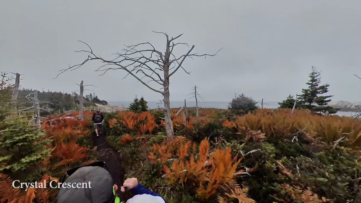
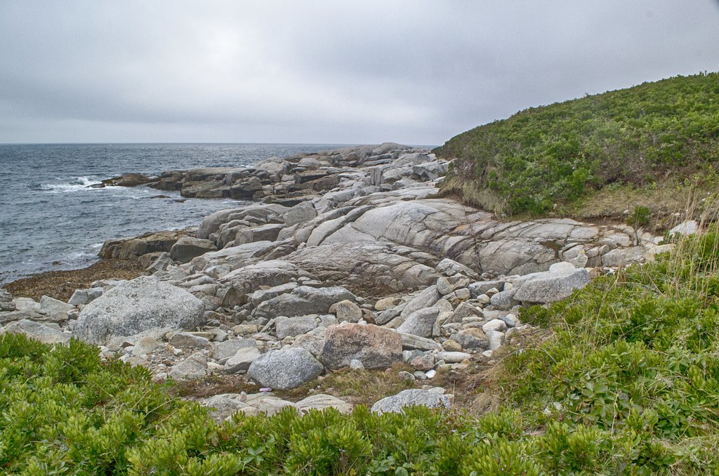
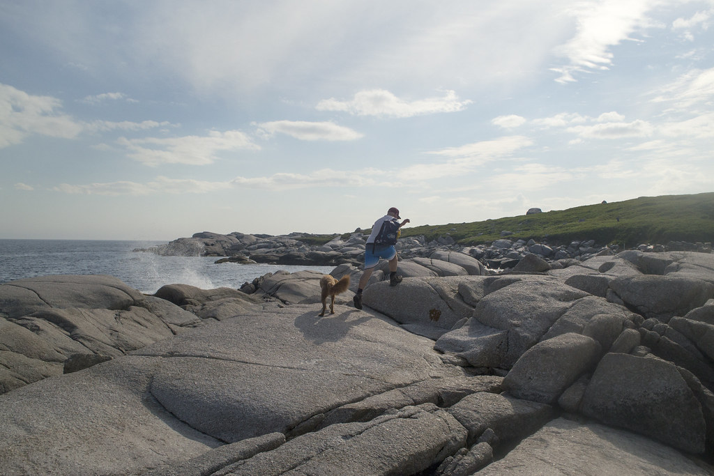
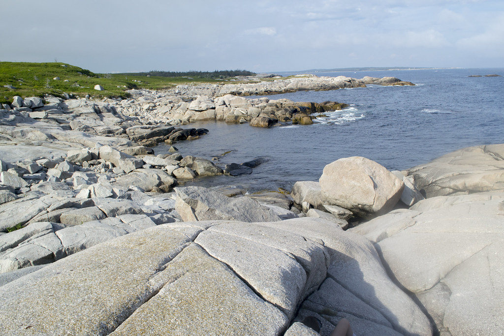
What is less well known is the coastal hiking trail that originates from the beach, known as the Pennant Point trail. Of the many great Nova Scotia #beach hiking areas, this one is amongst the best. Pennant Point trail is a breathtaking, unforgettable coastal hiking experience. It follows along the near-endless coastline of a peninsula. The longest route is an 11-kilometre loop that hugs the coastline for most of it. There are plenty of nooks slightly off the trail, along the coastline, where rock scrambling can lead to some great places to chill. The landscape is something fans of Peggy’s Cove and other rocky #coastal trails will really appreciate.
Crystal Crescent Beach Provincial Park is located in Sambro, Nova Scotia, a 45-minute drive from downtown Halifax. It encompasses a large peninsula, spanning 540 hectares. Like the hike, the drive can be done as a scenic loop known as the Sambro loop, with urban Halifax at one end and the fishing community of Sambro at the other. The winding two-lane road is similar to driving the Peggy’s Cove loop. The park is open seasonally (late May to late October), and a gate closes off access to the parking lots in the offseason.
Parking & Access
A 450m drive down the Crystal Crescent Beach Road, you’ll come to the turnoff for the main parking lot that was expanded in recent years to accommodate more visitors. Known as the lower lot, it’s segmented into 5 different parking lots. This is the parking area most people use to access the main beach. On warm summer weekends and holidays, it can still fill up quickly. There is another large parking area, known as the upper lot, a wide-open space that is a better option for accessing the hiking trails. During peak times (nice summer days), arrive early to secure a spot. Both parking areas have very basic outhouses, and there are no other services on site.
The gravel access road and parking lots are poorly maintained, so take it slow. During the offseason, when the gate is closed, you can park on the side of the access road, but don’t block the gate or the road. The walk from the gate to the first beach is a substantial 600m. From the gate to the upper parking entrance is 1km. There is no winter maintenance, including garbage services, so plan to bring your garbage out with you. Use of the park is at your own risk during the offseason.
Pennant Point Hiking
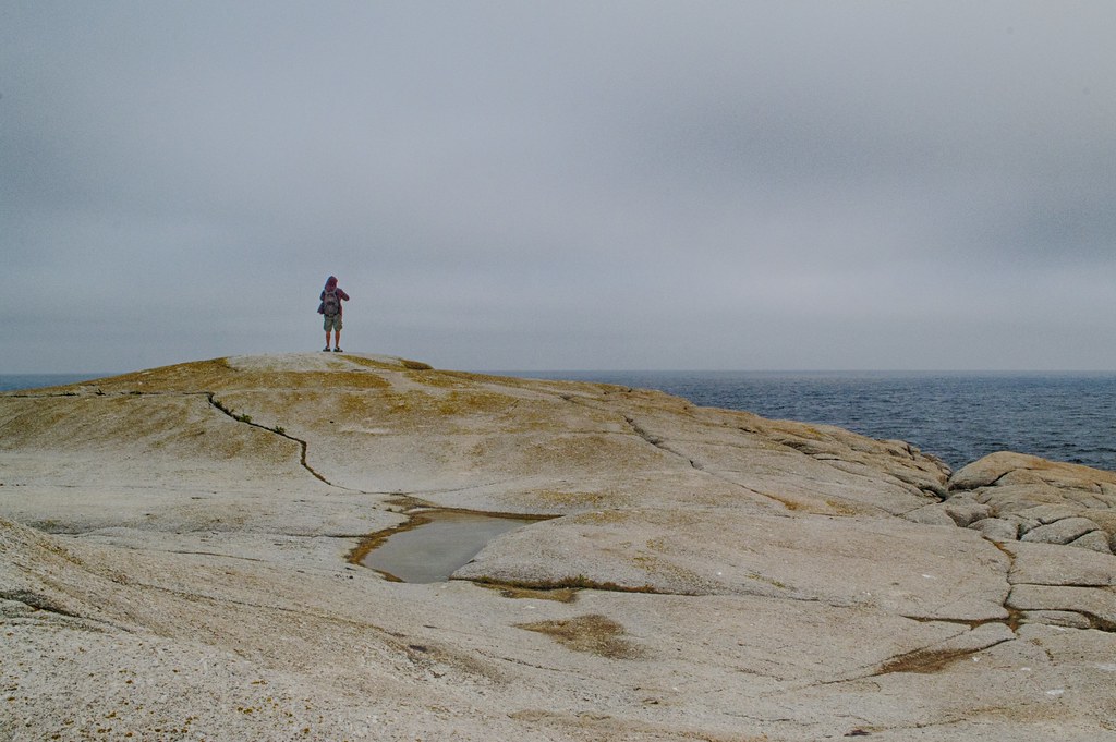
The hiking is very challenging due to its rugged, slippery, muddy, and ankle-twisting terrain. It’s not an outing to take lightly. Unpredictable weather often changes from warm and sunny to dense fog & wind in a matter of minutes. Bring survival essentials & proper gear for a long hike. Know the current sunset time, and don’t play it close, as the return trip back to the parking lot can be full of time-depleting surprises.
The last time I hiked the Eastern Shore Trail to Pennant Point & returned via the Spine Trail, it took me 2h 20min of hiking time, but I spent a total of 3h 20min, including my frequent photography stops and some time to sit and enjoy the views. Weather & trail conditions can impact these times dramatically, so take these figures as a ballpark estimate.
If you’re doing the full East/West loop, I recommend setting aside the majority of the day, as it can be quite difficult. It can be challenging in parts as you’ll have to climb over rocks and pay attention to navigating. Wet, muddy conditions can quite literally bog down your progress as well. Click here to view the elevation profile of my hike to Pennant Point via the Eastern Shore, returning via the Spine Trail. Being tired and in a hurry is a recipe for injuries, so it’s good to allow plenty of time for breaks to take in the amazing scenery. If you make it out early, you can spend some extra time relaxing on the beach, much better than panicking about making it out before sunset.
Trail Routes
 There are 3 routes to choose from. Regardless of the route you choose, your hike will be around a 10km return trip if you make it to Pennant Point. None of the trails are marked or maintained. They’re all rugged, and it’s definitely possible to get off track. Please try to stick to the most-used trails, as trail braiding is a destructive issue for this sensitive ecosystem. Set aside a minimum of 3-4 hours to do any of these hikes, but allow yourself extra time for both safety and enjoyment.
The easiest route is to walk the Eastern shore up and back, indicated by the blue line on my map. This is the most scenic route with lots of rugged, rocky terrain. Occasionally, blue spray paint markings show you’re on the right track (please don’t spray paint anything). I would highly recommend this route if it is your first time hiking here, so you can get a feel for the challenges without risking all of the variables involved in the other routes.
The hardest route is a full loop of the eastern & western shorelines. This route takes longer than the others. Completely unmaintained, it has some very muddy, very wet inland hiking that connects the parking lot to the Western shore. It can be very easy to miss 2 key turns on the trail that can send you far in the wrong direction. One is where the coastal trail turns sharply inland into a densely forested section, and another is where the trail turns sharply to the parking lot. You won’t want to wing it if you do this route, so make sure you’re well prepared & paying attention to your navigation.
Another route is the Spine Trail, named so as it runs down the middle of the peninsula like a spine. This trail should only be done in dry (or frozen) conditions, as it is very muddy and there are a couple of 100m stretches where the trail is completely flooded, requiring some difficult bushwacking to get around. Worst-case scenarios can leave you waist-deep in a muddy pond. Despite the difficulty, there are some very scenic spots. The varied terrain has pine forests and open areas that offer great views of colourful vegetation, including high bush blueberries and wildflowers. Near the coast, you’ll see remnants of a very old tractor, which was likely the last vehicle ever to drive on this trail. Neither trailhead for the Spine Trail are marked, and the one nearest Pennant Point is very easy to miss.
My Crystal Crescent Photos


Insider Tips
Good preparation is required in this remote area. Proper hiking shoes, water, navigation aid, first aid, etc., are all a must if setting out to hike the full Pennant Point loop. Keep in mind that the weather and temperature can change drastically at any moment.
It is crucial to know that there are no lifeguard services at any of the beaches in Crystal Crescent Provincial Park. Swimming is at your own risk. As with any ocean beach, be aware of the potential for rip currents. Learn how to spot them and what to do if you get caught in one. The Atlantic water is typically cold, even in the peak of summer, with average temperatures in August hovering around 17°C (62°F). Be prepared for a refreshing, if not chilly, dip.
The closest spot for food and supplies is a 5-minute drive from the parking lots. Takeout food, a convenience store, and a small liquor store are located on the corner of West Pennant Road and Old Sambro Road. There are no gas stations nearby, so make sure you’re not running on fumes to get there. Unfortunately, the park is not accessible via public transit (click here to view adventures that are).
Leave No Trace. Help keep this beautiful park pristine by packing out everything you pack in. There are limited garbage disposal facilities, so be prepared to take your trash with you. Camping is not allowed, nor are open fires. Stick to the most well-used paths to minimize trail braiding, which causes significant environmental damage to sensitive ecosystems like this. Expect mud & wear appropriate footwear (waterproof hiking boots).
For multiple reasons, keep your dog on-leash. First, it’s part of the rules for the park, but also to protect the sensitive ecosystem that includes endangered ground-nesting birds. Another big reason is that this area is a haven for porcupines. A curious dog with a face full of porcupine quills is no joke; the barbed quills can be life-threatening & require an emergency (expensive) veterinarian visit. Also, make sure you have a plan to carry used poop bags, as there are no garbage cans along the way.
Looking for a fun, outdoor adventure to complete with family and friends in Crystal Crescent Beach? Try “Knights of the Stone Table” to become a knight and prove yourself to the Queen of Crystal Crescent. The step-by-step instructions for this 3.4 km (return) trail adventure and a route map can be downloaded at earthadventures.ca. The approximate time to complete the adventure is 2 hours, 30 minutes.


Now retrieving an image set.
🍂🌊 Coastal #AutumnVibes along Pennant Point #hiking trail in Crystal Crescent Provincial Park - #Halifax, #NovaScotia. Map, guide & 360° virtual tour: https://www.halifaxtrails.ca/crystal-crescent/