Categories
Hiking
Easy
Moderate
Difficult
Short
Half-Day
Long
Biking
Camping
Paddling
Swimming
Tags
Accessible
Backcountry
Beach
Bird Watching
Boardwalk
Bridge
Coastal
Dog Friendly
Family Friendly
Fishing
Historic Sites
Lake
Lookoff
Loop
Off-leash
Old-growth
Public Transit
Picnic
Rails-To-Trails
River
Skating
Snowshoeing
Waterfall
Wetlands
Winter Maintenance
Photos
Photos
Videos
Virtual Tours
Shop
Gear
Books
Exclusives
On Sale
Info
About Me
Advertise
Events
How-To
Socials
Support Me
Login
Menu
Categories
Hiking
Short
Half-Day
Long
Easy
Moderate
Difficult
Biking
Paddling
Tags
Backcountry
Beach
Bird Watching
Bridge
Public Transit
Coastal
Dog Friendly
Family Friendly
Fishing
Historic Sites
Lake
Lookoff
Loop
Off-leash
Old-growth
Park
Picnic
Rails-To-Trails
River
Skating
Skiing
Snowshoeing
Waterfall
Wetlands
Accessible
Winter Maintenance
Photos
Photos
Videos
Virtual Tours
Shop
Gear
Books
Exclusives
On Sale
Info
How-To
About Me
Follow Me
Supporters
Advertise
Search
Top
Home
>
Posts tagged "Pond"
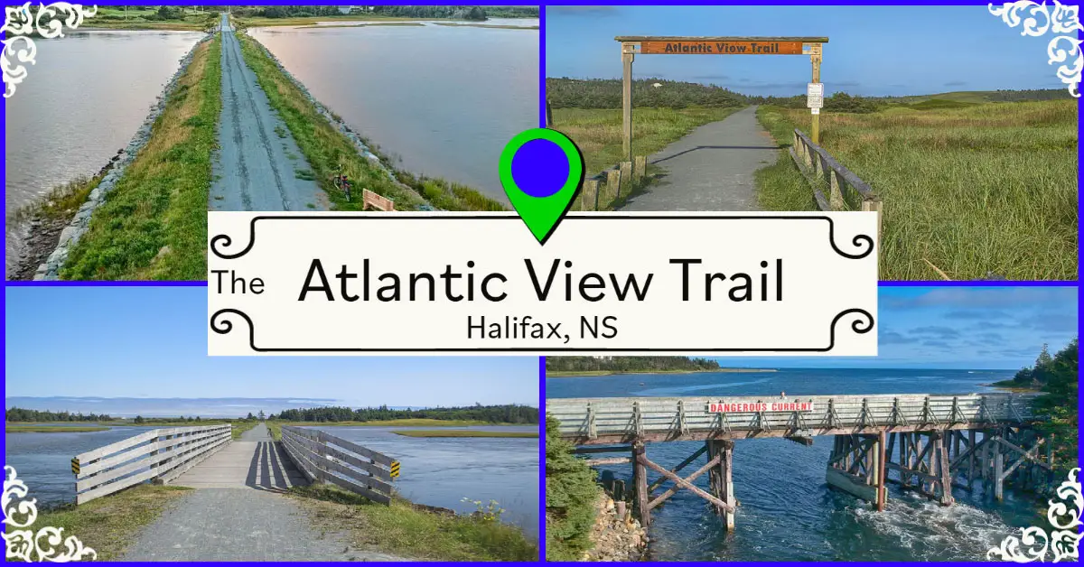
Halifax Regional Municipality
The Atlantic View Trail
Biking
,
Easy
,
Half-Day
,
Swimming
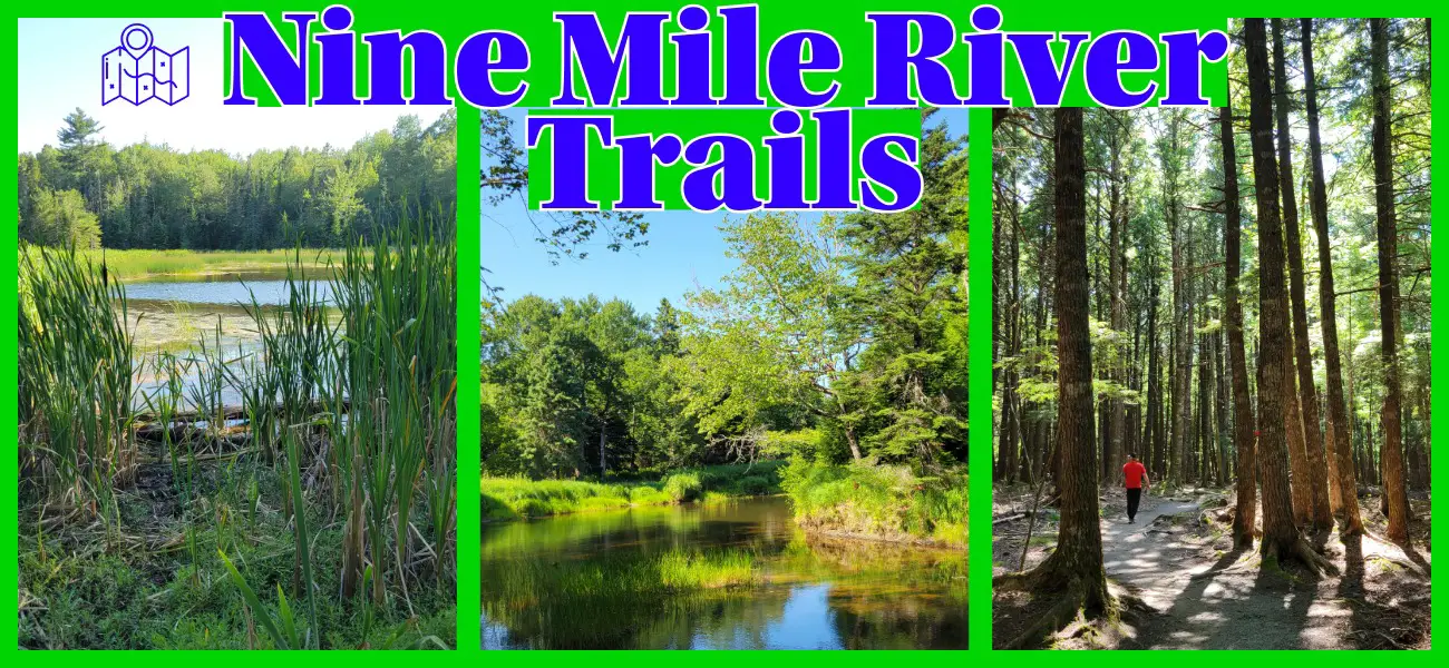
Hants County
Nine Mile River Trails
Long
,
Biking
,
Difficult
,
Easy
,
Half-Day
,
Hiking
,
Moderate
,
Short
Halifax Regional Municipality
Sir Sandford Fleming Park
Easy
,
Hiking
,
Paddling
,
Short
,
Swimming
Halifax Regional Municipality
Hemlock Ravine Park
Easy
,
Biking
,
Hiking
,
Short
Halifax Regional Municipality
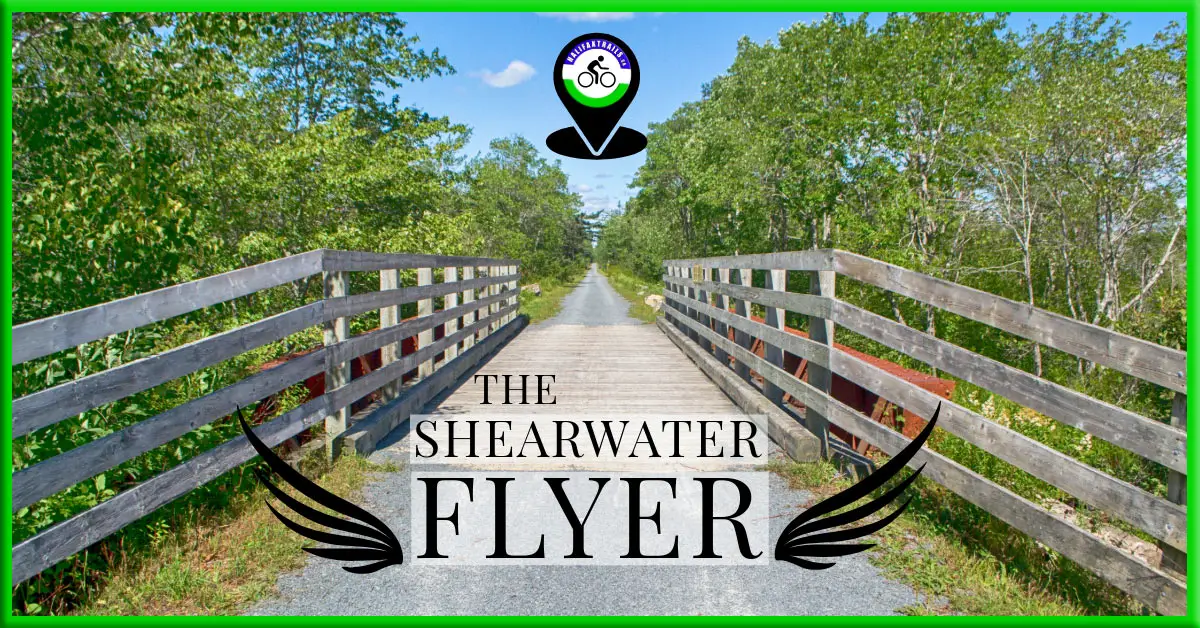
The Shearwater Flyer Trail
Biking
,
Easy
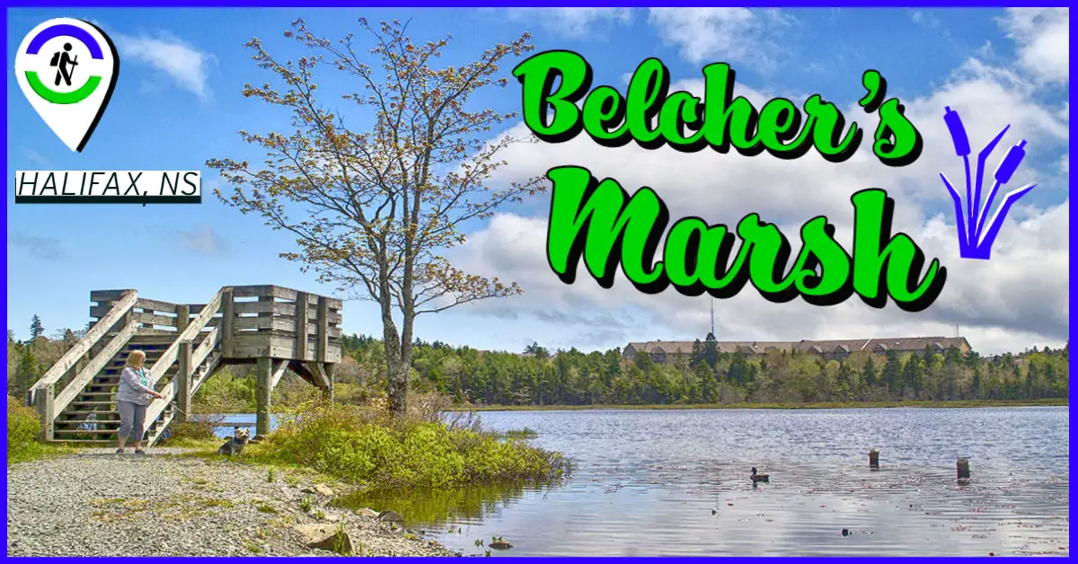
Halifax Regional Municipality
Belchers Marsh Park
Easy
,
Hiking
,
Short
CLOSE [X]